12
Beds
12
Baths
5,320
Sq Ft
18,295
Sq Ft
About This Home
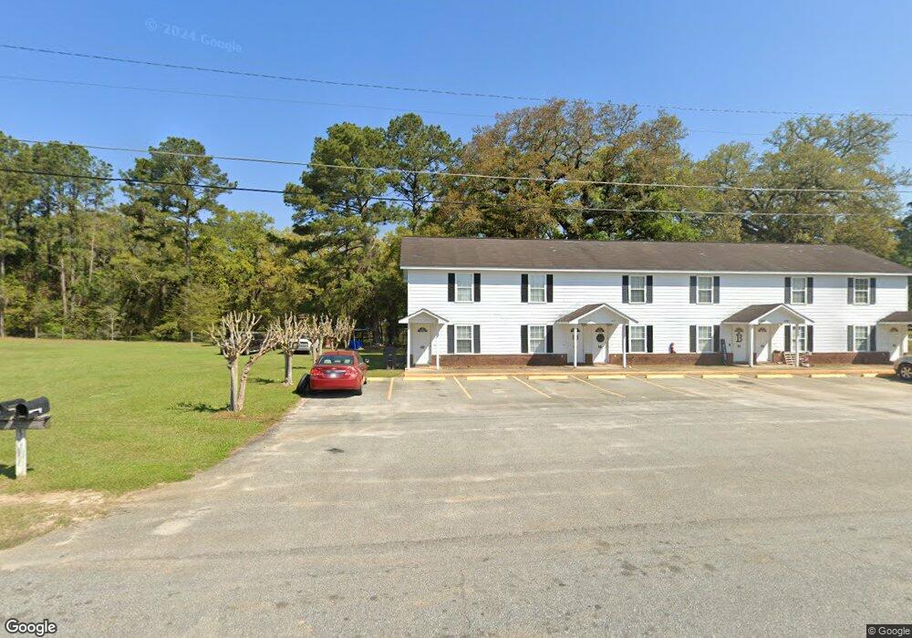
This home is located at 2853 Bark Ave NE, Cairo, GA 39828. 2853 Bark Ave NE is a home located in Grady County with nearby schools including Cairo High School.
Ownership History
Date
Name
Owned For
Owner Type
Purchase Details
Closed on
Nov 30, 2015
Sold by
Flowers Billy F
Bought by
Whigham Rentals Properties Llc
Purchase Details
Closed on
Feb 2, 2004
Bought by
Bil-Mar Apts Inc
Purchase Details
Closed on
Apr 16, 1999
Sold by
Hand Walter Frank
Bought by
Hand Walter Frank
Purchase Details
Closed on
Mar 25, 1998
Sold by
Hand Judson
Bought by
Hand Walter Frank
Purchase Details
Closed on
Jan 18, 1982
Bought by
Hand Judson
Create a Home Valuation Report for This Property
The Home Valuation Report is an in-depth analysis detailing your home's value as well as a comparison with similar homes in the area
Purchase History
| Date | Buyer | Sale Price | Title Company |
|---|---|---|---|
| Whigham Rentals Properties Llc | $554,990 | -- | |
| Bil-Mar Apts Inc | $305,000 | -- | |
| Hand Walter Frank | -- | -- | |
| Hand Walter Frank | -- | -- | |
| Hand Judson | -- | -- |
Source: Public Records
Tax History
| Year | Tax Paid | Tax Assessment Tax Assessment Total Assessment is a certain percentage of the fair market value that is determined by local assessors to be the total taxable value of land and additions on the property. | Land | Improvement |
|---|---|---|---|---|
| 2024 | $3,485 | $112,733 | $4,200 | $108,533 |
| 2023 | $4,010 | $108,334 | $23,674 | $84,660 |
| 2022 | $4,171 | $108,334 | $23,674 | $84,660 |
| 2021 | $4,182 | $108,334 | $23,674 | $84,660 |
| 2020 | $4,194 | $108,334 | $23,674 | $84,660 |
| 2019 | $4,193 | $108,334 | $23,674 | $84,660 |
| 2018 | $3,986 | $108,334 | $23,674 | $84,660 |
| 2017 | $3,833 | $108,334 | $23,674 | $84,660 |
| 2016 | $3,919 | $108,334 | $23,674 | $84,660 |
| 2015 | $3,881 | $108,334 | $23,674 | $84,660 |
| 2014 | -- | $108,334 | $23,674 | $84,660 |
| 2013 | -- | $108,333 | $23,673 | $84,660 |
Source: Public Records
Map
Nearby Homes
- 2690 U S 84
- 78.6 Ac Strickland Rd
- 21 24th St NE
- 66 22nd St NE
- 0 20th St NE
- 00 20th St NE
- 3109 U S 84
- 3109 U S 84
- 408 Bay Tree Rd NE
- 592 20th St SE
- 00 State Route 188
- 0 State Route 188
- 711 2nd Ave NE
- 00 Blackberry Ln
- 00 Meridian Rd
- Lot #15, 3 64 Acres Oakbend Cir
- 530 6th Ave SE
- 530 6th St
- 580 5th St SE
- 471 4th St SE
- 2847 Bark Ave NE
- 2800 Bark Ave NE
- 2860 Bark Ave NE
- 2846 Bark Ave NE
- 365 Airport Rd
- 290 Airport Rd
- 2829 Bark Ave NE
- 2829 Bark Ave NE
- 2827 Bark Ave NE
- 530 Loblolly Ln
- 320 Airport Rd
- 2807 Us Highway 84 E
- 375 Airport Rd
- 404 Airport Rd
- 2880 Slash Ave NE
- 2845 Slash Ave NE
- 2848 Slash Ave NE
- 420 Airport Rd
- 385 Airport Rd
- 390 Loblolly Ln
Your Personal Tour Guide
Ask me questions while you tour the home.