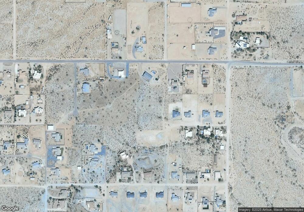
28538 N Wakefield Rd Unit T Queen Creek, AZ 85144
San Tan Mountain NeighborhoodEstimated Value: $160,000 - $551,000
--
Bed
--
Bath
--
Sq Ft
1.29
Acres
About This Home
This home is located at 28538 N Wakefield Rd Unit T, Queen Creek, AZ 85144 and is currently estimated at $382,333. 28538 N Wakefield Rd Unit T is a home located in Pinal County.
Ownership History
Date
Name
Owned For
Owner Type
Purchase Details
Closed on
Oct 7, 2009
Sold by
Deutsche Bank National Trust
Bought by
Gasso Joseph M
Current Estimated Value
Purchase Details
Closed on
Jun 1, 2009
Sold by
Corral Magdalena
Bought by
Deutsche Bank National Trust Company
Purchase Details
Closed on
Jul 25, 2006
Sold by
Okuszka Kevin Patrick Joseph and Wood Okuszka Sharon La Jean
Bought by
Corral Magdalena
Home Financials for this Owner
Home Financials are based on the most recent Mortgage that was taken out on this home.
Original Mortgage
$148,410
Interest Rate
6.87%
Mortgage Type
New Conventional
Create a Home Valuation Report for This Property
The Home Valuation Report is an in-depth analysis detailing your home's value as well as a comparison with similar homes in the area
Home Values in the Area
Average Home Value in this Area
Purchase History
| Date | Buyer | Sale Price | Title Company |
|---|---|---|---|
| Gasso Joseph M | $10,250 | Great American Title Agency | |
| Deutsche Bank National Trust | -- | Great American Title Agency | |
| Deutsche Bank National Trust Company | $48,088 | None Available | |
| Corral Magdalena | $164,900 | First American Title Ins Co |
Source: Public Records
Mortgage History
| Date | Status | Borrower | Loan Amount |
|---|---|---|---|
| Previous Owner | Corral Magdalena | $148,410 |
Source: Public Records
Tax History Compared to Growth
Tax History
| Year | Tax Paid | Tax Assessment Tax Assessment Total Assessment is a certain percentage of the fair market value that is determined by local assessors to be the total taxable value of land and additions on the property. | Land | Improvement |
|---|---|---|---|---|
| 2025 | $307 | -- | -- | -- |
| 2024 | $302 | -- | -- | -- |
| 2023 | $307 | $12,875 | $12,875 | $0 |
| 2022 | $302 | $7,930 | $7,930 | $0 |
| 2021 | $327 | $8,458 | $0 | $0 |
| 2020 | $298 | $8,458 | $0 | $0 |
| 2019 | $298 | $6,339 | $0 | $0 |
| 2018 | $287 | $5,497 | $0 | $0 |
| 2017 | $271 | $6,874 | $0 | $0 |
| 2016 | $266 | $7,528 | $7,528 | $0 |
| 2014 | -- | $2,096 | $2,096 | $0 |
Source: Public Records
Map
Nearby Homes
- 0000 N Sandridge --
- 2569 W Silverdale Rd
- 1928 W Big Sky Ln
- 0 W Adobe Dam Rd Unit 3 6878032
- 0 W Adobe Dam Rd Unit 2 6869090
- - Bryce Trail
- 0 N Bryce Trail Unit 26 6921779
- 0 W Magma 53 Rd Unit 6903673
- 27500 N Sandridge Dr Unit 5
- 28821 N Ashbrook Ln
- 0 W Marita St Unit D
- 2531 W Marita St
- 2507 W Marita St
- 2579 W Marita St
- 2557 W Marita St
- 28143 N Quintana Place
- 1550 W Adobe Dam Dr
- 1814 W Brooke Ln
- 0 W Foxtrot Trail
- 1907 W Brooke Ln
- 0 N Silverdale Rd Unit 19 6514179
- 0 N Silverdale Rd
- 2062 W Moon Dust Trail
- 22XX W Josiah (Approx) Rd
- 22XX W Josiah (Approx) Rd
- 000 W Silverdale Lot D2 Rd Unit D2
- 000 W Silverdale Lot D3 Rd Unit D3
- 2141 W Silverdale Rd
- 2079 W Silverdale Rd
- 22XX W Josiah Trail
- 22XX W Josiah Trail
- 22XX W Josiah Trail
- 2079 W Silverdale Rd
- 0 N Sandridge -- Unit 1 6512557
- 2034 W Moon Dust Trail
- 24XX W Silverdale (Approx) Rd Unit 19
- 2079 W Moon Dust Trail
- 25XX W Josiah (Approx) Rd
- 25XX W Josiah (Approx) Rd
- 0 W Silverdale -- Unit 6416094
