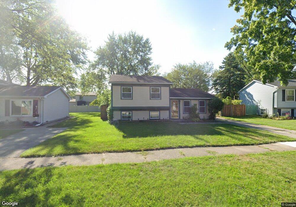
28547 Burning Tree Ln Unit Bldg-Unit Romulus, MI 48174
Estimated Value: $200,000 - $214,000
3
Beds
1
Bath
1,376
Sq Ft
$149/Sq Ft
Est. Value
About This Home
This home is located at 28547 Burning Tree Ln Unit Bldg-Unit, Romulus, MI 48174 and is currently estimated at $205,252, approximately $149 per square foot. 28547 Burning Tree Ln Unit Bldg-Unit is a home located in Wayne County with nearby schools including Halecreek Elementary School, Romulus Middle School, and Romulus Senior High School.
Ownership History
Date
Name
Owned For
Owner Type
Purchase Details
Closed on
Jul 30, 2018
Sold by
Demmy Debra
Bought by
Awosika Anthony A
Current Estimated Value
Purchase Details
Closed on
Mar 11, 2008
Sold by
Federal Home Loan Mortgage Corporation
Bought by
Dvorsky Debra E
Purchase Details
Closed on
Jan 10, 2007
Sold by
Mascorro Christina A
Bought by
Federal Home Loan Mortgage Corporation
Purchase Details
Closed on
Aug 27, 2004
Sold by
Flores Jesse M and Flores Denise K
Bought by
Mascorro Christina A
Create a Home Valuation Report for This Property
The Home Valuation Report is an in-depth analysis detailing your home's value as well as a comparison with similar homes in the area
Home Values in the Area
Average Home Value in this Area
Purchase History
| Date | Buyer | Sale Price | Title Company |
|---|---|---|---|
| Awosika Anthony A | $125,000 | First American Title Ins Co | |
| Dvorsky Debra E | $64,900 | Attorneys Title Agency Llc | |
| Federal Home Loan Mortgage Corporation | $115,540 | None Available | |
| Mascorro Christina A | $144,000 | Metropolitan Title Company |
Source: Public Records
Tax History
| Year | Tax Paid | Tax Assessment Tax Assessment Total Assessment is a certain percentage of the fair market value that is determined by local assessors to be the total taxable value of land and additions on the property. | Land | Improvement |
|---|---|---|---|---|
| 2025 | $2,209 | $87,500 | $0 | $0 |
| 2024 | $2,219 | $81,400 | $0 | $0 |
| 2023 | $2,142 | $69,200 | $0 | $0 |
| 2022 | $2,500 | $67,400 | $0 | $0 |
| 2021 | $2,426 | $51,900 | $0 | $0 |
| 2020 | $2,384 | $51,200 | $0 | $0 |
| 2019 | $2,383 | $41,100 | $0 | $0 |
| 2018 | $1,332 | $39,300 | $0 | $0 |
| 2017 | $916 | $38,800 | $0 | $0 |
| 2016 | $1,706 | $33,600 | $0 | $0 |
| 2015 | $3,130 | $31,300 | $0 | $0 |
| 2013 | $3,799 | $42,700 | $0 | $0 |
| 2012 | $1,172 | $37,100 | $5,000 | $32,100 |
Source: Public Records
Map
Nearby Homes
- 28339 Leroy St
- 16265 Harrison
- 28510 Halecreek St
- 16277 Harrison
- 28567 Forest Dale St
- 15756 Woodmont St
- 15630 Harrison
- 15654 Isabelle St
- 28670 Zellmer St
- 16913 Aberdeen Dr Unit 220
- 15486 Orchard St
- 15350 Woodmont St
- 15527 Meadow St
- 29067 Cullen Dr Unit BLDG8
- 16110 Farnum St
- 29055 Pennsylvania Rd
- 16068 Middlebelt Rd
- 15532 Wellington St
- 00 Eureka Rd
- 15900 Sandburg St
- 28547 Burning Tree Ln
- 28561 Burning Tree Ln
- 28533 Burning Tree Ln
- 16134 Harrison
- 16120 Harrison
- 28573 Burning Tree Ln
- 28548 Burning Tree Ln Unit Bldg-Unit
- 28548 Burning Tree Ln
- 16148 Harrison
- 16102 Harrison
- 28435 Leroy St
- 28505 Leroy St
- 16034 Harrison St
- 28603 Burning Tree Ln
- 28421 Leroy St
- 28608 Burning Tree Ln
- 16160 Harrison
- 28415 Leroy St
- 28517 Leroy St
- 28617 Burning Tree Ln
Your Personal Tour Guide
Ask me questions while you tour the home.