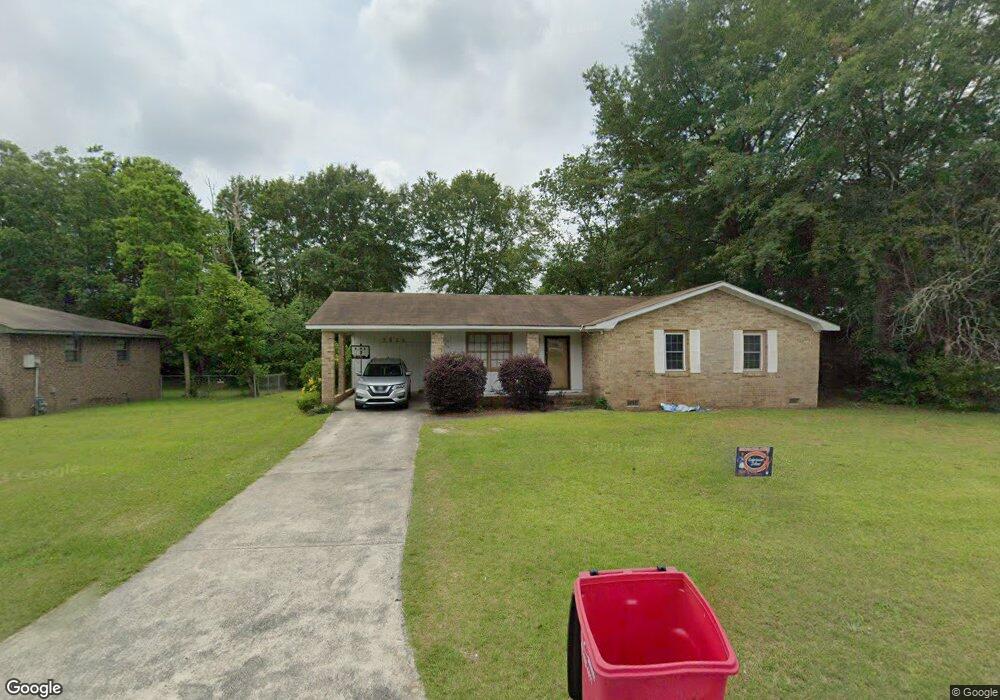
2855 Bob o Link Dr Macon, GA 31206
Estimated Value: $105,000 - $144,498
3
Beds
2
Baths
1,485
Sq Ft
$83/Sq Ft
Est. Value
About This Home
This home is located at 2855 Bob o Link Dr, Macon, GA 31206 and is currently estimated at $123,625, approximately $83 per square foot. 2855 Bob o Link Dr is a home located in Bibb County with nearby schools including Veterans Elementary School, Southwest High School, and Gilead Christian Academy.
Ownership History
Date
Name
Owned For
Owner Type
Purchase Details
Closed on
Apr 4, 2012
Sold by
Deutsche Bank National Trust Company
Bought by
Thunder Road 2012 Llc
Current Estimated Value
Purchase Details
Closed on
Dec 6, 2011
Sold by
Stafford Tonya L and Stafford Melvin Kenneth
Bought by
Deutsche Bank National Trust Company
Purchase Details
Closed on
May 20, 2003
Bought by
Stafford Tonya L and Stafford Melvin K
Purchase Details
Closed on
Dec 17, 2002
Create a Home Valuation Report for This Property
The Home Valuation Report is an in-depth analysis detailing your home's value as well as a comparison with similar homes in the area
Home Values in the Area
Average Home Value in this Area
Purchase History
| Date | Buyer | Sale Price | Title Company |
|---|---|---|---|
| Thunder Road 2012 Llc | $27,199 | None Available | |
| Deutsche Bank National Trust Company | $69,000 | None Available | |
| Stafford Tonya L | -- | -- | |
| -- | $84,000 | -- | |
| -- | $48,500 | -- |
Source: Public Records
Tax History Compared to Growth
Tax History
| Year | Tax Paid | Tax Assessment Tax Assessment Total Assessment is a certain percentage of the fair market value that is determined by local assessors to be the total taxable value of land and additions on the property. | Land | Improvement |
|---|---|---|---|---|
| 2025 | $943 | $38,359 | $2,240 | $36,119 |
| 2024 | $837 | $32,941 | $2,240 | $30,701 |
| 2023 | $837 | $32,941 | $2,240 | $30,701 |
| 2022 | $458 | $13,239 | $2,445 | $10,794 |
| 2021 | $503 | $13,239 | $2,445 | $10,794 |
| 2020 | $514 | $13,239 | $2,445 | $10,794 |
| 2019 | $542 | $13,851 | $3,057 | $10,794 |
| 2018 | $1,036 | $14,283 | $3,057 | $11,226 |
| 2017 | $535 | $14,283 | $3,057 | $11,226 |
| 2016 | $494 | $14,283 | $3,057 | $11,226 |
| 2015 | $699 | $14,283 | $3,057 | $11,226 |
| 2014 | $1,447 | $14,283 | $3,057 | $11,226 |
Source: Public Records
Map
Nearby Homes
- 3913 Blair Ct
- 2868 Barrett Ave
- 2765 Alden St
- 4738 Bloomfield Rd
- 2995 Virginia Dr
- 2770 Bonnie Ave
- 2769 Nancy Dr
- 5060 Pinefield Dr
- 3842 Wynnwood Dr
- 2768 Nancy Dr
- 140 Spencer Hill Ct
- 2704 Reynolds Dr
- 2443 Lambert Dr
- 2801 Deeb Dr
- 2521 Rocky Creek Rd
- 3607 Pineland Trail
- 2972 Richard Dr
- 5711 Sterling Place
- 3078 Alfred Dr
- 5746 Sterling Place
- 2851 Bob o Link Dr
- 2861 Bob o Link Dr
- 2739 Heaton Dr
- 2847 Bob o Link Dr
- 2745 Heaton Dr
- 2719 Heaton Dr
- 2856 Bob o Link Dr
- 0 Bob o Link Dr Unit 7194562
- 0 Bob o Link Dr Unit 7180927
- 0 Bob o Link Dr Unit 3163245
- 0 Bob o Link Dr Unit 7403388
- 2852 Bob o Link Dr
- 2860 Bob o Link Dr
- 2757 Heaton Dr
- 2845 Bob o Link Dr
- 2848 Bob o Link Dr
- 2864 Bob o Link Dr
- 2708 Heaton Dr
- 2714 Heaton Dr
- 2714 Heaton Dr Unit 37