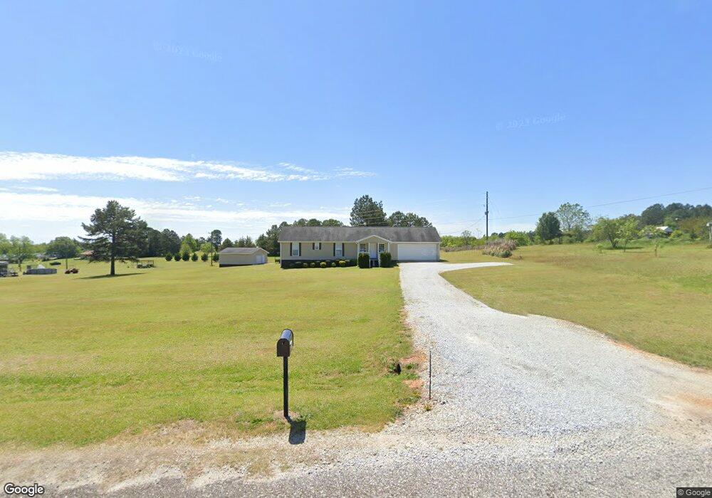
2857 Stanley Maxwell Rd Bowman, GA 30624
Estimated Value: $243,595 - $298,000
3
Beds
2
Baths
1,296
Sq Ft
$209/Sq Ft
Est. Value
About This Home
This home is located at 2857 Stanley Maxwell Rd, Bowman, GA 30624 and is currently estimated at $270,798, approximately $208 per square foot. 2857 Stanley Maxwell Rd is a home located in Elbert County with nearby schools including Elbert County Elementary School, Elbert County Primary School, and Elbert County Middle School.
Ownership History
Date
Name
Owned For
Owner Type
Purchase Details
Closed on
Nov 14, 2008
Sold by
Harkt Billy
Bought by
Mastin Kenneth D and Mastin Patricia L
Current Estimated Value
Home Financials for this Owner
Home Financials are based on the most recent Mortgage that was taken out on this home.
Original Mortgage
$71,000
Outstanding Balance
$46,620
Interest Rate
6.51%
Estimated Equity
$224,178
Purchase Details
Closed on
Dec 4, 2007
Sold by
Cornell Dennis Michael
Bought by
Hart Billy
Purchase Details
Closed on
Jan 7, 2005
Sold by
Benson Steven Scott
Bought by
Cornell Dennis Michael
Purchase Details
Closed on
Jun 19, 2002
Sold by
Cornell D Michael
Bought by
Benson Steven Scott
Purchase Details
Closed on
Jan 3, 2001
Sold by
Dickerson Thomas W
Bought by
Cornell D Michael
Create a Home Valuation Report for This Property
The Home Valuation Report is an in-depth analysis detailing your home's value as well as a comparison with similar homes in the area
Purchase History
| Date | Buyer | Sale Price | Title Company |
|---|---|---|---|
| Mastin Kenneth D | $97,500 | -- | |
| Hart Billy | $12,500 | -- | |
| Cornell Dennis Michael | $6,737 | -- | |
| Benson Steven Scott | -- | -- | |
| Cornell D Michael | $8,000 | -- |
Source: Public Records
Mortgage History
| Date | Status | Borrower | Loan Amount |
|---|---|---|---|
| Open | Mastin Kenneth D | $71,000 |
Source: Public Records
Tax History
| Year | Tax Paid | Tax Assessment Tax Assessment Total Assessment is a certain percentage of the fair market value that is determined by local assessors to be the total taxable value of land and additions on the property. | Land | Improvement |
|---|---|---|---|---|
| 2025 | $1,532 | $91,496 | $11,664 | $79,832 |
| 2024 | $1,888 | $84,060 | $10,142 | $73,918 |
| 2023 | $1,888 | $84,060 | $10,142 | $73,918 |
| 2022 | $1,577 | $71,018 | $6,038 | $64,980 |
| 2021 | $1,579 | $71,018 | $6,038 | $64,980 |
| 2020 | $1,401 | $56,841 | $4,830 | $52,011 |
| 2019 | $1,450 | $56,841 | $4,830 | $52,011 |
| 2018 | $1,490 | $56,841 | $4,830 | $52,011 |
| 2017 | $1,292 | $46,824 | $4,830 | $41,994 |
| 2016 | $1,216 | $46,824 | $4,830 | $41,994 |
| 2015 | -- | $46,824 | $4,830 | $41,994 |
| 2014 | -- | $46,824 | $4,830 | $41,994 |
| 2013 | -- | $40,400 | $4,830 | $35,571 |
Source: Public Records
Map
Nearby Homes
- 0 Fork Creek Rd Unit CL350628
- 0 Fork Creek Rd Unit 7728987
- 0 Fork Creek Rd Unit 10702901
- 494 S Broad St
- 225 Rehoboth Rd
- 0 Bowers St Unit LOT 1-8 10576344
- 0 Bowers St Unit LOT 1-8
- 100 S Broad St
- 3272 Horace Rd
- 8714 Georgia 172
- 231 Roosevelt Cir
- 260 Roosevelt Cir
- 2115 Dusty Rd
- 1574 Cordell Rd
- 1829 Hewell Rd NW
- 0 Dusty Rd Unit 10569563
- 0 Dusty Rd Unit 7619983
- 2661 Brickyard Rd
- 2607 Hughes Rd
- 0 Five Forks Rd Unit 10619685
- 2859 Stanley Maxwell Rd
- 2855 Stanley Maxwell Rd
- 2854 Stanley Maxwell Rd
- 1929 Brooke Ln
- 1951 Moon Rd
- 1921 Brooke Ln
- 1915 Brooke Ln
- 1975 Moon Rd
- 290 Moon Rd
- 1950 Brooke Ln
- 2032 Moon Rd
- 2852 Stanley Maxwell Rd
- 2034 Moon Rd
- 0 Moon Rd Unit 9074359
- 2958 Stanley Maxwell Rd
- 2885 Martin Rd
- 2107 Rehoboth Road Extension
- 2142 Rehoboth Road Extension
- 2133 Rehoboth Road Extension
- 0 Stanley Maxwell Rd Unit 8344551
Your Personal Tour Guide
Ask me questions while you tour the home.