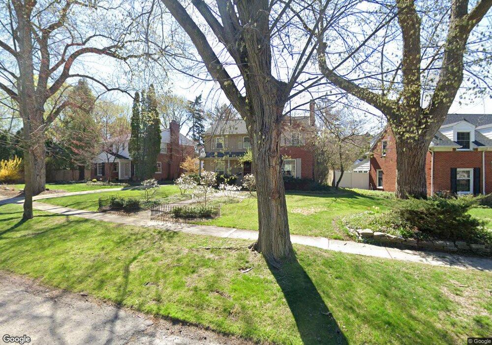
286 Abbey St Birmingham, MI 48009
Estimated Value: $835,660 - $901,000
4
Beds
3
Baths
2,253
Sq Ft
$388/Sq Ft
Est. Value
About This Home
This home is located at 286 Abbey St, Birmingham, MI 48009 and is currently estimated at $873,165, approximately $387 per square foot. 286 Abbey St is a home located in Oakland County with nearby schools including Harlan Elementary School, Ernest W. Seaholm High School, and Holy Name School.
Ownership History
Date
Name
Owned For
Owner Type
Purchase Details
Closed on
Apr 23, 2003
Sold by
Kane Terry Ryan and The Terry Ryan Kane Living Tru
Bought by
Killion Thomas W and Psenka Carolyn E
Current Estimated Value
Purchase Details
Closed on
Jun 14, 1999
Sold by
Kane Thomas C
Bought by
Terry Ryan Kane Tr
Create a Home Valuation Report for This Property
The Home Valuation Report is an in-depth analysis detailing your home's value as well as a comparison with similar homes in the area
Home Values in the Area
Average Home Value in this Area
Purchase History
| Date | Buyer | Sale Price | Title Company |
|---|---|---|---|
| Killion Thomas W | $485,000 | Philip R Seaver Title Co Inc | |
| Terry Ryan Kane Tr | -- | -- |
Source: Public Records
Tax History Compared to Growth
Tax History
| Year | Tax Paid | Tax Assessment Tax Assessment Total Assessment is a certain percentage of the fair market value that is determined by local assessors to be the total taxable value of land and additions on the property. | Land | Improvement |
|---|---|---|---|---|
| 2024 | $8,349 | $343,860 | $0 | $0 |
| 2023 | $8,000 | $315,170 | $0 | $0 |
| 2022 | $8,578 | $295,820 | $0 | $0 |
| 2021 | $8,654 | $293,230 | $0 | $0 |
| 2020 | $7,710 | $285,250 | $0 | $0 |
| 2019 | $8,725 | $278,730 | $0 | $0 |
| 2018 | $9,501 | $284,580 | $0 | $0 |
| 2017 | $8,644 | $276,610 | $0 | $0 |
| 2016 | $8,660 | $262,040 | $0 | $0 |
| 2015 | -- | $239,050 | $0 | $0 |
| 2014 | -- | $212,580 | $0 | $0 |
| 2011 | -- | $207,140 | $0 | $0 |
Source: Public Records
Map
Nearby Homes
- 1330 Oxford Rd
- 654 Shepardbush St
- 680 Shepardbush St
- 928 Poppleton St
- 488 Vinewood Ave
- 549 N Old Woodward Ave
- 5554 Pine Brooke Ct
- 684 Madison St
- 524 Oakland Ave
- 000 N Adams Rd
- 1333 N Adams Rd
- 667 Oak Ave
- 850 N Adams Rd
- 369 N Old Woodward Ave Unit 301
- 369 N Old Woodward Ave Unit 307
- 369 N Old Woodward Ave Unit 206
- 369 N Old Woodward Ave Unit 207
- 1225 Derby Rd Unit 1
- 1111 N Old Woodward Ave Unit 4
- 1111 N Old Woodward Ave Unit 26