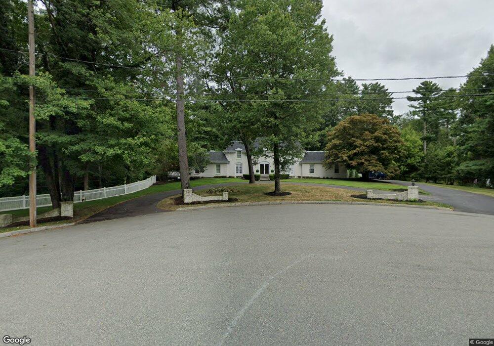
286 Mayflower Cir Hanover, MA 02339
Estimated Value: $1,344,000 - $1,927,000
5
Beds
5
Baths
5,080
Sq Ft
$310/Sq Ft
Est. Value
About This Home
This home is located at 286 Mayflower Cir, Hanover, MA 02339 and is currently estimated at $1,574,751, approximately $309 per square foot. 286 Mayflower Cir is a home located in Plymouth County with nearby schools including Hanover High School, The Master's Academy, and Cardinal Cushing Centers.
Ownership History
Date
Name
Owned For
Owner Type
Purchase Details
Closed on
Apr 4, 2023
Sold by
Noonan Michael R and Noonan Elizabeth A
Bought by
286 Mayflowers Cir Rt and Najarian
Current Estimated Value
Purchase Details
Closed on
Jul 21, 2004
Sold by
Najarian Robert G and Najarian Denise M
Bought by
Najarian Robert G and Najarian Denise M
Purchase Details
Closed on
Mar 9, 1979
Bought by
D Robert and D M Najarian T
Create a Home Valuation Report for This Property
The Home Valuation Report is an in-depth analysis detailing your home's value as well as a comparison with similar homes in the area
Home Values in the Area
Average Home Value in this Area
Purchase History
| Date | Buyer | Sale Price | Title Company |
|---|---|---|---|
| 286 Mayflowers Cir Rt | -- | None Available | |
| 286 Mayflowers Cir Rt | -- | None Available | |
| Najarian Robert G | -- | -- | |
| Najarian Robert G | -- | -- | |
| D Robert | -- | -- |
Source: Public Records
Tax History
| Year | Tax Paid | Tax Assessment Tax Assessment Total Assessment is a certain percentage of the fair market value that is determined by local assessors to be the total taxable value of land and additions on the property. | Land | Improvement |
|---|---|---|---|---|
| 2025 | $16,277 | $1,318,000 | $355,600 | $962,400 |
| 2024 | $16,923 | $1,318,000 | $355,600 | $962,400 |
| 2023 | $16,684 | $1,236,800 | $326,300 | $910,500 |
| 2022 | $17,053 | $1,118,200 | $275,400 | $842,800 |
| 2021 | $17,150 | $1,050,200 | $252,300 | $797,900 |
| 2020 | $15,341 | $940,600 | $252,300 | $688,300 |
| 2019 | $16,034 | $977,100 | $252,300 | $724,800 |
| 2018 | $13,884 | $852,800 | $252,300 | $600,500 |
| 2017 | $14,212 | $860,300 | $256,600 | $603,700 |
| 2016 | $14,140 | $838,700 | $235,000 | $603,700 |
| 2015 | $13,359 | $827,200 | $254,600 | $572,600 |
Source: Public Records
Map
Nearby Homes
- 506 Main St
- 62 Larchmont Ln
- 36 Grove St
- 250 Center St
- 51 Cervelli Farm Dr
- 37 Dr
- 23 Cervelli Farm Dr
- 38 Cervelli Farm Dr
- 9 Cervelli Farm Dr
- 561 Circuit St
- 776 Main St
- 44 Stone Meadow Ln
- 47 Stone Meadow Ln
- 75 School St
- 95 Tecumseh Dr
- 53 Chestnut St
- 36 Bayberry Ln
- 33 1st Parish Ln
- 823 Market St
- 35 Sproul Rd
- 298 Mayflower Cir
- 142 Colonial Dr
- 152 Colonial Dr
- 283 Mayflower Cir
- 293 Mayflower Cir
- 130 Colonial Dr
- 174 Colonial Dr
- 309 Mayflower Cir
- 5 Briscos Plain
- 141 Colonial Dr
- 131 Colonial Dr
- 320 Mayflower Cir
- 321 Mayflower Cir
- 171 Colonial Dr
- 319 Plain St
- 307 Plain St
- 332 Mayflower Cir
- 190 Colonial Dr
- 295 Plain St
- 331 Mayflower Cir
Your Personal Tour Guide
Ask me questions while you tour the home.