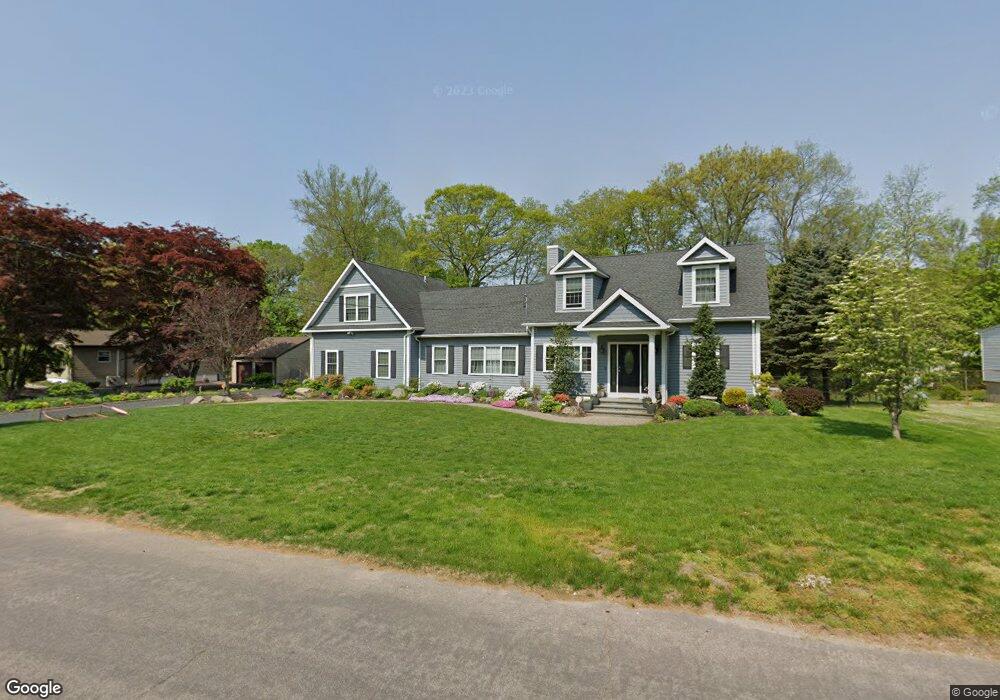
286 Stevenson Rd Fairfield, CT 06825
Estimated Value: $579,000 - $809,000
4
Beds
4
Baths
2,195
Sq Ft
$309/Sq Ft
Est. Value
About This Home
This home is located at 286 Stevenson Rd, Fairfield, CT 06825 and is currently estimated at $679,174, approximately $309 per square foot. 286 Stevenson Rd is a home located in Fairfield County with nearby schools including North Stratfield Elementary School, Fairfield Woods Middle School, and Fairfield Warde High School.
Ownership History
Date
Name
Owned For
Owner Type
Purchase Details
Closed on
Nov 30, 1999
Sold by
Partuli Vincent J
Bought by
Moreno Paul J
Current Estimated Value
Purchase Details
Closed on
Jan 31, 1996
Sold by
Collinmore Charles G
Bought by
Vartuli Vincent J
Create a Home Valuation Report for This Property
The Home Valuation Report is an in-depth analysis detailing your home's value as well as a comparison with similar homes in the area
Purchase History
| Date | Buyer | Sale Price | Title Company |
|---|---|---|---|
| Moreno Paul J | $208,000 | -- | |
| Moreno Paul J | $208,000 | -- | |
| Vartuli Vincent J | $170,000 | -- | |
| Vartuli Vincent J | $170,000 | -- |
Source: Public Records
Mortgage History
| Date | Status | Borrower | Loan Amount |
|---|---|---|---|
| Open | Vartuli Vincent J | $243,000 | |
| Closed | Vartuli Vincent J | $175,000 | |
| Closed | Vartuli Vincent J | $108,000 |
Source: Public Records
Tax History
| Year | Tax Paid | Tax Assessment Tax Assessment Total Assessment is a certain percentage of the fair market value that is determined by local assessors to be the total taxable value of land and additions on the property. | Land | Improvement |
|---|---|---|---|---|
| 2025 | $8,498 | $299,320 | $140,000 | $159,320 |
| 2024 | $8,351 | $299,320 | $140,000 | $159,320 |
| 2023 | $8,234 | $299,320 | $140,000 | $159,320 |
| 2022 | $8,153 | $299,320 | $140,000 | $159,320 |
| 2021 | $10,712 | $299,320 | $140,000 | $159,320 |
| 2020 | $9,849 | $367,640 | $186,690 | $180,950 |
| 2019 | $9,849 | $367,640 | $186,690 | $180,950 |
| 2018 | $9,944 | $367,640 | $186,690 | $180,950 |
| 2017 | $8,756 | $367,640 | $186,690 | $180,950 |
| 2016 | $9,356 | $367,640 | $186,690 | $180,950 |
| 2015 | $8,340 | $336,420 | $188,020 | $148,400 |
| 2014 | $5,850 | $239,750 | $188,020 | $51,730 |
Source: Public Records
Map
Nearby Homes
- 5763 Park Ave
- 132 Toll House Ln
- 40 Toll House Ln
- 18 Ridgebury Dr
- 121 Campbell Rd
- 8 Raleigh Rd
- 93 Tersana Dr
- 22 Newman Dr
- 3460 Old Town Rd
- 3432 Old Town Rd
- 84 Delaware Rd
- 170 Marilyn Dr
- lot 194 Prospect Ave
- 36 Rosewood Dr
- 35 Sturbridge Rd
- 66 Loftus Cir
- 71 Schiller Rd
- 134 Delaware Rd
- 3125 Old Town Rd
- 12 Ridgeway Rd
- 258 Stevenson Rd
- 310 Stevenson Rd
- 257 Stevenson Rd
- 299 Stevenson Rd
- 279 Stevenson Rd
- 236 Stevenson Rd
- 351 Toll House Ln
- 338 Stevenson Rd
- 321 Stevenson Rd
- 321 Stevenson Rd Unit 2ndFL
- 321 Stevenson Rd Unit 2
- 367 Toll House Ln
- 331 Toll House Ln
- 235 Stevenson Rd
- 218 Stevenson Rd
- 309 Toll House Ln
- 353 Stevenson Rd
- 411 Toll House Ln
- 387 Toll House Ln
- 207 Stevenson Rd
Your Personal Tour Guide
Ask me questions while you tour the home.