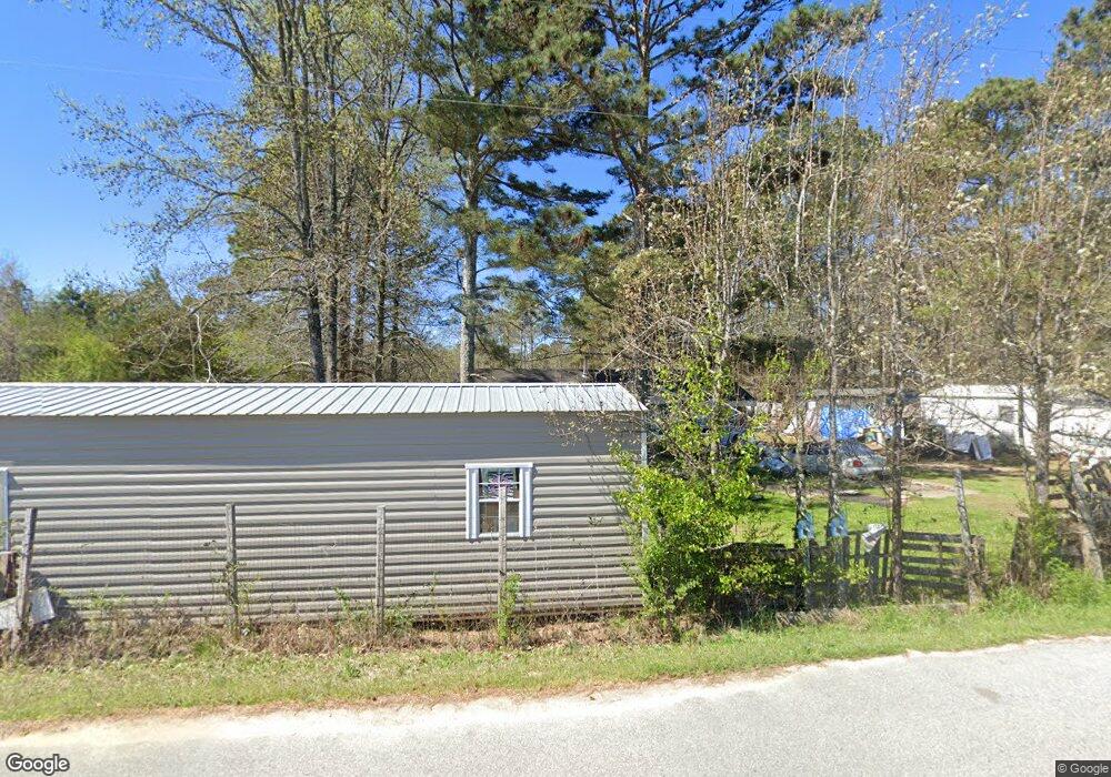
2861 Geer Rd Union Point, GA 30669
Estimated Value: $166,823 - $241,000
--
Bed
2
Baths
1,325
Sq Ft
$144/Sq Ft
Est. Value
About This Home
This home is located at 2861 Geer Rd, Union Point, GA 30669 and is currently estimated at $191,206, approximately $144 per square foot. 2861 Geer Rd is a home located in Greene County with nearby schools including Greene County High School.
Ownership History
Date
Name
Owned For
Owner Type
Purchase Details
Closed on
Jan 1, 1987
Sold by
First Federal Savings Bank/Ga
Bought by
Haynes Sarah L
Current Estimated Value
Purchase Details
Closed on
Jan 1, 1985
Sold by
Carter Milton
Bought by
Lawrence W B
Purchase Details
Closed on
Jan 1, 1984
Sold by
Mitchell Sandra F
Bought by
Farmers Home Adm
Purchase Details
Closed on
Jan 1, 1982
Sold by
Mitchell Sammie and Mitchell Sandra
Bought by
Mitchell Sandra F
Purchase Details
Closed on
Jan 1, 1980
Bought by
Mitchell Sammie and Mitchell Sandra
Create a Home Valuation Report for This Property
The Home Valuation Report is an in-depth analysis detailing your home's value as well as a comparison with similar homes in the area
Home Values in the Area
Average Home Value in this Area
Purchase History
| Date | Buyer | Sale Price | Title Company |
|---|---|---|---|
| Haynes Sarah L | -- | -- | |
| First Federal Savings Bank/Ga | -- | -- | |
| Lawrence W B | -- | -- | |
| Carter Milton | -- | -- | |
| Farmers Home Adm | -- | -- | |
| Mitchell Sandra F | -- | -- | |
| Mitchell Sammie | -- | -- |
Source: Public Records
Tax History Compared to Growth
Tax History
| Year | Tax Paid | Tax Assessment Tax Assessment Total Assessment is a certain percentage of the fair market value that is determined by local assessors to be the total taxable value of land and additions on the property. | Land | Improvement |
|---|---|---|---|---|
| 2025 | $637 | $64,520 | $4,040 | $60,480 |
| 2024 | $675 | $59,840 | $4,040 | $55,800 |
| 2023 | $386 | $55,600 | $3,040 | $52,560 |
| 2022 | $654 | $28,400 | $2,360 | $26,040 |
| 2021 | $622 | $25,320 | $2,360 | $22,960 |
| 2020 | $631 | $23,800 | $1,880 | $21,920 |
| 2019 | $641 | $23,800 | $1,880 | $21,920 |
| 2018 | $620 | $23,800 | $1,880 | $21,920 |
| 2017 | $590 | $23,860 | $1,894 | $21,966 |
| 2016 | $607 | $24,687 | $1,894 | $22,793 |
| 2015 | $582 | $24,687 | $1,894 | $22,793 |
| 2014 | $532 | $22,148 | $1,894 | $20,254 |
Source: Public Records
Map
Nearby Homes
- 5971 Penfield Rd
- 1211 Peachtree Ave W
- 5011 Penfield Rd
- 0 Woodville Rd Unit 7667944
- 0 Woodville Rd Unit 10628010
- 0 Dogwood Rd
- 3434 Union Point Rd
- 1101 Boswell Rd
- 1251 Adams Rd
- 3021 Penfield Rd
- 1110 Woodland Way
- 1110 Woodland Ln
- 0 Washington Hwy Unit 7276060
- 0 Old Union Point Rd Unit 1 10557753
- 0 Shady Side Ln
- 0 Union Point Hwy Unit 10555176
- 0 Union Point Hwy Unit 7607786
- 215 Hunter St
- 0 S Rhodes St Unit 10618488
- 324 N Rhodes St
- 2871 Geer Rd
- 2841 Geer Rd
- 2881 Geer Rd
- 2891 Geer Rd
- 2921 Geer Rd
- 5940 Penfield Rd
- 6051 Penfield Rd
- 6031 Penfield Rd
- 5941 Penfield Rd
- 6121 Penfield Rd
- 6161 Penfield Rd
- 6171 Penfield Rd
- 5790 Penfield Rd
- 5770 Penfield Rd
- 5770 Penfield Rd
- 42.35 aces Penfield Rd
- 0 Penfield Unit 3274632
- 5720 Penfield Rd
- 5680 Penfield Rd
- 5670 Penfield Rd