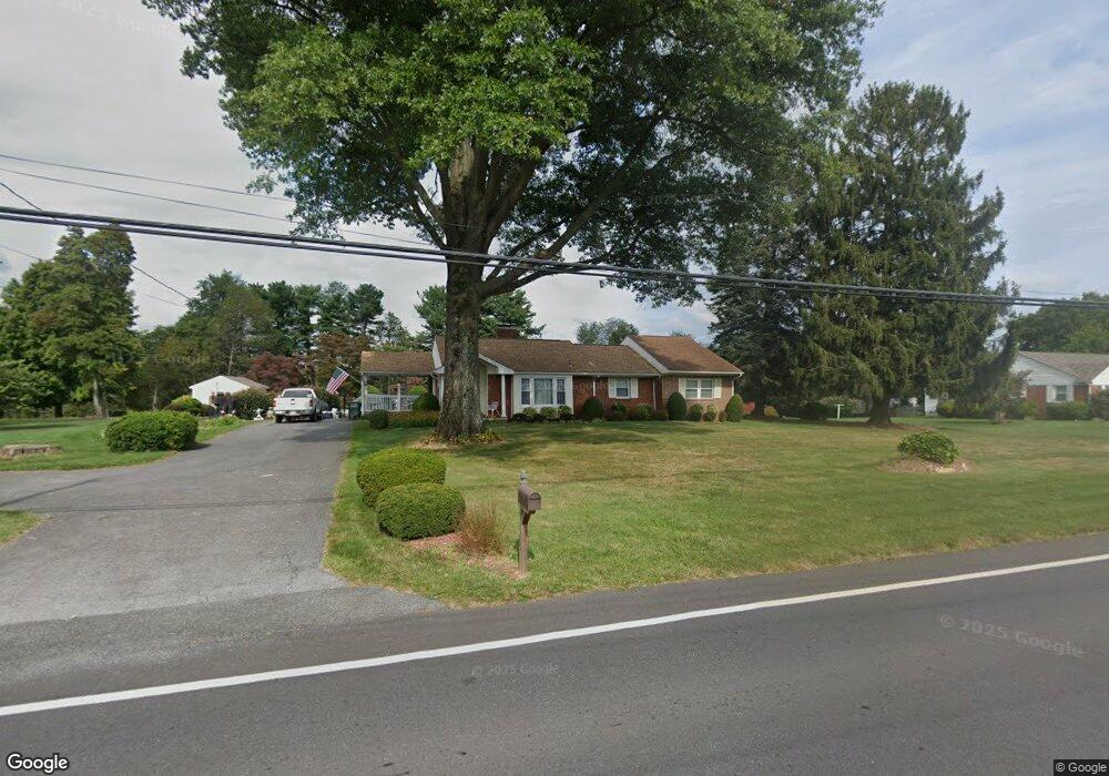
28613 Kemptown Rd Damascus, MD 20872
Estimated Value: $460,101 - $547,000
--
Bed
2
Baths
1,298
Sq Ft
$387/Sq Ft
Est. Value
About This Home
This home is located at 28613 Kemptown Rd, Damascus, MD 20872 and is currently estimated at $501,775, approximately $386 per square foot. 28613 Kemptown Rd is a home located in Montgomery County with nearby schools including Damascus Elementary School, John T. Baker Middle School, and Damascus High.
Ownership History
Date
Name
Owned For
Owner Type
Purchase Details
Closed on
Feb 22, 2013
Sold by
Thompson Suellen T and Nail Suellen T
Bought by
Nail Suellen T
Current Estimated Value
Home Financials for this Owner
Home Financials are based on the most recent Mortgage that was taken out on this home.
Original Mortgage
$225,000
Outstanding Balance
$44,540
Interest Rate
3.45%
Mortgage Type
Stand Alone Second
Estimated Equity
$457,235
Purchase Details
Closed on
Jan 17, 2003
Sold by
Thompson David and Thompson T S
Bought by
Thompson Suellen T
Purchase Details
Closed on
Jan 3, 1995
Sold by
Hruska James K
Bought by
Thompson David
Home Financials for this Owner
Home Financials are based on the most recent Mortgage that was taken out on this home.
Original Mortgage
$105,500
Interest Rate
9.2%
Create a Home Valuation Report for This Property
The Home Valuation Report is an in-depth analysis detailing your home's value as well as a comparison with similar homes in the area
Home Values in the Area
Average Home Value in this Area
Purchase History
| Date | Buyer | Sale Price | Title Company |
|---|---|---|---|
| Nail Suellen T | -- | Atg | |
| Thompson Suellen T | -- | -- | |
| Thompson David | $150,000 | -- |
Source: Public Records
Mortgage History
| Date | Status | Borrower | Loan Amount |
|---|---|---|---|
| Open | Nail Suellen T | $225,000 | |
| Previous Owner | Thompson David | $105,500 |
Source: Public Records
Tax History Compared to Growth
Tax History
| Year | Tax Paid | Tax Assessment Tax Assessment Total Assessment is a certain percentage of the fair market value that is determined by local assessors to be the total taxable value of land and additions on the property. | Land | Improvement |
|---|---|---|---|---|
| 2025 | $5,240 | $412,533 | -- | -- |
| 2024 | $5,240 | $392,600 | $228,400 | $164,200 |
| 2023 | $4,392 | $383,000 | $0 | $0 |
| 2022 | $4,075 | $373,400 | $0 | $0 |
| 2021 | $3,836 | $363,800 | $228,400 | $135,400 |
| 2020 | $3,836 | $361,000 | $0 | $0 |
| 2019 | $3,784 | $358,200 | $0 | $0 |
| 2018 | $3,752 | $355,400 | $228,400 | $127,000 |
| 2017 | $3,753 | $349,067 | $0 | $0 |
| 2016 | -- | $342,733 | $0 | $0 |
| 2015 | $2,865 | $336,400 | $0 | $0 |
| 2014 | $2,865 | $326,133 | $0 | $0 |
Source: Public Records
Map
Nearby Homes
- 28411 Kemptown Rd
- 10200 Moxley Rd Unit PARCEL 328
- 10200 Moxley Rd Unit 350 & 191
- 3553 Clarksburg Rd
- 28904 Ridge Rd
- 13253 Turf Terrace
- 28924 Ridge Rd
- 10901 Moxley Rd
- 29007 Ridge Rd
- 12353 Fingerboard Rd
- 13681 Samhill Dr
- 10895 Bethesda Church Rd
- 3914 Millstone Cir
- 3607 Moline Ct
- 13520 Autumn Crest Dr S
- 4407 Robmar Dr
- 10891 Bethesda Church Rd
- 4041 Lomar Dr
- 0 Gue Rd Unit MDMC2175860
- 4042 Lomar Dr
- 28621 Kemptown Rd
- 28625 Kemptown Rd
- 28639 Kemptown Rd
- 28635 Kemptown Rd
- 28631 Kemptown Rd
- 28605 Kemptown Rd
- 28601 Kemptown Rd
- 28607 Kemptown Rd
- 28608 Kemptown Rd
- 28612 Kemptown Rd
- 28604 Kemptown Rd
- 28616 Kemptown Rd
- 28440 Honeysuckle Dr
- 28620 Kemptown Rd
- 28624 Kemptown Rd
- 10105 Johns Dr
- 10113 Johns Dr
- 10101 Johns Dr
- 28441 Honeysuckle Dr
- 28628 Kemptown Rd