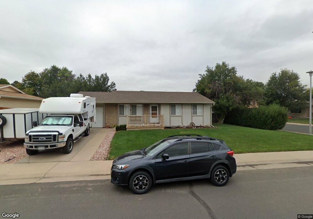
2865 E 118th Ct Thornton, CO 80233
Estimated Value: $402,000 - $491,000
3
Beds
2
Baths
1,000
Sq Ft
$443/Sq Ft
Est. Value
About This Home
This home is located at 2865 E 118th Ct, Thornton, CO 80233 and is currently estimated at $443,245, approximately $443 per square foot. 2865 E 118th Ct is a home located in Adams County with nearby schools including Woodglen Elementary School, Century Middle School, and Mountain Range High School.
Ownership History
Date
Name
Owned For
Owner Type
Purchase Details
Closed on
Jun 10, 2016
Sold by
Box Christopher M and Box Jennifer J
Bought by
Box Christopher M
Current Estimated Value
Home Financials for this Owner
Home Financials are based on the most recent Mortgage that was taken out on this home.
Original Mortgage
$162,500
Outstanding Balance
$128,093
Interest Rate
3.61%
Mortgage Type
New Conventional
Estimated Equity
$315,152
Purchase Details
Closed on
Oct 5, 2009
Sold by
Box Christopher M and Tate Jennifer J
Bought by
Box Christopher M
Purchase Details
Closed on
Mar 26, 1999
Sold by
Pyles Bryan C and Pyles Danette Danette
Bought by
Box Christopher M and Box Jennifer J
Home Financials for this Owner
Home Financials are based on the most recent Mortgage that was taken out on this home.
Original Mortgage
$136,871
Interest Rate
6.82%
Mortgage Type
FHA
Create a Home Valuation Report for This Property
The Home Valuation Report is an in-depth analysis detailing your home's value as well as a comparison with similar homes in the area
Home Values in the Area
Average Home Value in this Area
Purchase History
| Date | Buyer | Sale Price | Title Company |
|---|---|---|---|
| Box Christopher M | -- | None Available | |
| Box Christopher M | -- | None Available | |
| Box Christopher M | $138,000 | -- |
Source: Public Records
Mortgage History
| Date | Status | Borrower | Loan Amount |
|---|---|---|---|
| Open | Box Christopher M | $162,500 | |
| Closed | Box Christopher M | $136,871 |
Source: Public Records
Tax History
| Year | Tax Paid | Tax Assessment Tax Assessment Total Assessment is a certain percentage of the fair market value that is determined by local assessors to be the total taxable value of land and additions on the property. | Land | Improvement |
|---|---|---|---|---|
| 2025 | $2,991 | $31,080 | $5,960 | $25,120 |
| 2024 | $2,991 | $28,570 | $5,480 | $23,090 |
| 2023 | $2,960 | $32,610 | $5,410 | $27,200 |
| 2022 | $2,642 | $23,980 | $5,560 | $18,420 |
| 2021 | $2,730 | $23,980 | $5,560 | $18,420 |
| 2020 | $2,613 | $23,420 | $5,720 | $17,700 |
| 2019 | $2,618 | $23,420 | $5,720 | $17,700 |
| 2018 | $2,350 | $20,420 | $5,760 | $14,660 |
| 2017 | $2,136 | $20,420 | $5,760 | $14,660 |
| 2016 | $1,652 | $15,370 | $3,180 | $12,190 |
| 2015 | $1,649 | $15,370 | $3,180 | $12,190 |
| 2014 | $1,435 | $13,000 | $2,470 | $10,530 |
Source: Public Records
Map
Nearby Homes
- 11776 Saint Paul St
- 2656 E 117th Way
- 3491 E 119th St
- 11909 Monroe St
- 11867 Jackson Cir
- 12218 Adams St
- 12237 Cook Ct
- 11510 Milwaukee St
- 11529 Clayton St
- 11961 Bellaire St Unit C
- 4160 E 119th Place Unit B
- 3991 E 121st Ave
- 3422 E 114th Dr
- 4145 E 119th Place Unit B
- 11981 Bellaire St Unit D
- 2522 E 123rd Dr
- 3225 E 124th Ave
- 4220 E 119th Place Unit B
- 11731 Ash St
- 11919 Lavinia Ln
- 2845 E 118th Ct
- 11820 St Paul St
- 11820 Saint Paul St
- 11800 Saint Paul St
- 2874 E 118th Ct
- 2825 E 118th Ct
- 2854 E 118th Ct
- 11840 Saint Paul St
- 11790 Saint Paul St
- 11868 Saint Paul Cir
- 11848 Saint Paul Cir
- 2834 E 118th Ct
- 11888 Saint Paul Cir
- 11860 Saint Paul St
- 11803 Steele St
- 11793 Steele St
- 2873 E 117th Ct
- 2805 E 118th Ct
- 2853 E 117th Ct
- 11813 Steele St
Your Personal Tour Guide
Ask me questions while you tour the home.