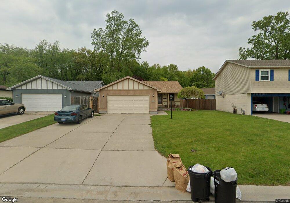
2865 W Rick Dr Port Huron, MI 48060
Estimated Value: $150,000 - $182,919
3
Beds
1
Bath
1,140
Sq Ft
$148/Sq Ft
Est. Value
About This Home
This home is located at 2865 W Rick Dr, Port Huron, MI 48060 and is currently estimated at $168,980, approximately $148 per square foot. 2865 W Rick Dr is a home located in St. Clair County with nearby schools including Michigamme Elementary School, Central Middle School, and Port Huron High School.
Ownership History
Date
Name
Owned For
Owner Type
Purchase Details
Closed on
May 7, 2019
Sold by
Thomason Clifford S
Bought by
Thomason Clifford S and Thomason Kristi
Current Estimated Value
Purchase Details
Closed on
Sep 25, 2014
Sold by
Thomason Shery L
Bought by
Thomason Clifford S
Home Financials for this Owner
Home Financials are based on the most recent Mortgage that was taken out on this home.
Original Mortgage
$64,865
Interest Rate
4.07%
Mortgage Type
FHA
Purchase Details
Closed on
Sep 27, 2011
Sold by
Faulkner Jovan R and Faulkner Jovan
Bought by
Halco Development Company Llc
Purchase Details
Closed on
Apr 14, 2011
Sold by
Faulkner Jovan R
Bought by
The Federal Home Loan Mortgage Corporati
Create a Home Valuation Report for This Property
The Home Valuation Report is an in-depth analysis detailing your home's value as well as a comparison with similar homes in the area
Home Values in the Area
Average Home Value in this Area
Purchase History
| Date | Buyer | Sale Price | Title Company |
|---|---|---|---|
| Thomason Clifford S | -- | None Listed On Document | |
| Thomason Clifford S | -- | None Available | |
| Thomason Clifford S | $38,500 | Attorneys Title Agency Llc | |
| Halco Development Company Llc | $36,000 | None Available | |
| The Federal Home Loan Mortgage Corporati | $30,000 | None Available |
Source: Public Records
Mortgage History
| Date | Status | Borrower | Loan Amount |
|---|---|---|---|
| Previous Owner | Thomason Clifford S | $64,865 |
Source: Public Records
Tax History Compared to Growth
Tax History
| Year | Tax Paid | Tax Assessment Tax Assessment Total Assessment is a certain percentage of the fair market value that is determined by local assessors to be the total taxable value of land and additions on the property. | Land | Improvement |
|---|---|---|---|---|
| 2025 | $1,921 | $84,000 | $0 | $0 |
| 2024 | $1,873 | $83,900 | $0 | $0 |
| 2023 | $1,769 | $74,200 | $0 | $0 |
| 2022 | $1,856 | $64,300 | $0 | $0 |
| 2021 | $1,762 | $58,600 | $0 | $0 |
| 2020 | $1,782 | $55,900 | $55,900 | $0 |
| 2019 | $1,750 | $41,200 | $0 | $0 |
| 2018 | $1,711 | $41,200 | $0 | $0 |
| 2017 | $1,528 | $37,200 | $0 | $0 |
| 2016 | $1,307 | $37,200 | $0 | $0 |
| 2015 | $1,282 | $37,300 | $37,300 | $0 |
| 2014 | $1,282 | $35,900 | $35,900 | $0 |
| 2013 | -- | $35,200 | $0 | $0 |
Source: Public Records
Map
Nearby Homes
- 1403 Catherine McAuley Dr
- 2718 Electric Ave
- 2752 Military St
- 2704 Military St
- 3136 Military St
- 9999 Cleveland Ave
- 2444 Military St
- 2627 24th St
- Lot 3 24th St
- 1127 Minnie St
- 2506 Vanness St
- 2411 26th St
- 2203 VL Railroad St
- 2200 VL Railroad St
- 2513 Vanness St
- 1831 11th St
- 1309 Division St
- 1325 Division St
- 2023 23rd St
- 2600 Vanness St
- 2875 W Rick Dr
- 2861 W Rick Dr
- 2681 Susan Ct Unit 1518
- 2679 Susan Ct Unit 1518
- 2870 W Rick Dr
- 2677 Susan Ct Unit 1518
- 2885 W Rick Dr
- 2876 W Rick Dr
- 2675 Susan Ct Unit 1518
- 2882 W Rick Dr
- 2886 W Rick Dr
- 2624 Susan Ct
- 2864 W Rick Dr
- 2827 E Rick Dr
- 1505 W Rick Ct
- 2646 Susan Ct
- 2828 E Rick Dr
- 1515 W Rick Ct
- 2673 Susan Ct
- 2671 Susan Ct