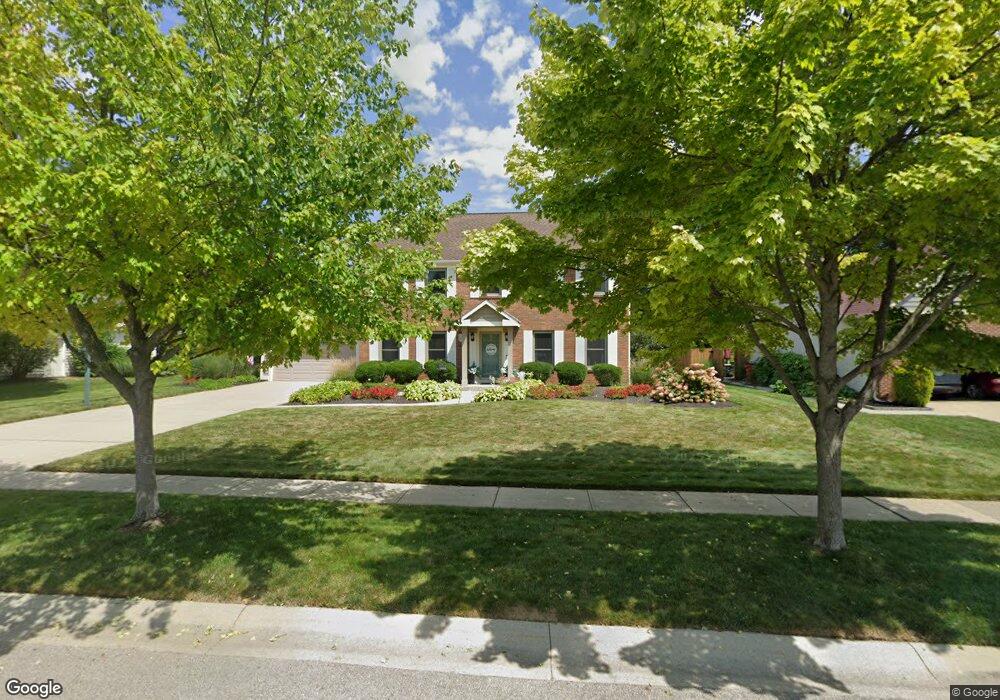
2866 Annabelle Ct Grove City, OH 43123
Estimated Value: $466,000 - $530,661
4
Beds
4
Baths
3,876
Sq Ft
$129/Sq Ft
Est. Value
About This Home
This home is located at 2866 Annabelle Ct, Grove City, OH 43123 and is currently estimated at $501,665, approximately $129 per square foot. 2866 Annabelle Ct is a home located in Franklin County with nearby schools including Hayes Intermediate School, Jc Sommer Elementary School, and Jackson Middle School.
Ownership History
Date
Name
Owned For
Owner Type
Purchase Details
Closed on
Aug 5, 1994
Sold by
Robinson Richard E
Bought by
Kent Robert A and Kent Lisa R
Current Estimated Value
Home Financials for this Owner
Home Financials are based on the most recent Mortgage that was taken out on this home.
Original Mortgage
$164,700
Interest Rate
6%
Mortgage Type
New Conventional
Purchase Details
Closed on
Apr 22, 1991
Create a Home Valuation Report for This Property
The Home Valuation Report is an in-depth analysis detailing your home's value as well as a comparison with similar homes in the area
Home Values in the Area
Average Home Value in this Area
Purchase History
| Date | Buyer | Sale Price | Title Company |
|---|---|---|---|
| Kent Robert A | $183,000 | -- | |
| -- | $110,000 | -- |
Source: Public Records
Mortgage History
| Date | Status | Borrower | Loan Amount |
|---|---|---|---|
| Closed | Kent Robert A | $164,700 |
Source: Public Records
Tax History Compared to Growth
Tax History
| Year | Tax Paid | Tax Assessment Tax Assessment Total Assessment is a certain percentage of the fair market value that is determined by local assessors to be the total taxable value of land and additions on the property. | Land | Improvement |
|---|---|---|---|---|
| 2024 | $6,855 | $150,750 | $33,250 | $117,500 |
| 2023 | $6,758 | $150,745 | $33,250 | $117,495 |
| 2022 | $6,410 | $105,110 | $18,900 | $86,210 |
| 2021 | $6,534 | $105,110 | $18,900 | $86,210 |
| 2020 | $6,512 | $105,110 | $18,900 | $86,210 |
| 2019 | $5,645 | $84,530 | $15,750 | $68,780 |
| 2018 | $6,176 | $84,530 | $15,750 | $68,780 |
| 2017 | $6,164 | $84,530 | $15,750 | $68,780 |
| 2016 | $6,725 | $92,790 | $18,520 | $74,270 |
| 2015 | $6,727 | $92,790 | $18,520 | $74,270 |
| 2014 | $6,732 | $92,790 | $18,520 | $74,270 |
| 2013 | $3,026 | $88,375 | $17,640 | $70,735 |
Source: Public Records
Map
Nearby Homes
- 2873 Woodgrove Dr
- 4370 Maplegrove Dr
- 4318 Maplegrove Dr
- 4284 Beechgrove Dr
- 4277 Beechgrove Dr
- 2690 Eugene Ave
- 4754 Glencross Ct
- 4241 Ashgrove Dr
- 4236 Maplegrove Dr
- 2618 Vililly Cir W
- 2651 Hoover Crossing Way
- 4287 Knapp Dr
- 3022 Crabapple Place Unit 4
- 4256 Eleanor Ave
- 4879 Blossom Way Unit 41
- 2750 Longridge Way
- 4598 Gillenbury Loop W
- 4838 Adwell Loop
- 3084 Sawyer Dr
- 2642 Gardenview Loop
- 2854 Annabelle Ct
- 0 Annabelle Ct
- 2867 Buxton Ln
- 2890 Annabelle Ct
- 2879 Buxton Ln
- 2842 Annabelle Ct
- 2871 Annabelle Ct
- 2883 Annabelle Ct
- 2889 Buxton Ln
- 2847 Buxton Ln
- 2847 Annabelle Ct
- 2830 Annabelle Ct
- 2903 Buxton Ln
- 2902 Annabelle Ct
- 2895 Annabelle Ct
- 2837 Buxton Ln
- 2835 Annabelle Ct
- 2915 Buxton Ln
- 2907 Annabelle Ct
- 2827 Buxton Ln