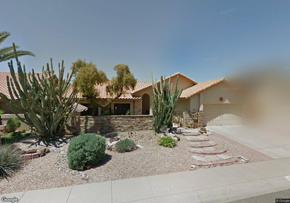
2866 N Ellis St Chandler, AZ 85224
Central Ridge NeighborhoodEstimated Value: $482,175 - $610,000
--
Bed
3
Baths
1,922
Sq Ft
$292/Sq Ft
Est. Value
About This Home
This home is located at 2866 N Ellis St, Chandler, AZ 85224 and is currently estimated at $561,544, approximately $292 per square foot. 2866 N Ellis St is a home located in Maricopa County with nearby schools including Pomeroy Elementary School, Franklin at Brimhall Elementary School, and Franklin Accelerated Academy Jordan Campus.
Ownership History
Date
Name
Owned For
Owner Type
Purchase Details
Closed on
Apr 4, 2022
Sold by
Thorpe Kevin P and Thorpe Merrian C
Bought by
Thorpe Kevin P and Thorpe Merrian C
Current Estimated Value
Purchase Details
Closed on
Jan 30, 1997
Sold by
Solmundson Bonita C
Bought by
Thorpe Kevin P and Thorpe Merrian C
Home Financials for this Owner
Home Financials are based on the most recent Mortgage that was taken out on this home.
Original Mortgage
$110,400
Interest Rate
7.86%
Mortgage Type
New Conventional
Create a Home Valuation Report for This Property
The Home Valuation Report is an in-depth analysis detailing your home's value as well as a comparison with similar homes in the area
Home Values in the Area
Average Home Value in this Area
Purchase History
| Date | Buyer | Sale Price | Title Company |
|---|---|---|---|
| Thorpe Kevin P | -- | None Listed On Document | |
| Thorpe Kevin P | $138,000 | Security Title Agency |
Source: Public Records
Mortgage History
| Date | Status | Borrower | Loan Amount |
|---|---|---|---|
| Previous Owner | Thorpe Kevin P | $110,400 |
Source: Public Records
Tax History Compared to Growth
Tax History
| Year | Tax Paid | Tax Assessment Tax Assessment Total Assessment is a certain percentage of the fair market value that is determined by local assessors to be the total taxable value of land and additions on the property. | Land | Improvement |
|---|---|---|---|---|
| 2025 | $2,031 | $23,818 | -- | -- |
| 2024 | $2,050 | $22,684 | -- | -- |
| 2023 | $2,050 | $42,210 | $8,440 | $33,770 |
| 2022 | $1,994 | $31,810 | $6,360 | $25,450 |
| 2021 | $2,005 | $29,760 | $5,950 | $23,810 |
| 2020 | $1,983 | $27,720 | $5,540 | $22,180 |
| 2019 | $1,826 | $26,020 | $5,200 | $20,820 |
| 2018 | $1,774 | $24,260 | $4,850 | $19,410 |
| 2017 | $1,705 | $23,170 | $4,630 | $18,540 |
| 2016 | $1,668 | $23,050 | $4,610 | $18,440 |
| 2015 | $1,570 | $20,860 | $4,170 | $16,690 |
Source: Public Records
Map
Nearby Homes
- 2674 N El Dorado Dr
- 2337 W Cheyenne Dr
- 2727 N Price Rd Unit 50
- 2727 N Price Rd Unit 57
- 2727 N Price Rd Unit 28
- 2029 W Shawnee Dr
- 2615 N Yucca St
- 2210 N Los Altos Dr
- 2014 W Summit Place
- 2103 W Palomino Dr
- 1821 W Mission Dr
- 2811 W Rosewood Dr
- 1805 W Cheyenne Dr
- 2334 W Peralta Ave
- 2050 N 90th Place
- 1807 W Mission Dr
- 1800 W Rosewood Ct
- 2431 W Los Arboles Place
- 2453 W Pecos Ave
- 2702 W Brooks St
- 2862 N Ellis St
- 2870 N Ellis St
- 2415 W Comstock Dr
- 2874 N Ellis St
- 2412 W Marlboro Dr
- 2858 N Ellis St
- 2418 W Comstock Dr
- 2411 W Comstock Dr
- 2413 W Marlboro Dr
- 2505 W Marlboro Dr
- 2414 W Comstock Dr
- 2408 W Marlboro Dr
- 2409 W Marlboro Dr
- 2421 W Gregg Dr
- 2407 W Comstock Dr
- 2690 N Ellis St
- 2936 N Ellis St
- 2686 N Ellis St
- 2417 W Gregg Dr
- 2410 W Comstock Dr