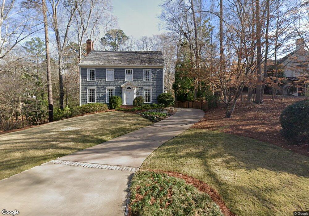
2867 Bakers Farm Rd SE Unit 1 Atlanta, GA 30339
Estimated Value: $1,308,000 - $1,821,000
4
Beds
4
Baths
3,686
Sq Ft
$423/Sq Ft
Est. Value
About This Home
This home is located at 2867 Bakers Farm Rd SE Unit 1, Atlanta, GA 30339 and is currently estimated at $1,558,023, approximately $422 per square foot. 2867 Bakers Farm Rd SE Unit 1 is a home located in Cobb County with nearby schools including Teasley Elementary School, Campbell Middle School, and Campbell High School.
Ownership History
Date
Name
Owned For
Owner Type
Purchase Details
Closed on
Jun 9, 2025
Sold by
Lanier Thomas H
Bought by
Lanier Mary
Current Estimated Value
Purchase Details
Closed on
Oct 26, 1999
Sold by
Anderson Sallye H
Bought by
Lanier Thomas and Lanier Mary
Home Financials for this Owner
Home Financials are based on the most recent Mortgage that was taken out on this home.
Original Mortgage
$450,000
Interest Rate
7.81%
Mortgage Type
New Conventional
Create a Home Valuation Report for This Property
The Home Valuation Report is an in-depth analysis detailing your home's value as well as a comparison with similar homes in the area
Home Values in the Area
Average Home Value in this Area
Purchase History
| Date | Buyer | Sale Price | Title Company |
|---|---|---|---|
| Lanier Mary | -- | None Listed On Document | |
| Lanier Mary | -- | None Listed On Document | |
| Lanier Thomas | $990,000 | -- |
Source: Public Records
Mortgage History
| Date | Status | Borrower | Loan Amount |
|---|---|---|---|
| Previous Owner | Lanier Thomas | $450,000 |
Source: Public Records
Tax History Compared to Growth
Tax History
| Year | Tax Paid | Tax Assessment Tax Assessment Total Assessment is a certain percentage of the fair market value that is determined by local assessors to be the total taxable value of land and additions on the property. | Land | Improvement |
|---|---|---|---|---|
| 2025 | $16,048 | $532,624 | $200,000 | $332,624 |
| 2024 | $16,059 | $532,624 | $200,000 | $332,624 |
| 2023 | $16,059 | $532,624 | $200,000 | $332,624 |
| 2022 | $15,302 | $504,180 | $200,000 | $304,180 |
| 2021 | $15,302 | $504,180 | $200,000 | $304,180 |
| 2020 | $11,521 | $379,602 | $163,800 | $215,802 |
| 2019 | $12,801 | $421,780 | $182,000 | $239,780 |
| 2018 | $12,801 | $421,780 | $182,000 | $239,780 |
| 2017 | $12,126 | $421,780 | $182,000 | $239,780 |
| 2016 | $12,126 | $421,780 | $182,000 | $239,780 |
| 2015 | $12,053 | $409,120 | $182,000 | $227,120 |
| 2014 | $12,155 | $409,120 | $0 | $0 |
Source: Public Records
Map
Nearby Homes
- 4395 Woodland Brook Dr SE
- 4421 Paradise Cir SE
- 3099 Farmington Dr SE
- 2792 Lansdowne Ln SE
- 4101 Brookview Dr SE
- 4408 Brookview Dr SE
- 4412 Brookview Dr SE
- 4503 Atley Woods Dr SE
- 4320 Brookview Dr SE
- 3200 Farmington
- 4432 Brookview Dr SE
- 4201 Brookview Dr SE
- 4604 Vinings Central Run SE Unit 131
- 2718 Vinings Oak Drive South E
- 4559 Paradise Shoals Rd SE
- 4509 Vinings Central Trace SE Unit 75
- 4751 Rosebrook Place SE
- 2607 Vinings Central Run SE Unit 6
- 4379 Log Cabin Dr SE
- 4 W Wesley Ridge NW
- 4290 Bakers Farm Place SE
- 2861 Bakers Farm Rd SE
- 2864 Bakers Farm Rd SE Unit 4
- 4297 Woodland Brook Dr SE
- 2868 Bakers Farm Rd SE Unit 1
- 4270 Bakers Farm Place SE
- 2860 Bakers Farm Rd SE
- 2872 Bakers Farm Rd SE
- 4279 Bakers Farm Place SE
- 4260 Bakers Farm Place SE
- 2876 Bakers Farm Rd SE
- 4271 Woodland Brook Dr SE
- 4361 Woodland Brook Dr SE
- 4269 Woodland Brook Dr SE
- 4267 Woodland Brook Dr SE
- 4269 Bakers Farm Place SE Unit 1
- 2890 Bakers Farm Rd SE
- 4328 Woodland Brook Dr SE