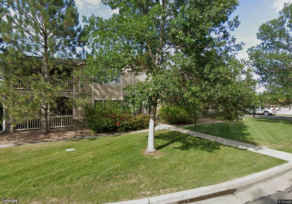
2867 Whitetail Cir Unit 2867 Lafayette, CO 80026
Estimated Value: $450,000 - $495,000
2
Beds
2
Baths
1,534
Sq Ft
$310/Sq Ft
Est. Value
About This Home
This home is located at 2867 Whitetail Cir Unit 2867, Lafayette, CO 80026 and is currently estimated at $475,777, approximately $310 per square foot. 2867 Whitetail Cir Unit 2867 is a home located in Boulder County with nearby schools including Ryan Elementary School, Angevine Middle School, and Centaurus High School.
Ownership History
Date
Name
Owned For
Owner Type
Purchase Details
Closed on
Mar 30, 2006
Sold by
Ralph A Deorio Marital Trust
Bought by
2867 Whitetail Circle Llc
Current Estimated Value
Purchase Details
Closed on
Jan 4, 2005
Sold by
Robertson Jay N
Bought by
Ralph A Deorio Marital Trust
Purchase Details
Closed on
Sep 17, 1999
Sold by
Ranch Southpointe Ii Llc
Bought by
Robertson Jay N
Home Financials for this Owner
Home Financials are based on the most recent Mortgage that was taken out on this home.
Original Mortgage
$177,705
Interest Rate
7.5%
Create a Home Valuation Report for This Property
The Home Valuation Report is an in-depth analysis detailing your home's value as well as a comparison with similar homes in the area
Home Values in the Area
Average Home Value in this Area
Purchase History
| Date | Buyer | Sale Price | Title Company |
|---|---|---|---|
| 2867 Whitetail Circle Llc | -- | None Available | |
| Ralph A Deorio Marital Trust | $224,000 | North Amer Title Co Of Co | |
| Robertson Jay N | $187,058 | North American Title Co |
Source: Public Records
Mortgage History
| Date | Status | Borrower | Loan Amount |
|---|---|---|---|
| Previous Owner | Robertson Jay N | $177,705 |
Source: Public Records
Tax History Compared to Growth
Tax History
| Year | Tax Paid | Tax Assessment Tax Assessment Total Assessment is a certain percentage of the fair market value that is determined by local assessors to be the total taxable value of land and additions on the property. | Land | Improvement |
|---|---|---|---|---|
| 2025 | $2,459 | $31,069 | -- | $31,069 |
| 2024 | $2,459 | $31,069 | -- | $31,069 |
| 2023 | $2,417 | $27,755 | -- | $31,440 |
| 2022 | $2,607 | $27,751 | $0 | $27,751 |
| 2021 | $2,578 | $28,550 | $0 | $28,550 |
| 2020 | $2,224 | $24,339 | $0 | $24,339 |
| 2019 | $2,194 | $24,339 | $0 | $24,339 |
| 2018 | $2,343 | $25,668 | $0 | $25,668 |
| 2017 | $2,282 | $28,377 | $0 | $28,377 |
| 2016 | $1,791 | $19,502 | $0 | $19,502 |
| 2015 | $1,678 | $15,737 | $0 | $15,737 |
| 2014 | $1,361 | $15,737 | $0 | $15,737 |
Source: Public Records
Map
Nearby Homes
- 2837 Whitetail Cir Unit 2837
- 2984 Hawk Ct
- 210 S Cherrywood Dr Unit 303
- 310 S Cherrywood Dr Unit 301
- 310 S Cherrywood Dr Unit 203
- 310 S Cherrywood Dr Unit 201
- 270 S Cherrywood Dr
- 2834 Blue Jay Way
- 329 Bobcat Point
- 1203 S 112th St
- 2370 Redwood Ave
- 2385 Heartwood Ct
- 290 S Cherrywood Dr Unit 103
- 290 S Cherrywood Dr Unit 203
- 290 S Cherrywood Dr Unit 201
- 290 S Cherrywood Dr Unit 204
- 10975 Maple Rd
- 375 Pika Point
- 299 Cheyenne Dr
- 335 Jackson St
- 2879 Whitetail Cir Unit 2879
- 2879 Whitetail Cir Unit 342879
- 2863 Whitetail Cir
- 2865 Whitetail Cir Unit 2865
- 2869 Whitetail Cir Unit 2869
- 2871 Whitetail Cir Unit 2871
- 2873 Whitetail Cir Unit 2873
- 2875 Whitetail Cir Unit 2875
- 2875 Whitetail Cir Unit 34-2875
- 247 Remuda Ln Unit 247
- 245 Remuda Ln Unit 245
- 243 Remuda Ln Unit 243
- 241 Remuda Ln Unit 241
- 237 Remuda Ln Unit 237
- 231 Remuda Ln Unit 231
- 231 Remuda Ln
- 235 Remuda Ln Unit 235
- 233 Remuda Ln Unit 233
- 2847 Whitetail Cir Unit 2847
- 1021 S 112th St