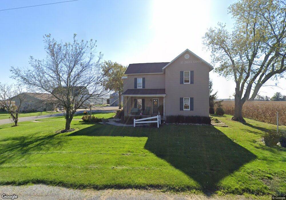
28680 State Route 67 Waynesfield, OH 45896
Estimated Value: $366,000 - $404,000
3
Beds
2
Baths
2,366
Sq Ft
$163/Sq Ft
Est. Value
About This Home
This home is located at 28680 State Route 67, Waynesfield, OH 45896 and is currently estimated at $385,560, approximately $162 per square foot. 28680 State Route 67 is a home located in Auglaize County with nearby schools including Waynesfield-Goshen Local Elementary School and Waynesfield-Goshen Local High School.
Ownership History
Date
Name
Owned For
Owner Type
Purchase Details
Closed on
Apr 9, 2015
Sold by
Turner Chris D and Turner Holly A
Bought by
Turner Chris D and Turner Holly A
Current Estimated Value
Purchase Details
Closed on
Nov 20, 1996
Sold by
Turner Carol Jean
Bought by
Turner Chris D and Turner Holly A
Create a Home Valuation Report for This Property
The Home Valuation Report is an in-depth analysis detailing your home's value as well as a comparison with similar homes in the area
Purchase History
| Date | Buyer | Sale Price | Title Company |
|---|---|---|---|
| Turner Chris D | -- | Attorney | |
| Turner Chris D | -- | -- |
Source: Public Records
Tax History
| Year | Tax Paid | Tax Assessment Tax Assessment Total Assessment is a certain percentage of the fair market value that is determined by local assessors to be the total taxable value of land and additions on the property. | Land | Improvement |
|---|---|---|---|---|
| 2025 | $6,032 | $95,900 | $8,420 | $87,480 |
| 2024 | $6,032 | $95,900 | $8,420 | $87,480 |
| 2023 | $3,374 | $95,900 | $8,420 | $87,480 |
| 2022 | $3,688 | $89,060 | $7,850 | $81,210 |
| 2021 | $3,686 | $89,060 | $7,850 | $81,210 |
| 2020 | $3,630 | $89,054 | $7,847 | $81,207 |
| 2019 | $2,961 | $74,211 | $6,538 | $67,673 |
| 2018 | $2,887 | $74,400 | $6,538 | $67,862 |
| 2017 | $2,867 | $74,400 | $6,538 | $67,862 |
| 2016 | $2,317 | $62,118 | $6,230 | $55,888 |
| 2015 | $1,047 | $55,507 | $6,230 | $49,277 |
| 2014 | $2,113 | $56,574 | $6,230 | $50,344 |
| 2013 | $1,186 | $56,574 | $6,230 | $50,344 |
Source: Public Records
Map
Nearby Homes
- 211 E Wapakoneta St
- 25836 Ohio 67
- 105 Guthrie St
- 25353 Buckland Holden Rd
- 18544 Santa Fe Line Rd
- 23481 Fairmount Rd
- 15281 US Highway 33
- 11588 Blackhawk Path
- 11571 Mohawk Path
- 4850 Bowdle Rd
- 11496 Powhatan Path
- 11478 Chickasaw
- 15527 State Route 235
- 14606 Beech Ave
- 11475 Township Road 293 Unit 330
- 13501 Eagle Path
- 4111 S Phillips Rd
- 11377 Township Road 266 Unit 99
- 11377 Township Road 266 Unit 34
- 11377 Township Road 266 Unit 28
Your Personal Tour Guide
Ask me questions while you tour the home.