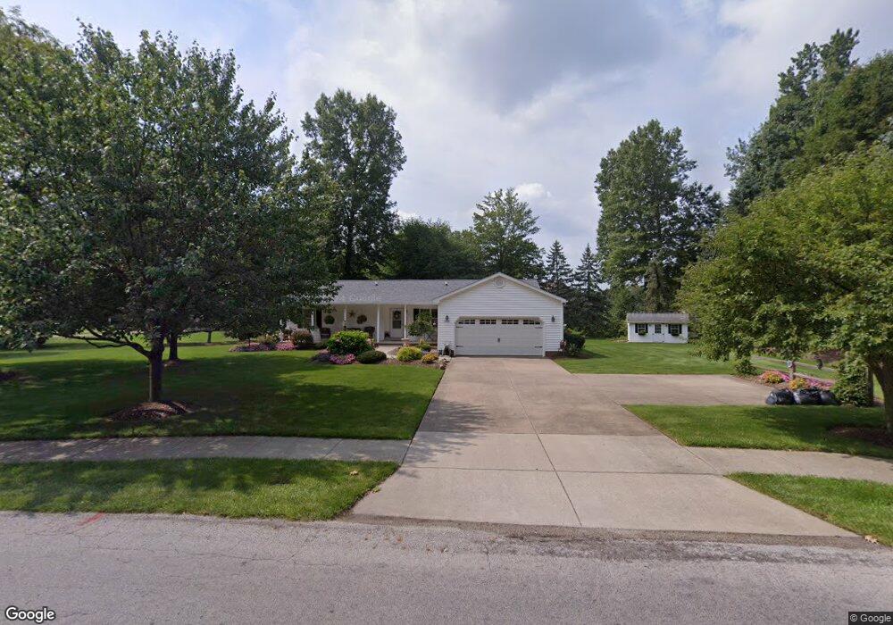
2869 S Rockhill Ave Alliance, OH 44601
Estimated Value: $235,440 - $331,000
3
Beds
2
Baths
1,624
Sq Ft
$171/Sq Ft
Est. Value
About This Home
This home is located at 2869 S Rockhill Ave, Alliance, OH 44601 and is currently estimated at $277,110, approximately $170 per square foot. 2869 S Rockhill Ave is a home located in Stark County with nearby schools including Alliance Elementary School at Rockhill, Alliance Intermediate School at Northside, and Alliance Middle School.
Ownership History
Date
Name
Owned For
Owner Type
Purchase Details
Closed on
Dec 13, 1995
Sold by
Garraway Ruby J
Bought by
Waltenbaugh Donald J and Waltenbaugh Diane
Current Estimated Value
Home Financials for this Owner
Home Financials are based on the most recent Mortgage that was taken out on this home.
Original Mortgage
$50,000
Outstanding Balance
$1,031
Interest Rate
7.45%
Mortgage Type
New Conventional
Estimated Equity
$276,079
Purchase Details
Closed on
Dec 10, 1992
Purchase Details
Closed on
Mar 6, 1991
Create a Home Valuation Report for This Property
The Home Valuation Report is an in-depth analysis detailing your home's value as well as a comparison with similar homes in the area
Home Values in the Area
Average Home Value in this Area
Purchase History
| Date | Buyer | Sale Price | Title Company |
|---|---|---|---|
| Waltenbaugh Donald J | $75,000 | -- | |
| -- | $18,000 | -- | |
| -- | -- | -- |
Source: Public Records
Mortgage History
| Date | Status | Borrower | Loan Amount |
|---|---|---|---|
| Open | Waltenbaugh Donald J | $50,000 |
Source: Public Records
Tax History Compared to Growth
Tax History
| Year | Tax Paid | Tax Assessment Tax Assessment Total Assessment is a certain percentage of the fair market value that is determined by local assessors to be the total taxable value of land and additions on the property. | Land | Improvement |
|---|---|---|---|---|
| 2025 | -- | $73,750 | $32,660 | $41,090 |
| 2024 | -- | $73,750 | $32,660 | $41,090 |
| 2023 | $2,563 | $72,950 | $29,860 | $43,090 |
| 2022 | $1,299 | $72,950 | $29,860 | $43,090 |
| 2021 | $2,599 | $72,950 | $29,860 | $43,090 |
| 2020 | $2,315 | $62,160 | $25,900 | $36,260 |
| 2019 | $2,282 | $62,170 | $25,910 | $36,260 |
| 2018 | $2,294 | $62,170 | $25,910 | $36,260 |
| 2017 | $2,095 | $56,750 | $21,710 | $35,040 |
| 2016 | $1,992 | $54,020 | $18,980 | $35,040 |
| 2015 | $2,009 | $54,020 | $18,980 | $35,040 |
| 2014 | $1,872 | $48,900 | $16,560 | $32,340 |
| 2013 | $934 | $48,900 | $16,560 | $32,340 |
Source: Public Records
Map
Nearby Homes
- 2839 S Rockhill Ave
- 3101 Ridgehill Ave
- 2705 Shunk Ave
- 1059 Oakwood Dr
- 1325 W Beech St
- 277 W Carol St
- 2195 Blenheim Ave
- 2112 Blenheim Ave
- 2220 Western Ave
- 236 E Milton St
- 884 W College Rd
- 0 Winchester St
- 0 Winchester St Unit 5162877
- 2460 S Arch Ave
- 1515 S Rockhill Ave
- 3709 S Union Ave
- 2408 S Linden Ave
- 555 E Milton St
- 317 E State St
- 112 E College St
- 2907 Ridgewood Ave
- 2840 S Rockhill Ave
- 2920 Ridgewood Ave
- 841 Birchwood Dr
- 2923 Ridgewood Ave
- 800 Oakwood Dr
- 842 Dogwood Trail
- 2910 Ridgewood Ave
- 2905 Ridgewood Ave
- 540 Maplewood Dr
- 810 Oakwood Dr
- 510 Maplewood Dr
- 851 Birchwood Dr
- 573 Linwood Dr
- 820 Oakwood Dr
- 561 Linwood Dr
- 2906 Ridgewood Ave
- 801 Oakwood Dr
- 845 Dogwood Trail
- 848 Dogwood Trail