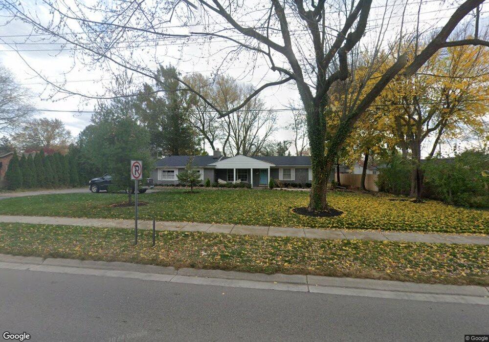
2869 W Maple Rd Bloomfield Hills, MI 48301
Estimated Value: $505,229 - $739,000
4
Beds
2
Baths
1,619
Sq Ft
$369/Sq Ft
Est. Value
About This Home
This home is located at 2869 W Maple Rd, Bloomfield Hills, MI 48301 and is currently estimated at $597,807, approximately $369 per square foot. 2869 W Maple Rd is a home located in Oakland County with nearby schools including Pierce Elementary School, Derby Middle School, and Ernest W. Seaholm High School.
Ownership History
Date
Name
Owned For
Owner Type
Purchase Details
Closed on
Jun 9, 2017
Sold by
Raider Melvyn C
Bought by
Larose Roger and Larose Frances
Current Estimated Value
Home Financials for this Owner
Home Financials are based on the most recent Mortgage that was taken out on this home.
Original Mortgage
$304,000
Outstanding Balance
$252,865
Interest Rate
4.02%
Mortgage Type
FHA
Estimated Equity
$344,942
Purchase Details
Closed on
Jun 28, 2014
Sold by
Scheiwe Tina P
Bought by
Scheiwe Peter
Create a Home Valuation Report for This Property
The Home Valuation Report is an in-depth analysis detailing your home's value as well as a comparison with similar homes in the area
Home Values in the Area
Average Home Value in this Area
Purchase History
| Date | Buyer | Sale Price | Title Company |
|---|---|---|---|
| Larose Roger | $380,000 | None Available | |
| Scheiwe Peter | -- | None Available |
Source: Public Records
Mortgage History
| Date | Status | Borrower | Loan Amount |
|---|---|---|---|
| Open | Larose Roger | $304,000 |
Source: Public Records
Tax History Compared to Growth
Tax History
| Year | Tax Paid | Tax Assessment Tax Assessment Total Assessment is a certain percentage of the fair market value that is determined by local assessors to be the total taxable value of land and additions on the property. | Land | Improvement |
|---|---|---|---|---|
| 2024 | $2,386 | $205,810 | $0 | $0 |
| 2023 | $2,290 | $187,500 | $0 | $0 |
| 2022 | $3,876 | $183,310 | $0 | $0 |
| 2021 | $3,908 | $181,790 | $0 | $0 |
| 2020 | $2,199 | $168,330 | $0 | $0 |
| 2019 | $3,902 | $156,090 | $0 | $0 |
| 2018 | $3,873 | $140,860 | $0 | $0 |
| 2017 | $3,871 | $137,660 | $0 | $0 |
| 2016 | $3,941 | $132,310 | $0 | $0 |
| 2015 | -- | $117,130 | $0 | $0 |
| 2014 | -- | $101,280 | $0 | $0 |
| 2011 | -- | $95,490 | $0 | $0 |
Source: Public Records
Map
Nearby Homes
- 100 Overhill Rd
- 397 S Cranbrook Rd
- 421 S Williamsbury Rd
- 231 Wadsworth Ln
- 3320 Morningview Terrace
- 2802 Heathfield Rd
- 2579 Amberly Rd
- 2721 Heathfield Rd
- 786 S Cranbrook Rd
- 394 S Glenhurst Dr
- 120 Westchester Way
- 3627 Middlebury Ln
- 1019 N Cranbrook Rd
- 345 Kimberly St
- 1834 Fairview St
- 6727 Lahser Rd
- 6580 Red Maple Ln
- 695 Westchester Way
- 2330 Fairway Dr
- 1882 Melbourne St
- 122 Bassett Place
- 136 Bassett Place
- 149 S Cranbrook Cross Rd
- 152 Bassett Place
- 173 S Cranbrook Cross Rd
- 2801 W Maple Rd
- 2840 W Maple Rd
- 164 Bassett Place
- 122 S Cranbrook Cross Rd
- 138 S Cranbrook Cross Rd
- 115 Hamilton Rd
- 130 N Cranbrook Cross Rd
- 131 Bassett Place
- 147 Bassett Place
- 199 S Cranbrook Cross Rd
- 154 S Cranbrook Cross Rd
- 174 Bassett Place
- 170 S Cranbrook Cross Rd
- 133 N Cranbrook Cross Rd
- 135 Hamilton Rd