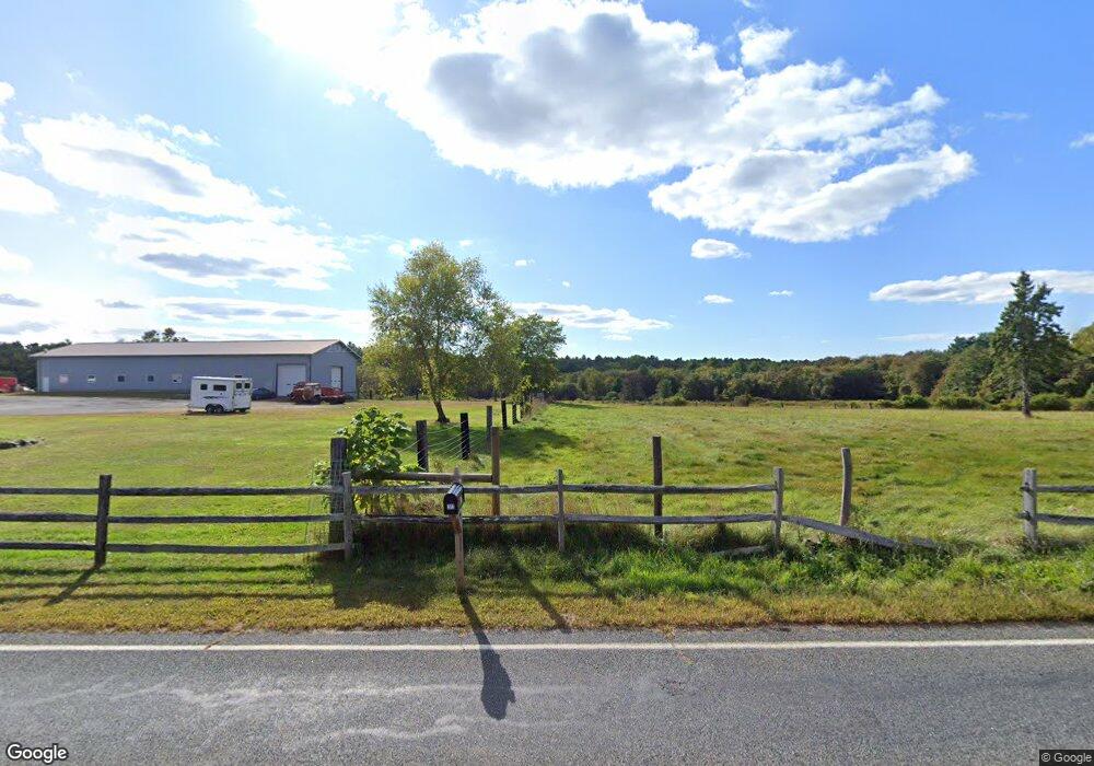
287-289 & 309 Gifford Rd Westport, MA 02790
North Westport NeighborhoodEstimated Value: $584,000
3
Beds
--
Bath
1,502
Sq Ft
$389/Sq Ft
Est. Value
About This Home
This home is located at 287-289 & 309 Gifford Rd, Westport, MA 02790 and is currently priced at $584,000, approximately $388 per square foot. 287-289 & 309 Gifford Rd is a home located in Bristol County with nearby schools including Alice A. Macomber Primary School, Westport Elementary School, and Westport Middle-High School.
Ownership History
Date
Name
Owned For
Owner Type
Purchase Details
Closed on
Jan 12, 2024
Sold by
Carvalho Joaquim and Carvalho Sandra
Bought by
Reynolds Jeffrey E and Reynolds Feather L
Current Estimated Value
Purchase Details
Closed on
Sep 29, 2020
Sold by
Feery Mary
Bought by
Carvalho Joaquim and Carvalho Sandra
Home Financials for this Owner
Home Financials are based on the most recent Mortgage that was taken out on this home.
Original Mortgage
$700,000
Interest Rate
2.9%
Mortgage Type
Purchase Money Mortgage
Purchase Details
Closed on
Feb 2, 2005
Sold by
Ferry Mary F
Bought by
Ferry
Create a Home Valuation Report for This Property
The Home Valuation Report is an in-depth analysis detailing your home's value as well as a comparison with similar homes in the area
Home Values in the Area
Average Home Value in this Area
Purchase History
| Date | Buyer | Sale Price | Title Company |
|---|---|---|---|
| Reynolds Jeffrey E | $495,000 | None Available | |
| Reynolds Jeffrey E | $495,000 | None Available | |
| Carvalho Joaquim | $1,100,000 | None Available | |
| Carvalho Joaquim | $1,100,000 | None Available | |
| Ferry | -- | -- | |
| Ferry Mary F | -- | -- | |
| Ferry | -- | -- |
Source: Public Records
Mortgage History
| Date | Status | Borrower | Loan Amount |
|---|---|---|---|
| Previous Owner | Carvalho Joaquim | $700,000 | |
| Previous Owner | Ferry | $137,600 |
Source: Public Records
Tax History Compared to Growth
Tax History
| Year | Tax Paid | Tax Assessment Tax Assessment Total Assessment is a certain percentage of the fair market value that is determined by local assessors to be the total taxable value of land and additions on the property. | Land | Improvement |
|---|---|---|---|---|
| 2025 | $3,717 | $498,900 | $189,100 | $309,800 |
| 2024 | $4,041 | $522,800 | $253,700 | $269,100 |
| 2023 | $3,600 | $441,200 | $235,100 | $206,100 |
| 2022 | $3,657 | $431,300 | $235,100 | $196,200 |
| 2021 | $2,492 | $289,090 | $0 | $0 |
| 2020 | $2,168 | $257,150 | $0 | $0 |
| 2019 | $2,120 | $256,310 | $121,710 | $134,600 |
| 2018 | $1,912 | $234,080 | $0 | $0 |
| 2017 | $1,827 | $229,230 | $0 | $0 |
| 2016 | $1,723 | $217,880 | $0 | $0 |
| 2015 | $1,691 | $213,280 | $0 | $0 |
Source: Public Records
Map
Nearby Homes
- 296 Gifford Rd
- 309 Gifford Rd
- 292 Gifford Rd
- 303 Gifford Rd
- 323 Gifford Rd
- 286 Gifford Rd
- 320 Gifford Rd
- 294 Gifford Rd
- 327 Gifford Rd
- 328 Gifford Rd
- 278 Gifford Rd
- 263 Gifford Rd
- 287 Gifford Rd
- 287 Gifford Rd Unit 2
- 287 Gifford Rd
- 331 Gifford Rd
- 332 Gifford Rd
- 333 Gifford Rd
- 318 Gifford Rd
- 272 Gifford Rd