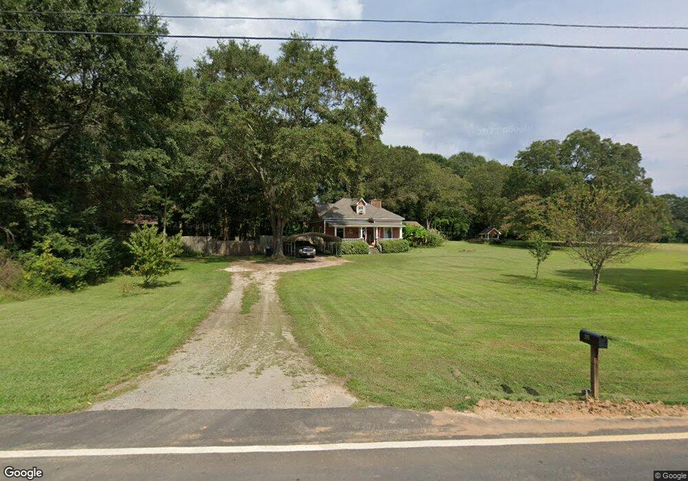
287 E Union Grove Cir Auburn, GA 30011
Estimated Value: $259,000 - $387,000
3
Beds
2
Baths
1,353
Sq Ft
$224/Sq Ft
Est. Value
About This Home
This home is located at 287 E Union Grove Cir, Auburn, GA 30011 and is currently estimated at $303,542, approximately $224 per square foot. 287 E Union Grove Cir is a home located in Gwinnett County with nearby schools including Mulberry Elementary School, Dacula Middle School, and Dacula High School.
Ownership History
Date
Name
Owned For
Owner Type
Purchase Details
Closed on
May 26, 2023
Sold by
Mitchell Ladonna D
Bought by
Jencarell Michael Roy and Jencarell Melissa Ann
Current Estimated Value
Home Financials for this Owner
Home Financials are based on the most recent Mortgage that was taken out on this home.
Original Mortgage
$109,800
Outstanding Balance
$106,652
Interest Rate
6.43%
Mortgage Type
New Conventional
Estimated Equity
$196,890
Purchase Details
Closed on
Sep 15, 1999
Sold by
Ward Scott A and Ward Kami S
Bought by
Mitchell Ladonna
Home Financials for this Owner
Home Financials are based on the most recent Mortgage that was taken out on this home.
Original Mortgage
$107,950
Interest Rate
7.91%
Mortgage Type
New Conventional
Create a Home Valuation Report for This Property
The Home Valuation Report is an in-depth analysis detailing your home's value as well as a comparison with similar homes in the area
Home Values in the Area
Average Home Value in this Area
Purchase History
| Date | Buyer | Sale Price | Title Company |
|---|---|---|---|
| Jencarell Michael Roy | $150,000 | -- | |
| Mitchell Ladonna | $127,000 | -- |
Source: Public Records
Mortgage History
| Date | Status | Borrower | Loan Amount |
|---|---|---|---|
| Open | Jencarell Michael Roy | $109,800 | |
| Previous Owner | Mitchell Ladonna | $107,950 |
Source: Public Records
Tax History
| Year | Tax Paid | Tax Assessment Tax Assessment Total Assessment is a certain percentage of the fair market value that is determined by local assessors to be the total taxable value of land and additions on the property. | Land | Improvement |
|---|---|---|---|---|
| 2025 | $3,438 | $95,800 | $22,520 | $73,280 |
| 2024 | $2,318 | $60,000 | $22,520 | $37,480 |
| 2023 | $2,318 | $95,800 | $22,520 | $73,280 |
| 2022 | $2,045 | $67,160 | $13,520 | $53,640 |
| 2021 | $2,074 | $67,160 | $13,520 | $53,640 |
| 2020 | $2,088 | $67,160 | $13,520 | $53,640 |
| 2019 | $1,652 | $48,680 | $10,000 | $38,680 |
| 2018 | $1,647 | $48,680 | $10,000 | $38,680 |
| 2016 | $1,671 | $48,680 | $10,000 | $38,680 |
| 2015 | $1,685 | $48,680 | $10,000 | $38,680 |
| 2014 | $1,709 | $49,480 | $8,960 | $40,520 |
Source: Public Records
Map
Nearby Homes
- 335 Wages Rd
- 3800 Bailey Rd
- 331 Wages Rd
- 0 Union Grove Cir W Unit 26174798
- 0 Union Grove Cir W Unit 10681821
- 538 Mulberry Fern Dr
- 1236 Maston Rd
- 1283 Maston Rd
- 1466 Maston Rd
- 441 Wages Rd
- 3817 Wages Rd
- 3755 Wages Rd
- 692 W Union Grove Cir
- 325 Rodeo Dr
- 486 Glen Terrace Rd
- 1778 Wynfield Ln
- 4050 Whitfield Oak Way
- 148 Longhorn Way
- 58 Longhorn Way
- 306 Rodeo Dr
- 310 E Union Grove Cir
- 2069 Blackberry Ln
- 2067 Blackberry Ln
- 2071 Blackberry Ln
- 5428 Union Grove Cir
- 250 E Union Grove Cir
- 280 E Union Grove Cir
- 2065 Blackberry Ln
- 2065 Blackberry Ln NE
- 2073 Blackberry Ln
- 2086 Blackberry Ln
- 360 E Union Grove Cir
- 391 E Union Grove Cir Unit LOT 4
- 391 E Union Grove Cir
- 391 E Union Grove Cir
- 2075 Blackberry Ln
- 381 E Union Grove Cir
- 2061 Blackberry Ln
- 2084 Blackberry Ln
- 320 E Union Grove Cir
Your Personal Tour Guide
Ask me questions while you tour the home.