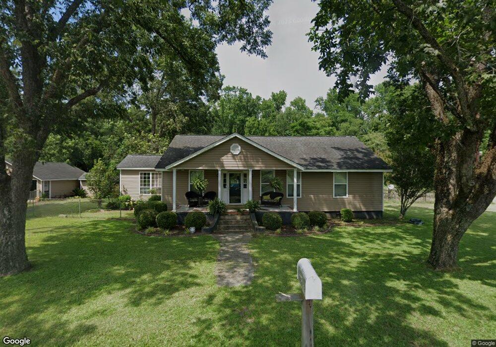
287 Earl Dr Saint George, SC 29477
Estimated Value: $155,000 - $376,610
3
Beds
2
Baths
2,276
Sq Ft
$135/Sq Ft
Est. Value
About This Home
This home is located at 287 Earl Dr, Saint George, SC 29477 and is currently estimated at $306,653, approximately $134 per square foot. 287 Earl Dr is a home located in Dorchester County with nearby schools including Williams Memorial Elementary School, St. George Middle School, and Harleyville-Ridgeville Middle.
Ownership History
Date
Name
Owned For
Owner Type
Purchase Details
Closed on
Jan 20, 2011
Sold by
Hartzog Lynette Crook
Bought by
Wade Tracy Q and Wade Rebecca L
Current Estimated Value
Home Financials for this Owner
Home Financials are based on the most recent Mortgage that was taken out on this home.
Original Mortgage
$80,000
Outstanding Balance
$43,739
Interest Rate
4.58%
Mortgage Type
Seller Take Back
Estimated Equity
$262,914
Create a Home Valuation Report for This Property
The Home Valuation Report is an in-depth analysis detailing your home's value as well as a comparison with similar homes in the area
Home Values in the Area
Average Home Value in this Area
Purchase History
| Date | Buyer | Sale Price | Title Company |
|---|---|---|---|
| Wade Tracy Q | $60,000 | -- |
Source: Public Records
Mortgage History
| Date | Status | Borrower | Loan Amount |
|---|---|---|---|
| Open | Wade Tracy Q | $80,000 |
Source: Public Records
Tax History Compared to Growth
Tax History
| Year | Tax Paid | Tax Assessment Tax Assessment Total Assessment is a certain percentage of the fair market value that is determined by local assessors to be the total taxable value of land and additions on the property. | Land | Improvement |
|---|---|---|---|---|
| 2025 | $1,573 | $9,189 | $2,400 | $6,789 |
| 2024 | $1,573 | $9,189 | $2,400 | $6,789 |
| 2023 | $1,573 | $7,629 | $840 | $6,789 |
| 2022 | $1,360 | $6,360 | $1,730 | $4,630 |
| 2021 | $1,217 | $6,360 | $1,730 | $4,630 |
| 2020 | $937 | $6,365 | $1,730 | $4,635 |
| 2019 | $937 | $6,365 | $1,730 | $4,635 |
| 2018 | $669 | $4,370 | $1,500 | $2,870 |
| 2017 | $664 | $4,370 | $1,500 | $2,870 |
| 2016 | $654 | $4,370 | $1,500 | $2,870 |
| 2015 | $652 | $4,370 | $1,500 | $2,870 |
| 2014 | $562 | $95,000 | $0 | $0 |
| 2013 | -- | $3,800 | $0 | $0 |
Source: Public Records
Map
Nearby Homes
- 472 Reeves Farm Rd
- 471 Reeves Farm Rd
- 461 Reeves Farm Rd
- 0 Ordie Rd Unit 22026751
- 678 Winningham Rd
- 686 Winningham Rd
- 114 Leisure St
- 335 Hudson Rd
- 00 Davis Terrace
- 01 Davis Terrace
- 00 Mulberry Rd
- 0 Mulberry Rd Unit 22536201
- 0 Mulberry Rd Unit 25022166
- 515 Farmers Market Rd
- 00 Flatwoods Rd
- 219 Rigby St
- 6156 Badham Dr
- 0 Doyle St Unit 24018915
- 0 Bethel Cemetery Rd
- 159 Bishopville Rd
- 270 Earl Dr
- 0 Earl Dr
- 290 Doodle Hill Dr
- 120 Shadow Pond Rd
- 222 Doodle Hill Dr
- 140 Earl Dr
- 437 Earl Dr
- 166 Saint Marks Dr
- 180 Saint Marks Dr
- 131 Angel Dr
- 168 Partridge Ln
- 120 Earl Dr
- 204 Doodle Hill Dr
- 0 Partridge Ln
- 1292 Saint Mark Bowman Rd
- 1292 St Mark Bowman Rd
- 193 Doodle Hill Dr
- 0 Doodle Hill Dr Unit 19008581
- 0 Doodle Hill Dr Unit 20012531
- 00 Doodle Hill Dr