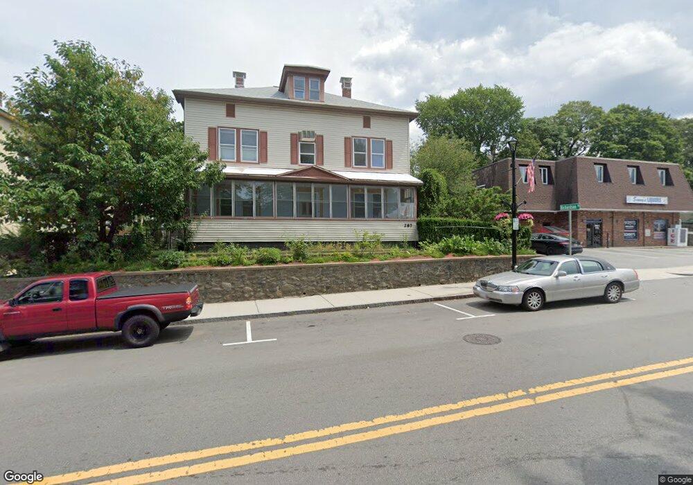
287 High St Clinton, MA 01510
Estimated Value: $405,000 - $481,000
4
Beds
2
Baths
2,052
Sq Ft
$214/Sq Ft
Est. Value
About This Home
This home is located at 287 High St, Clinton, MA 01510 and is currently estimated at $438,278, approximately $213 per square foot. 287 High St is a home located in Worcester County with nearby schools including Clinton Elementary School, Clinton Senior High School, and Clinton Middle School.
Ownership History
Date
Name
Owned For
Owner Type
Purchase Details
Closed on
Jun 15, 2001
Sold by
Kalinowski Steven F and Kalinowski Mary
Bought by
Netsetskiy Mikhail and Netsetskiy Raisa
Current Estimated Value
Home Financials for this Owner
Home Financials are based on the most recent Mortgage that was taken out on this home.
Original Mortgage
$120,000
Interest Rate
7.15%
Mortgage Type
Purchase Money Mortgage
Create a Home Valuation Report for This Property
The Home Valuation Report is an in-depth analysis detailing your home's value as well as a comparison with similar homes in the area
Home Values in the Area
Average Home Value in this Area
Purchase History
| Date | Buyer | Sale Price | Title Company |
|---|---|---|---|
| Netsetskiy Mikhail | $150,000 | -- |
Source: Public Records
Mortgage History
| Date | Status | Borrower | Loan Amount |
|---|---|---|---|
| Open | Netsetskiy Mikhail | $141,000 | |
| Closed | Netsetskiy Mikhail | $139,000 | |
| Closed | Netsetskiy Mikhail | $120,000 | |
| Closed | Netsetskiy Mikhail | $22,500 |
Source: Public Records
Tax History Compared to Growth
Tax History
| Year | Tax Paid | Tax Assessment Tax Assessment Total Assessment is a certain percentage of the fair market value that is determined by local assessors to be the total taxable value of land and additions on the property. | Land | Improvement |
|---|---|---|---|---|
| 2025 | $5,069 | $381,100 | $79,600 | $301,500 |
| 2024 | $4,970 | $378,200 | $79,600 | $298,600 |
| 2023 | $3,043 | $227,600 | $72,400 | $155,200 |
| 2022 | $3,045 | $204,200 | $65,800 | $138,400 |
| 2021 | $3,005 | $188,500 | $62,700 | $125,800 |
| 2020 | $2,920 | $188,500 | $62,700 | $125,800 |
| 2019 | $2,769 | $173,800 | $60,800 | $113,000 |
| 2018 | $3,632 | $213,900 | $68,400 | $145,500 |
| 2017 | $2,914 | $164,900 | $57,000 | $107,900 |
| 2016 | $2,965 | $171,700 | $57,000 | $114,700 |
| 2015 | $2,514 | $150,900 | $55,400 | $95,500 |
| 2014 | $2,437 | $150,900 | $55,400 | $95,500 |
Source: Public Records
Map
Nearby Homes
- 23 Ash St
- 324 1/2 Chestnut St
- 216 Walnut St
- 57 Clark St
- 55 Sterling St Unit 306
- 55 Sterling St Unit 314
- 55 Sterling St Unit 212
- 459 High St
- 155 Cedar St
- 1 Grady St
- 861 Main St
- 201 Stone St Unit 203
- 201-203 Stone St
- 125 Grove St
- 229 Sterling St
- 143 Grove St
- 51 Rigby St
- 66 Oak St Unit 66
- 30 John F. Kennedy Ave
- 151 Chace St
- 10 Richardson Place
- 301 High St Unit 303
- 14 Richardson Place
- 315 High St Unit 319
- 18 Richardson Place
- 15 Richardson Place Unit 17
- 270 High St
- 321 High St Unit 2
- 16 Prospect St
- 325 High St
- 22 Richardson Place
- 22 Richardson Place Unit 1
- 280 High St
- 91 Water St
- 242 High St
- 2 Prospect St
- 97 Water St
- 300 High St
- 18 Prospect St Unit 3
- 18 Prospect St Unit 2