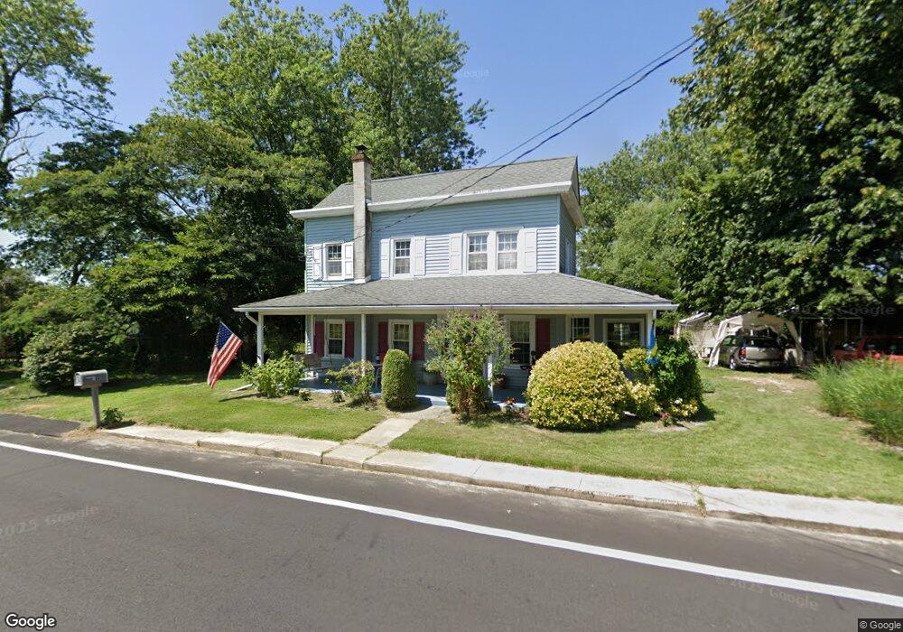
287 Landing Rd Newport, NJ 08345
Estimated Value: $169,689 - $302,000
--
Bed
--
Bath
1,718
Sq Ft
$150/Sq Ft
Est. Value
About This Home
This home is located at 287 Landing Rd, Newport, NJ 08345 and is currently estimated at $257,172, approximately $149 per square foot. 287 Landing Rd is a home located in Cumberland County with nearby schools including Downe Township Elementary School.
Ownership History
Date
Name
Owned For
Owner Type
Purchase Details
Closed on
Apr 5, 2006
Sold by
Jones Raymond S and Jones Elbertson, C
Bought by
Farkas Steve
Current Estimated Value
Purchase Details
Closed on
Aug 30, 1996
Sold by
Riland Chester and Riland Barbara
Bought by
Jones Raymond S and Elbertson Cynthia L
Home Financials for this Owner
Home Financials are based on the most recent Mortgage that was taken out on this home.
Original Mortgage
$71,250
Interest Rate
8.11%
Create a Home Valuation Report for This Property
The Home Valuation Report is an in-depth analysis detailing your home's value as well as a comparison with similar homes in the area
Home Values in the Area
Average Home Value in this Area
Purchase History
| Date | Buyer | Sale Price | Title Company |
|---|---|---|---|
| Farkas Steve | $165,000 | -- | |
| Jones Raymond S | $75,000 | Beacon Title |
Source: Public Records
Mortgage History
| Date | Status | Borrower | Loan Amount |
|---|---|---|---|
| Previous Owner | Jones Raymond S | $71,250 |
Source: Public Records
Tax History Compared to Growth
Tax History
| Year | Tax Paid | Tax Assessment Tax Assessment Total Assessment is a certain percentage of the fair market value that is determined by local assessors to be the total taxable value of land and additions on the property. | Land | Improvement |
|---|---|---|---|---|
| 2025 | $3,507 | $121,600 | $30,000 | $91,600 |
| 2024 | $3,507 | $121,600 | $30,000 | $91,600 |
| 2023 | $3,198 | $121,600 | $30,000 | $91,600 |
| 2022 | $3,118 | $121,600 | $30,000 | $91,600 |
| 2021 | $2,473 | $121,600 | $30,000 | $91,600 |
| 2020 | $2,924 | $121,600 | $30,000 | $91,600 |
| 2019 | $2,876 | $121,600 | $30,000 | $91,600 |
| 2018 | $2,914 | $121,600 | $30,000 | $91,600 |
| 2017 | $2,798 | $121,600 | $30,000 | $91,600 |
| 2016 | $2,796 | $121,600 | $30,000 | $91,600 |
| 2015 | $2,372 | $121,600 | $30,000 | $91,600 |
| 2014 | $2,178 | $121,600 | $30,000 | $91,600 |
Source: Public Records
Map
Nearby Homes
- 13 Hall St
- 184 Landing Rd
- 91 Landis Ave
- 281 Fortescue Rd
- 442 Shaws Mill Rd
- 0 Relm Ave Unit NJCB2022890
- 0 Keln Ave Unit NJCB2022904
- 554 Old Beaver Dam Rd
- 297 Factory Rd
- 395 Main St
- 377 Main St
- 73 Maple Ave
- 348 Main St
- 0 Lawn Ave Unit NJCB2022888
- 0 Lawn Ave Unit NJCB2022906
- 0 Forn Unit NJCB2022896
- 0 W Forn Unit NJCB2022892
- 0 Nark-Lawn Ave Unit NJCB2022900
- 0 Nark-Lawn Ave Unit NJCB2022902
- 0 Nark-Lawn Ave Unit NJCB2022898
- 289 Landing Rd
- 284 Landing Rd
- 288 Landing Rd
- 290 Landing Rd
- 281 Landing Rd
- 293 Landing Rd
- 292 Landing Rd
- 277 Landing Rd
- 274 Landing Rd
- 294 Landing Rd Unit 296
- 272 Landing Rd
- 273 Landing Rd
- 297 Landing Rd
- 297 Landing Rd Unit 299
- 0 Fortescue Rd Unit 356222
- 0 Fortescue Rd Unit 5922828
- 0 Fortescue Rd Unit 1004772505
- 0 Fortescue Rd Unit 1009322670
- 6 Fortescue Rd
- 301 Baptist Rd