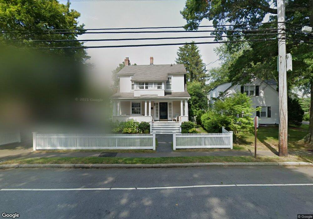
287 S Benson Rd Fairfield, CT 06824
Fairfield Beach NeighborhoodEstimated Value: $1,439,053 - $1,685,000
4
Beds
3
Baths
2,822
Sq Ft
$543/Sq Ft
Est. Value
About This Home
This home is located at 287 S Benson Rd, Fairfield, CT 06824 and is currently estimated at $1,532,763, approximately $543 per square foot. 287 S Benson Rd is a home located in Fairfield County with nearby schools including Roger Sherman Elementary School, Roger Ludlowe Middle School, and Fairfield Ludlowe High School.
Ownership History
Date
Name
Owned For
Owner Type
Purchase Details
Closed on
Dec 14, 2017
Sold by
Adams Jonathan J and Dalbec Katherine W
Bought by
Ogurick Matthew and Ogurick Christine L
Current Estimated Value
Home Financials for this Owner
Home Financials are based on the most recent Mortgage that was taken out on this home.
Original Mortgage
$601,000
Outstanding Balance
$510,772
Interest Rate
3.94%
Mortgage Type
Purchase Money Mortgage
Estimated Equity
$1,021,991
Purchase Details
Closed on
May 24, 2006
Sold by
Cohn Kenneth A and Cohn Joelle G
Bought by
James Jonathan and Dalbec Katherine W
Purchase Details
Closed on
Nov 19, 1999
Sold by
Namin Randolph E and Namin Heidi L
Bought by
Cohn Kenneth A and Cohn Juelle G
Purchase Details
Closed on
Feb 22, 1994
Sold by
Mcmanos Robin K and Mcmanus James P
Bought by
Namin Randolph E and Namin Heidi L
Purchase Details
Closed on
Jun 7, 1991
Sold by
Canzonetti Richard A and Lerman Andrew N
Bought by
Mcmanus Robin K and Mcmanus James P
Create a Home Valuation Report for This Property
The Home Valuation Report is an in-depth analysis detailing your home's value as well as a comparison with similar homes in the area
Home Values in the Area
Average Home Value in this Area
Purchase History
| Date | Buyer | Sale Price | Title Company |
|---|---|---|---|
| Ogurick Matthew | $755,000 | -- | |
| Ogurick Matthew | $755,000 | -- | |
| James Jonathan | $800,000 | -- | |
| James Jonathan | $800,000 | -- | |
| Cohn Kenneth A | $365,000 | -- | |
| Cohn Kenneth A | $365,000 | -- | |
| Namin Randolph E | $239,000 | -- | |
| Namin Randolph E | $239,000 | -- | |
| Mcmanus Robin K | $206,000 | -- |
Source: Public Records
Mortgage History
| Date | Status | Borrower | Loan Amount |
|---|---|---|---|
| Open | Mcmanus Robin K | $601,000 |
Source: Public Records
Tax History Compared to Growth
Tax History
| Year | Tax Paid | Tax Assessment Tax Assessment Total Assessment is a certain percentage of the fair market value that is determined by local assessors to be the total taxable value of land and additions on the property. | Land | Improvement |
|---|---|---|---|---|
| 2025 | $14,811 | $521,710 | $277,270 | $244,440 |
| 2024 | $14,556 | $521,710 | $277,270 | $244,440 |
| 2023 | $14,352 | $521,710 | $277,270 | $244,440 |
| 2022 | $14,211 | $521,710 | $277,270 | $244,440 |
| 2021 | $14,076 | $521,710 | $277,270 | $244,440 |
| 2020 | $14,822 | $553,280 | $305,130 | $248,150 |
| 2019 | $14,822 | $553,280 | $305,130 | $248,150 |
| 2018 | $14,584 | $553,280 | $305,130 | $248,150 |
| 2017 | $14,286 | $553,280 | $305,130 | $248,150 |
| 2016 | $14,081 | $553,280 | $305,130 | $248,150 |
| 2015 | $13,834 | $558,040 | $352,800 | $205,240 |
| 2014 | $13,616 | $558,040 | $352,800 | $205,240 |
Source: Public Records
Map
Nearby Homes
- 96 Clinton St
- 174 Sunnieholme Dr
- 117 Turney Rd
- 378 Penfield Rd
- 394 Penfield Rd
- 260 Birch Rd
- 361 Riverside Dr
- 2180 Kings Hwy Unit 1
- 38 Edge Hill Rd
- 20 Ermine St
- 122 Colony St
- 137 Millard St
- 35 Millard St
- 345 Reef Rd Unit B6
- 345 Reef Rd Unit C9
- 245 Unquowa Rd Unit 34
- 245 Unquowa Rd Unit 11
- 245 Unquowa Rd Unit 33
- 294 Catherine Terrace
- 196 Catherine Terrace
- 120 Eleanor Terrace
- 281 S Benson Rd
- 112 Eleanor Terrace
- 265 S Benson Rd
- 24 Horace Ct
- 257 S Benson Rd
- 286 S Benson Rd
- 321 S Benson Rd
- 298 S Benson Rd
- 40 Horace Ct
- 16 Horace Ct
- 251 S Benson Rd
- 314 S Benson Rd
- 274 S Benson Rd
- 260 S Benson Rd
- 896 Riverside Dr
- 330 S Benson Rd
- 326 S Benson Rd
- 10 Horace Ct
- 31 Horace Ct