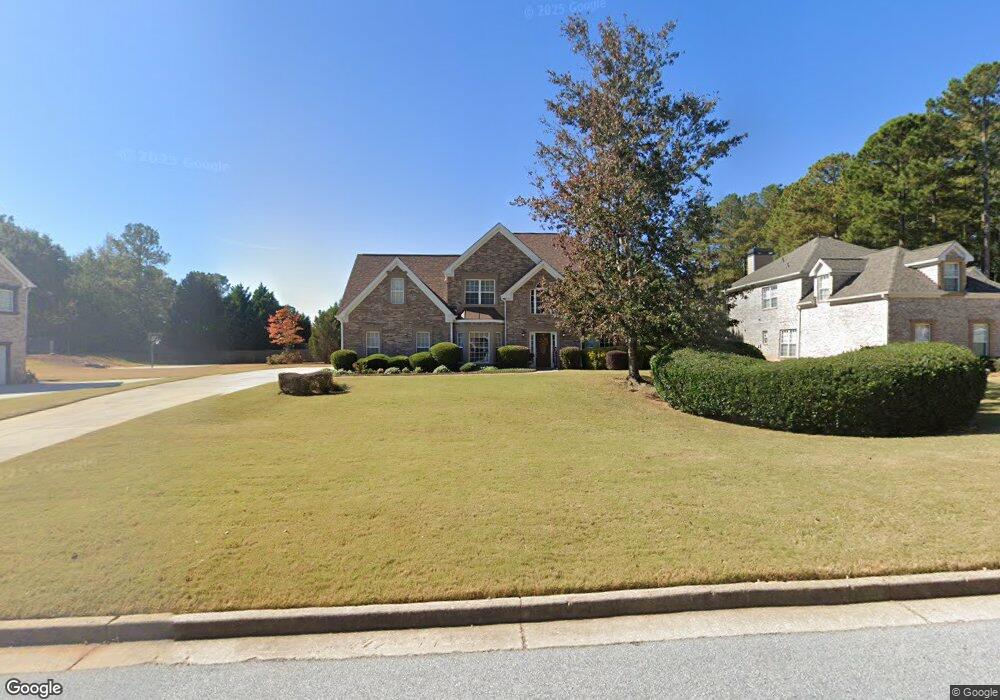
2870 Weatherstone Cir SE Unit 7 Conyers, GA 30094
Estimated Value: $369,532 - $447,000
4
Beds
3
Baths
2,730
Sq Ft
$151/Sq Ft
Est. Value
About This Home
This home is located at 2870 Weatherstone Cir SE Unit 7, Conyers, GA 30094 and is currently estimated at $411,133, approximately $150 per square foot. 2870 Weatherstone Cir SE Unit 7 is a home located in Rockdale County with nearby schools including Flat Shoals Elementary School, Edwards Middle School, and Rockdale County High School.
Ownership History
Date
Name
Owned For
Owner Type
Purchase Details
Closed on
Apr 23, 2004
Sold by
Greenwood Hms Ic
Bought by
Thomas Willie D and Thomas Angela
Current Estimated Value
Home Financials for this Owner
Home Financials are based on the most recent Mortgage that was taken out on this home.
Original Mortgage
$176,000
Outstanding Balance
$81,028
Interest Rate
5.35%
Mortgage Type
New Conventional
Estimated Equity
$330,105
Create a Home Valuation Report for This Property
The Home Valuation Report is an in-depth analysis detailing your home's value as well as a comparison with similar homes in the area
Home Values in the Area
Average Home Value in this Area
Purchase History
| Date | Buyer | Sale Price | Title Company |
|---|---|---|---|
| Thomas Willie D | $220,000 | -- |
Source: Public Records
Mortgage History
| Date | Status | Borrower | Loan Amount |
|---|---|---|---|
| Open | Thomas Willie D | $176,000 |
Source: Public Records
Tax History Compared to Growth
Tax History
| Year | Tax Paid | Tax Assessment Tax Assessment Total Assessment is a certain percentage of the fair market value that is determined by local assessors to be the total taxable value of land and additions on the property. | Land | Improvement |
|---|---|---|---|---|
| 2024 | $4,646 | $184,480 | $30,920 | $153,560 |
| 2023 | $3,863 | $159,960 | $30,800 | $129,160 |
| 2022 | $3,142 | $131,880 | $24,960 | $106,920 |
| 2021 | $2,784 | $110,760 | $20,800 | $89,960 |
| 2020 | $2,503 | $97,520 | $17,760 | $79,760 |
| 2019 | $2,352 | $90,560 | $10,800 | $79,760 |
| 2018 | $2,016 | $79,240 | $10,800 | $68,440 |
| 2017 | $1,865 | $73,560 | $10,800 | $62,760 |
| 2016 | $1,723 | $73,560 | $10,800 | $62,760 |
| 2015 | $1,470 | $64,720 | $9,320 | $55,400 |
| 2014 | $1,127 | $57,400 | $8,000 | $49,400 |
| 2013 | -- | $90,240 | $13,600 | $76,640 |
Source: Public Records
Map
Nearby Homes
- 2464 Lennox Rd SE
- Boston Plan at Millers Pointe
- Atlanta Plan at Millers Pointe
- Columbus Plan at Millers Pointe
- 2608 Downing Park Dr SE
- 2537 Lennox Rd SE
- 1420 Hillside Place SE
- 2197 Boxwood Cir
- 1508 Hillside Dr SE
- 340 Windsor Walk SE
- 1511 Hillside Dr SE
- 2631 Rolling Hills Way SE
- Astrid Plan at Alder Park
- Harrison Plan at Alder Park
- Baker Plan at Alder Park
- Oliver Plan at Alder Park
- 1601 Creek Crossing SE
- 2617 Laurel Woods Ln SE Unit 3
- 2717 Stanton Woods Dr SE
- 309 Windsor Walk SE Unit 1
- 2860 Weatherstone Cir SE
- 2880 Weatherstone Cir SE Unit 7
- 3291 Liberty Ct SE Unit 7
- 2850 Weatherstone Cir SE
- 2890 Weatherstone Cir SE Unit 5
- 2890 Weatherstone Cir SE
- 2871 Weatherstone Cir SE
- 3290 Liberty Ct SE
- 2881 Weatherstone Cir SE
- 2861 Weatherstone Cir SE Unit 7
- 3281 Liberty Ct SE Unit 7
- 2900 Weatherstone Cir SE
- 2891 Weatherstone Cir SE
- 2830 Weatherstone Cir SE
- 2790 Weatherstone Cir SE Unit 7
- 3280 Liberty Ct SE
- 2841 Weatherstone Cir SE
- 0 Liberty Ct SE Unit 7377603
- 0 Liberty Ct SE
- 2901 Weatherstone Cir SE Unit 5