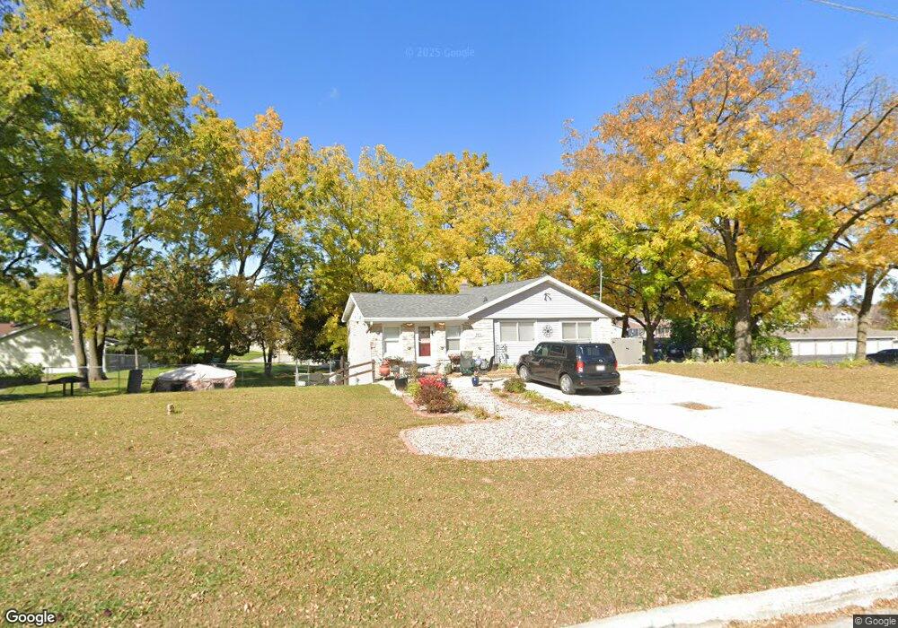
2871 Saint Anthony Dr Green Bay, WI 54311
Schmitt Park NeighborhoodEstimated Value: $282,000 - $297,606
1
Bed
1
Bath
672
Sq Ft
$430/Sq Ft
Est. Value
About This Home
This home is located at 2871 Saint Anthony Dr, Green Bay, WI 54311 and is currently estimated at $288,902, approximately $429 per square foot. 2871 Saint Anthony Dr is a home located in Brown County with nearby schools including Baird Elementary School, Preble High School, and St. Thomas More Catholic School.
Ownership History
Date
Name
Owned For
Owner Type
Purchase Details
Closed on
Jul 17, 2019
Sold by
Mobeta Llc
Bought by
Kendall Ingeborg and Kendall Jason M
Current Estimated Value
Home Financials for this Owner
Home Financials are based on the most recent Mortgage that was taken out on this home.
Original Mortgage
$127,920
Outstanding Balance
$112,069
Interest Rate
3.82%
Mortgage Type
New Conventional
Estimated Equity
$176,833
Purchase Details
Closed on
Jan 26, 2018
Sold by
Martin Catherine A
Bought by
Mobeta Llc
Purchase Details
Closed on
Dec 18, 1998
Sold by
Krumpos Keith
Bought by
Martin Lester F and Martin Catherine A
Home Financials for this Owner
Home Financials are based on the most recent Mortgage that was taken out on this home.
Original Mortgage
$42,222
Interest Rate
7.02%
Create a Home Valuation Report for This Property
The Home Valuation Report is an in-depth analysis detailing your home's value as well as a comparison with similar homes in the area
Home Values in the Area
Average Home Value in this Area
Purchase History
| Date | Buyer | Sale Price | Title Company |
|---|---|---|---|
| Kendall Ingeborg | $159,900 | First American Title | |
| Mobeta Llc | $40,500 | Liberty Title | |
| Martin Lester F | $28,000 | -- |
Source: Public Records
Mortgage History
| Date | Status | Borrower | Loan Amount |
|---|---|---|---|
| Open | Kendall Ingeborg | $127,920 | |
| Previous Owner | Martin Lester F | $42,222 |
Source: Public Records
Tax History Compared to Growth
Tax History
| Year | Tax Paid | Tax Assessment Tax Assessment Total Assessment is a certain percentage of the fair market value that is determined by local assessors to be the total taxable value of land and additions on the property. | Land | Improvement |
|---|---|---|---|---|
| 2024 | $3,350 | $182,900 | $40,600 | $142,300 |
| 2023 | $3,083 | $177,600 | $40,600 | $137,000 |
| 2022 | $3,250 | $177,600 | $40,600 | $137,000 |
| 2021 | $3,149 | $129,700 | $24,000 | $105,700 |
| 2020 | $3,424 | $129,700 | $24,000 | $105,700 |
| 2019 | $1,338 | $58,500 | $24,000 | $34,500 |
| 2018 | $1,024 | $46,800 | $24,000 | $22,800 |
| 2017 | $1,447 | $71,800 | $30,000 | $41,800 |
| 2016 | $1,419 | $71,800 | $30,000 | $41,800 |
| 2015 | $1,534 | $71,800 | $30,000 | $41,800 |
| 2014 | $1,532 | $71,800 | $30,000 | $41,800 |
| 2013 | $1,532 | $71,800 | $30,000 | $41,800 |
Source: Public Records
Map
Nearby Homes
- 1123 Saint Charles Dr
- 1019 Mt Mary Dr
- 980 Queoff St
- 1014 Laverne Dr
- 1000 Mount Hood Ct
- 2800 Humboldt Rd
- 3038 Bay View Dr
- 2780 Humboldt Rd
- 2686 Humboldt Rd Unit 1
- 2686 Humboldt Rd Unit 12
- 3032 Humboldt Rd
- 2932 Suzanne Ct
- 910 Pine Ridge Dr
- 2352 Bay Beach Ct
- 3199 Humboldt Rd
- 175 Burgundy Ct
- 2659 Sage Dr
- 141 Thyme Place
- 0 Largo Ridge Dr Unit 50299111
- 0 Largo Ridge Dr Unit 50316072
- 2871 St Anthony Dr
- 2813 Mount Mary Cir
- 2813 Mount Mary Cir Unit 2815
- 2859 St Anthony Dr
- 2859 Saint Anthony Dr
- 2868 Saint Anthony Dr
- 1221 Mount Mary Dr
- 2820 Mount Mary Cir
- 1220 Saint Lawrence Dr
- 2819 Mount Mary Cir Unit 2821
- 2825 Mount Mary Cir Unit 2827
- 2825 Mount Mary Cir
- 1207 Mount Mary Dr
- 1188 Saint Lawrence Dr
- 2851 Saint Anthony Dr
- 2829 Mount Mary Cir Unit 2831
- 2833 Mt Mary Cir
- 1129 Mount Mary Dr
- 2833 Mount Mary Cir Unit 2835
- 1210 Mount Mary Dr