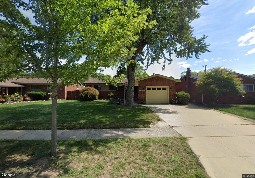
28718 Newport Dr Warren, MI 48088
Northeast Warren NeighborhoodEstimated Value: $232,420 - $246,000
3
Beds
2
Baths
1,205
Sq Ft
$197/Sq Ft
Est. Value
About This Home
This home is located at 28718 Newport Dr, Warren, MI 48088 and is currently estimated at $237,473, approximately $197 per square foot. 28718 Newport Dr is a home located in Macomb County with nearby schools including Warren Woods Tower High School, Frontier International Academy Elementary, and Warren Woods Christian School.
Ownership History
Date
Name
Owned For
Owner Type
Purchase Details
Closed on
Aug 13, 2024
Sold by
Eddy Elisabeth and Eddy Elisabeth A
Bought by
Whitehead Sean
Current Estimated Value
Home Financials for this Owner
Home Financials are based on the most recent Mortgage that was taken out on this home.
Original Mortgage
$216,310
Outstanding Balance
$213,900
Interest Rate
6.95%
Mortgage Type
New Conventional
Estimated Equity
$23,573
Purchase Details
Closed on
Mar 23, 2010
Sold by
Eddy Gerald M and Eddy Elisabeth
Bought by
Eddy Gerald M and Eddy Elisabeth
Purchase Details
Closed on
Dec 5, 2006
Sold by
Eddy Gerald Micheal and Eddy Betty Anne
Bought by
Eddy Gerald M and Eddy Elisabeth
Home Financials for this Owner
Home Financials are based on the most recent Mortgage that was taken out on this home.
Original Mortgage
$50,000
Interest Rate
6.33%
Mortgage Type
Stand Alone Refi Refinance Of Original Loan
Create a Home Valuation Report for This Property
The Home Valuation Report is an in-depth analysis detailing your home's value as well as a comparison with similar homes in the area
Home Values in the Area
Average Home Value in this Area
Purchase History
| Date | Buyer | Sale Price | Title Company |
|---|---|---|---|
| Whitehead Sean | $223,000 | Ata National Title | |
| Eddy Gerald M | -- | None Available | |
| Eddy Gerald M | -- | Strategic Title Agency |
Source: Public Records
Mortgage History
| Date | Status | Borrower | Loan Amount |
|---|---|---|---|
| Open | Whitehead Sean | $216,310 | |
| Previous Owner | Eddy Gerald M | $50,000 |
Source: Public Records
Tax History
| Year | Tax Paid | Tax Assessment Tax Assessment Total Assessment is a certain percentage of the fair market value that is determined by local assessors to be the total taxable value of land and additions on the property. | Land | Improvement |
|---|---|---|---|---|
| 2025 | $5,611 | $108,120 | $0 | $0 |
| 2024 | $29 | $98,530 | $0 | $0 |
| 2023 | $2,743 | $88,430 | $0 | $0 |
| 2022 | $2,689 | $77,940 | $0 | $0 |
| 2021 | $2,639 | $73,720 | $0 | $0 |
| 2020 | $2,529 | $69,840 | $0 | $0 |
| 2019 | $2,416 | $65,690 | $0 | $0 |
| 2018 | $2,441 | $63,340 | $0 | $0 |
| 2017 | $2,309 | $56,000 | $9,660 | $46,340 |
| 2016 | $2,291 | $56,000 | $0 | $0 |
| 2015 | -- | $50,210 | $0 | $0 |
| 2013 | $4,425 | $43,300 | $0 | $0 |
Source: Public Records
Map
Nearby Homes
- 29105 Palomino Dr
- 29143 Dover Ave
- 28540 Roan Dr
- 28127 Suburban Dr
- 29091 Wagner Dr
- 54765 Palomino Ave
- 12876 Martin Rd
- 29337 Roan Dr
- 29134 Bonnie Dr
- 29366 Wagner Dr
- 12855 Ray Dr
- 13517 Yvonne Dr
- 29820 Palomino Dr
- 29460 Hoover Rd Unit D37
- 29346 Hoover Rd
- 13513 Angela Dr
- 29368 Hoover Rd Unit A3
- 11960 E Fort Lauderdale St
- 12531 Common Rd
- 13510 Angela Dr
- 28730 Newport Dr
- 28706 Newport Dr
- 28742 Newport Dr
- 28676 Newport Dr
- 28711 Adler Dr
- 28723 Adler Dr
- 28701 Adler Dr
- 28735 Adler Dr
- 28754 Newport Dr
- 28664 Newport Dr
- 28687 Adler Dr
- 28747 Adler Dr
- 28721 Newport Dr
- 28679 Newport Dr
- 28709 Newport Dr
- 28679 Newport Dr
- 28766 Newport Dr
- 28652 Newport Dr
- 28745 Newport Dr
- 28675 Adler Dr
Your Personal Tour Guide
Ask me questions while you tour the home.