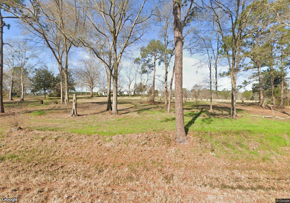
2872 Highway 441 Mc Rae, GA 31055
Estimated Value: $142,000 - $354,597
2
Beds
3
Baths
1,448
Sq Ft
$171/Sq Ft
Est. Value
About This Home
This home is located at 2872 Highway 441, Mc Rae, GA 31055 and is currently estimated at $248,299, approximately $171 per square foot. 2872 Highway 441 is a home located in Telfair County with nearby schools including Telfair County Elementary School, Telfair County Middle School, and Telfair County High School.
Ownership History
Date
Name
Owned For
Owner Type
Purchase Details
Closed on
Dec 8, 2023
Sold by
Swain Chester L
Bought by
Swain Karen D and Swain Ricky E
Current Estimated Value
Purchase Details
Closed on
Nov 30, 2015
Sold by
Swain Josh
Bought by
Swain Chester L and Swain Ricky E
Purchase Details
Closed on
Mar 12, 2013
Sold by
Swain Chester L and Swain Ricky E
Bought by
Swain Josh and Swain Reece
Purchase Details
Closed on
Jan 26, 2007
Sold by
Swain Chester L
Bought by
Swain Ricky E
Purchase Details
Closed on
Oct 12, 2005
Sold by
Swain Chester L
Bought by
Swain Helen M and Swain Chester L
Purchase Details
Closed on
Sep 26, 2005
Sold by
Swain Ricky E
Bought by
Swain Chester L
Create a Home Valuation Report for This Property
The Home Valuation Report is an in-depth analysis detailing your home's value as well as a comparison with similar homes in the area
Home Values in the Area
Average Home Value in this Area
Purchase History
| Date | Buyer | Sale Price | Title Company |
|---|---|---|---|
| Swain Karen D | -- | -- | |
| Swain Chester L | -- | -- | |
| Swain Josh | -- | -- | |
| Swain Ricky E | -- | -- | |
| Swain Helen M | -- | -- | |
| Swain Chester L | -- | -- |
Source: Public Records
Tax History
| Year | Tax Paid | Tax Assessment Tax Assessment Total Assessment is a certain percentage of the fair market value that is determined by local assessors to be the total taxable value of land and additions on the property. | Land | Improvement |
|---|---|---|---|---|
| 2025 | $1,467 | $118,465 | $101,771 | $16,694 |
| 2024 | $1,462 | $80,769 | $64,154 | $16,615 |
| 2023 | $2,475 | $115,655 | $64,154 | $51,501 |
| 2022 | $2,215 | $115,655 | $64,154 | $51,501 |
| 2021 | $2,382 | $107,598 | $61,228 | $46,370 |
| 2020 | $2,337 | $105,779 | $61,228 | $44,551 |
| 2019 | $2,324 | $105,779 | $61,228 | $44,551 |
| 2018 | $3,403 | $105,779 | $61,228 | $44,551 |
| 2017 | $2,103 | $90,870 | $50,513 | $40,357 |
| 2016 | $2,103 | $90,870 | $50,513 | $40,357 |
| 2015 | -- | $95,593 | $54,099 | $41,494 |
| 2014 | -- | $84,460 | $45,659 | $38,802 |
| 2013 | -- | $80,462 | $45,658 | $34,804 |
Source: Public Records
Map
Nearby Homes
- 0 Macedonia Church Rd Unit 10572610
- 0 Old Prison Camp Rd Unit 23374479
- 0 Camp Unit 10542474
- Hwy 319-441
- County Road 121
- 0 Garrison Rd Unit 26174216
- 0 Garrison Rd Unit 26174964
- 000 Bowen Padgett Rd
- 1564 Big Horse Creek Rd
- 0 Big Horse Creek Rd Unit 24187040
- 3 Powell School Rd
- 2 Powell School Rd
- 4 Powell School Rd
- Tract 6 United Church Rd
- Tract 8 United Church Rd
- 0 United Church Rd
- 0 Jim Hammock Dr Unit 10680893
- 0 Jim Hammock Dr
- 02 Big Horse Creek Rd
- 589 Jacksonville Scotland Rd
- 2904 Highway 441
- 2962 Highway 441
- 2982 Highway 441
- 72 Workmore Milan Rd
- 3000 Highway 441
- 3000 U S 441
- 3001 U S 441
- 2702 Highway 441
- 162 Workmore Milan Rd
- 147 Workmore Milan Rd
- 48 Hulett Ln
- 52 Macedonia Church Rd
- 46 Taylor Ln
- 2616 Highway 441
- 49 Jimmy Powell Ln
- 145 Ward Rd
- 122 Ward Rd
- 2548 Highway 441
- 411 Kinnett Rd
- 741 Workmore Milan Rd
Your Personal Tour Guide
Ask me questions while you tour the home.
