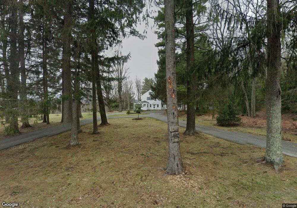
2873 Route 390 Canadensis, PA 18325
Estimated Value: $605,000 - $852,641
--
Bed
6
Baths
2,773
Sq Ft
$271/Sq Ft
Est. Value
About This Home
This home is located at 2873 Route 390, Canadensis, PA 18325 and is currently estimated at $750,660, approximately $270 per square foot. 2873 Route 390 is a home with nearby schools including Swiftwater Interm School, Swiftwater Elementary Center, and Pocono Mountain East Junior High School.
Ownership History
Date
Name
Owned For
Owner Type
Purchase Details
Closed on
Dec 29, 2021
Sold by
Aughenbaugh Holly S and The Holy S Aughenbaugh Revocab
Bought by
Mlller David M
Current Estimated Value
Home Financials for this Owner
Home Financials are based on the most recent Mortgage that was taken out on this home.
Original Mortgage
$480,000
Outstanding Balance
$442,438
Interest Rate
3.12%
Mortgage Type
New Conventional
Estimated Equity
$308,222
Purchase Details
Closed on
Feb 3, 1994
Bought by
Aughenbaugh Holly S Trustee
Create a Home Valuation Report for This Property
The Home Valuation Report is an in-depth analysis detailing your home's value as well as a comparison with similar homes in the area
Home Values in the Area
Average Home Value in this Area
Purchase History
| Date | Buyer | Sale Price | Title Company |
|---|---|---|---|
| Mlller David M | $640,000 | Pocono Area Abstract | |
| Aughenbaugh Holly S Trustee | -- | -- |
Source: Public Records
Mortgage History
| Date | Status | Borrower | Loan Amount |
|---|---|---|---|
| Open | Mlller David M | $480,000 |
Source: Public Records
Tax History Compared to Growth
Tax History
| Year | Tax Paid | Tax Assessment Tax Assessment Total Assessment is a certain percentage of the fair market value that is determined by local assessors to be the total taxable value of land and additions on the property. | Land | Improvement |
|---|---|---|---|---|
| 2025 | $3,755 | $465,240 | $207,690 | $257,550 |
| 2024 | $3,057 | $465,240 | $207,690 | $257,550 |
| 2023 | $12,176 | $465,240 | $207,690 | $257,550 |
| 2022 | $11,969 | $465,240 | $207,690 | $257,550 |
| 2021 | $23,009 | $465,240 | $207,690 | $257,550 |
| 2020 | $23,009 | $894,390 | $551,400 | $342,990 |
| 2019 | $12,349 | $69,850 | $42,430 | $27,420 |
| 2018 | $12,349 | $69,850 | $42,430 | $27,420 |
| 2017 | $12,488 | $69,850 | $42,430 | $27,420 |
| 2016 | $2,899 | $69,850 | $42,430 | $27,420 |
| 2015 | -- | $69,850 | $42,430 | $27,420 |
| 2014 | -- | $69,850 | $42,430 | $27,420 |
Source: Public Records
Map
Nearby Homes
- 2872 Pennsylvania 390
- 2872 Route 390
- 7317 Meadow Ln
- 2735 Route 390
- 289 Forest Dr
- 275 Forest Dr
- 2153 Gravel Rd
- 111 Rippling Brook Rd
- 105 Glenmere Rd
- 5715 Pennsylvania 447
- 2413 Pennsylvania 390
- 1215 Seese Hill Rd
- 86 D Lookout Point Rd
- 479 Golf Dr
- 144 Raspberry Dr
- 4648 Route 447
- 5126 Beatty Cir
- 2148 Laurel Ln
- 2138 Laurel Ln
- 111 Lake In the Clouds Rd
- 2873 Pennsylvania 390
- 0 Pennsylvania 390
- 109 Fairway Ln
- 2859 Route 390
- 63 Falls Rd
- 2866 Route 390
- 2886 Pennsylvania 390
- 2886 Route 390
- 115 Fairway Ln
- 2849 Route 390
- 2895 Route 390
- 2892 Route 390
- 121 Fairway Ln
- 121 Fairway Ln
- 2848 Pennsylvania 390
- 0 Route 390 Unit 3-6056
- 0 Route 390 Unit 4-1933
- 0 Route 390 Unit 5-2051
- 0 Route 390 Unit 2-2060
- 0 Route 390 Unit 5-11126