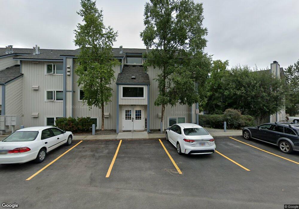
2875 W Intl Airport Rd Unit D204 Anchorage, AK 99502
Spenard NeighborhoodEstimated Value: $76,000 - $216,000
1
Bed
1
Bath
640
Sq Ft
$258/Sq Ft
Est. Value
About This Home
This home is located at 2875 W Intl Airport Rd Unit D204, Anchorage, AK 99502 and is currently estimated at $165,430, approximately $258 per square foot. 2875 W Intl Airport Rd Unit D204 is a home located in Anchorage Municipality with nearby schools including Northwood Elementary School, Romig Middle School, and West High School.
Ownership History
Date
Name
Owned For
Owner Type
Purchase Details
Closed on
Sep 15, 2024
Sold by
Sparaga Joseph
Bought by
Bond Debra A
Current Estimated Value
Home Financials for this Owner
Home Financials are based on the most recent Mortgage that was taken out on this home.
Original Mortgage
$164,000
Outstanding Balance
$161,997
Interest Rate
6.47%
Mortgage Type
New Conventional
Estimated Equity
$3,433
Purchase Details
Closed on
May 9, 2019
Sold by
Schleusner Clifford M
Bought by
Sparaga Joseph
Home Financials for this Owner
Home Financials are based on the most recent Mortgage that was taken out on this home.
Original Mortgage
$140,409
Interest Rate
4.4%
Mortgage Type
FHA
Purchase Details
Closed on
Apr 18, 2011
Sold by
Hess James M and Hess Kathleen M
Bought by
Litten Anthony W
Home Financials for this Owner
Home Financials are based on the most recent Mortgage that was taken out on this home.
Original Mortgage
$135,859
Interest Rate
4.83%
Purchase Details
Closed on
Sep 11, 2008
Sold by
Neil Jason J
Bought by
Hess James M and Hess Kathleen M
Home Financials for this Owner
Home Financials are based on the most recent Mortgage that was taken out on this home.
Original Mortgage
$101,600
Interest Rate
6.5%
Purchase Details
Closed on
Oct 26, 2005
Sold by
Jones Donald C
Bought by
Neil Jason J
Home Financials for this Owner
Home Financials are based on the most recent Mortgage that was taken out on this home.
Original Mortgage
$100,400
Interest Rate
5.68%
Purchase Details
Closed on
Apr 22, 2002
Sold by
Riordan Jean A
Bought by
Jones Donald C
Home Financials for this Owner
Home Financials are based on the most recent Mortgage that was taken out on this home.
Original Mortgage
$89,250
Interest Rate
6.87%
Mortgage Type
Purchase Money Mortgage
Purchase Details
Closed on
Jul 25, 1996
Sold by
Daniels Danny
Bought by
Childers Dana M
Home Financials for this Owner
Home Financials are based on the most recent Mortgage that was taken out on this home.
Original Mortgage
$64,150
Interest Rate
8.39%
Mortgage Type
FHA
Create a Home Valuation Report for This Property
The Home Valuation Report is an in-depth analysis detailing your home's value as well as a comparison with similar homes in the area
Home Values in the Area
Average Home Value in this Area
Purchase History
| Date | Buyer | Sale Price | Title Company |
|---|---|---|---|
| Bond Debra A | -- | None Listed On Document | |
| Sparaga Joseph | -- | Fatic | |
| Litten Anthony W | -- | Stewart Title Company | |
| Hess James M | -- | Stewart | |
| Neil Jason J | -- | First American Title Ins Co | |
| Jones Donald C | -- | -- | |
| Childers Dana M | -- | -- |
Source: Public Records
Mortgage History
| Date | Status | Borrower | Loan Amount |
|---|---|---|---|
| Open | Bond Debra A | $164,000 | |
| Previous Owner | Sparaga Joseph | $140,409 | |
| Previous Owner | Litten Anthony W | $135,859 | |
| Previous Owner | Hess James M | $101,600 | |
| Previous Owner | Neil Jason J | $100,400 | |
| Previous Owner | Jones Donald C | $89,250 | |
| Previous Owner | Childers Dana M | $64,150 |
Source: Public Records
Tax History Compared to Growth
Tax History
| Year | Tax Paid | Tax Assessment Tax Assessment Total Assessment is a certain percentage of the fair market value that is determined by local assessors to be the total taxable value of land and additions on the property. | Land | Improvement |
|---|---|---|---|---|
| 2025 | $2,352 | $156,800 | -- | $156,800 |
| 2024 | $2,352 | $145,700 | $0 | $145,700 |
| 2023 | $2,209 | $129,700 | $0 | $129,700 |
| 2022 | $1,989 | $118,100 | $0 | $118,100 |
| 2021 | $2,126 | $118,000 | $0 | $118,000 |
| 2020 | $1,986 | $116,800 | $0 | $116,800 |
| 2019 | $1,529 | $116,800 | $0 | $116,800 |
| 2018 | $1,464 | $111,600 | $0 | $111,600 |
| 2017 | $1,807 | $128,200 | $0 | $128,200 |
| 2016 | $1,761 | $130,600 | $0 | $130,600 |
| 2015 | $1,761 | $125,400 | $0 | $125,400 |
| 2014 | $1,761 | $120,900 | $0 | $120,900 |
Source: Public Records
Map
Nearby Homes
- 2891 W Intl Airport Rd Unit C108
- 2801 W International Airport Rd Unit A202
- 2820 Malibu Meadows Way Unit 3B
- 2808 Iris Dr
- 3333 Lakeshore Dr Unit 5
- 3333 Lakeshore Dr Unit 2
- 6017 Collins Way
- 6305 Blackberry St
- 2040 Wenmatt Cir
- NHN Northwood Dr
- 5000 Northwood Dr
- 1808 W 47th Ave
- 3223 W 62nd Ave
- 6140 Collins Way
- 3913 Barbara Dr
- 4000 Iowa Dr
- 2202 Lincoln Ave
- 3900 Crosson Dr
- 2105 Mckinley Ave
- 2820 Wiley Post Ave
- 2875 W Intl Airport Rd
- 2875 W Intl Airport Rd
- 2875 W Intl Airport Rd
- 2875 W Intl Airport Rd
- 2875 W Intl Airport Rd
- 2875 W Intl Airport Rd
- 2875 W Intl Airport Rd
- 2875 W Intl Airport Rd
- 2875 W Intl Airport Rd
- 2875 W Intl Airport Rd
- 2875 W Intl Airport Rd
- 2875 W Intl Airport Rd
- 2875 W Intl Airport Rd
- 2875 W Intl Airport Rd
- 2875 W Intl Airport Rd
- 2875 W Intl Airport Rd
- 2875 W Intl Airport Rd
- 2875 W Intl Airport Rd
- 2875 W International Airport Rd Unit D302
- 2875 W International Airport Rd Unit D105