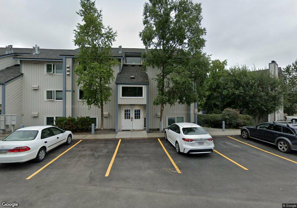
2875 W Intl Airport Rd Anchorage, AK 99502
Spenard NeighborhoodEstimated Value: $76,000 - $195,000
1
Bed
1
Bath
650
Sq Ft
$235/Sq Ft
Est. Value
About This Home
This home is located at 2875 W Intl Airport Rd, Anchorage, AK 99502 and is currently estimated at $152,665, approximately $234 per square foot. 2875 W Intl Airport Rd is a home located in Anchorage Municipality with nearby schools including Northwood Elementary School, Romig Middle School, and West High School.
Ownership History
Date
Name
Owned For
Owner Type
Purchase Details
Closed on
Sep 30, 2022
Sold by
Oleary Christopher D
Bought by
Marshall Zjhandon D and Marshall Michelle
Current Estimated Value
Home Financials for this Owner
Home Financials are based on the most recent Mortgage that was taken out on this home.
Original Mortgage
$146,301
Outstanding Balance
$140,637
Interest Rate
5.89%
Mortgage Type
FHA
Estimated Equity
$12,028
Purchase Details
Closed on
Apr 16, 2021
Sold by
Corey Frederick and Corey Patricia
Bought by
Oleary Christopher D
Home Financials for this Owner
Home Financials are based on the most recent Mortgage that was taken out on this home.
Original Mortgage
$11,000
Interest Rate
3.05%
Mortgage Type
New Conventional
Purchase Details
Closed on
Apr 6, 2021
Sold by
Corey Frederick and Corey Patricia
Bought by
Oleary Christopher D
Home Financials for this Owner
Home Financials are based on the most recent Mortgage that was taken out on this home.
Original Mortgage
$11,000
Interest Rate
3.05%
Mortgage Type
New Conventional
Purchase Details
Closed on
Aug 11, 2009
Sold by
Simpson Brandon D and Pace Breanna M
Bought by
Byrne Jan F
Home Financials for this Owner
Home Financials are based on the most recent Mortgage that was taken out on this home.
Original Mortgage
$109,800
Interest Rate
5.3%
Purchase Details
Closed on
Sep 26, 2007
Sold by
Brocies Rebecca
Bought by
Simpson Brandon D and Pace Breanna M
Home Financials for this Owner
Home Financials are based on the most recent Mortgage that was taken out on this home.
Original Mortgage
$116,065
Interest Rate
6.61%
Purchase Details
Closed on
Mar 29, 2006
Sold by
Johnson Douglas A
Bought by
Brocies Rebecca
Purchase Details
Closed on
Apr 26, 2002
Sold by
Ochabauer Peter and Ochabauer Amanda R
Bought by
Johnson Douglas A
Home Financials for this Owner
Home Financials are based on the most recent Mortgage that was taken out on this home.
Original Mortgage
$68,800
Interest Rate
7.08%
Mortgage Type
Purchase Money Mortgage
Purchase Details
Closed on
Apr 25, 2002
Sold by
Ochabauer Peter and Ochabauer Amanda R
Bought by
Johnson Douglas A
Home Financials for this Owner
Home Financials are based on the most recent Mortgage that was taken out on this home.
Original Mortgage
$68,800
Interest Rate
7.08%
Mortgage Type
Purchase Money Mortgage
Purchase Details
Closed on
Apr 27, 2000
Sold by
Shrader David W and Shrader Roberta J
Bought by
Ochabauer Peter and Ochabauer Amanda R
Home Financials for this Owner
Home Financials are based on the most recent Mortgage that was taken out on this home.
Original Mortgage
$77,456
Interest Rate
8.24%
Mortgage Type
VA
Purchase Details
Closed on
Aug 26, 1988
Sold by
Federal National Mortgage Assn
Bought by
Schaeffer Roberta J
Home Financials for this Owner
Home Financials are based on the most recent Mortgage that was taken out on this home.
Original Mortgage
$31,000
Interest Rate
10.52%
Mortgage Type
Seller Take Back
Create a Home Valuation Report for This Property
The Home Valuation Report is an in-depth analysis detailing your home's value as well as a comparison with similar homes in the area
Home Values in the Area
Average Home Value in this Area
Purchase History
| Date | Buyer | Sale Price | Title Company |
|---|---|---|---|
| Marshall Zjhandon D | -- | -- | |
| Oleary Christopher D | -- | None Available | |
| Oleary Christopher D | -- | None Listed On Document | |
| Byrne Jan F | -- | United Title | |
| Simpson Brandon D | -- | United Title | |
| Brocies Rebecca | -- | None Available | |
| Johnson Douglas A | -- | -- | |
| Johnson Douglas A | -- | -- | |
| Ochabauer Peter | -- | -- | |
| Schaeffer Roberta J | -- | -- | |
| Schaeffer Roberta J | -- | -- |
Source: Public Records
Mortgage History
| Date | Status | Borrower | Loan Amount |
|---|---|---|---|
| Open | Marshall Zjhandon D | $146,301 | |
| Previous Owner | Oleary Christopher D | $11,000 | |
| Previous Owner | Oleary Christopher D | $11,000 | |
| Previous Owner | Byrne Jan F | $109,800 | |
| Previous Owner | Simpson Brandon D | $116,065 | |
| Previous Owner | Johnson Douglas A | $68,800 | |
| Previous Owner | Johnson Douglas A | $68,800 | |
| Previous Owner | Ochabauer Peter | $77,456 | |
| Previous Owner | Schaeffer Roberta J | $31,000 |
Source: Public Records
Tax History Compared to Growth
Tax History
| Year | Tax Paid | Tax Assessment Tax Assessment Total Assessment is a certain percentage of the fair market value that is determined by local assessors to be the total taxable value of land and additions on the property. | Land | Improvement |
|---|---|---|---|---|
| 2025 | $1,424 | $157,700 | -- | $157,700 |
| 2024 | $1,424 | $147,000 | $0 | $147,000 |
| 2023 | $2,216 | $130,100 | $0 | $130,100 |
| 2022 | $1,996 | $118,500 | $0 | $118,500 |
| 2021 | $2,132 | $118,300 | $0 | $118,300 |
| 2020 | $1,992 | $117,200 | $0 | $117,200 |
| 2019 | $1,917 | $117,200 | $0 | $117,200 |
| 2018 | $1,838 | $112,100 | $0 | $112,100 |
| 2017 | $1,815 | $128,800 | $0 | $128,800 |
| 2016 | $1,595 | $131,500 | $0 | $131,500 |
| 2015 | $1,595 | $126,000 | $0 | $126,000 |
| 2014 | $1,595 | $121,600 | $0 | $121,600 |
Source: Public Records
Map
Nearby Homes
- 2891 W Intl Airport Rd Unit C108
- 2801 W International Airport Rd Unit A202
- 2820 Malibu Meadows Way Unit 3B
- 2808 Iris Dr
- 3333 Lakeshore Dr Unit 5
- 3333 Lakeshore Dr Unit 2
- 6017 Collins Way
- 6305 Blackberry St
- 2040 Wenmatt Cir
- NHN Northwood Dr
- 5000 Northwood Dr
- 1808 W 47th Ave
- 3223 W 62nd Ave
- 6140 Collins Way
- 3913 Barbara Dr
- 4000 Iowa Dr
- 2202 Lincoln Ave
- 3900 Crosson Dr
- 2105 Mckinley Ave
- 2820 Wiley Post Ave
- 2875 W Intl Airport Rd
- 2875 W Intl Airport Rd
- 2875 W Intl Airport Rd
- 2875 W Intl Airport Rd
- 2875 W Intl Airport Rd
- 2875 W Intl Airport Rd
- 2875 W Intl Airport Rd
- 2875 W Intl Airport Rd
- 2875 W Intl Airport Rd
- 2875 W Intl Airport Rd
- 2875 W Intl Airport Rd
- 2875 W Intl Airport Rd
- 2875 W Intl Airport Rd
- 2875 W Intl Airport Rd
- 2875 W Intl Airport Rd
- 2875 W Intl Airport Rd
- 2875 W Intl Airport Rd
- 2875 W Intl Airport Rd Unit D204
- 2875 W International Airport Rd Unit D302
- 2875 W International Airport Rd Unit D105