Estimated Value: $135,000 - $284,000
3
Beds
1
Bath
1,420
Sq Ft
$131/Sq Ft
Est. Value
About This Home
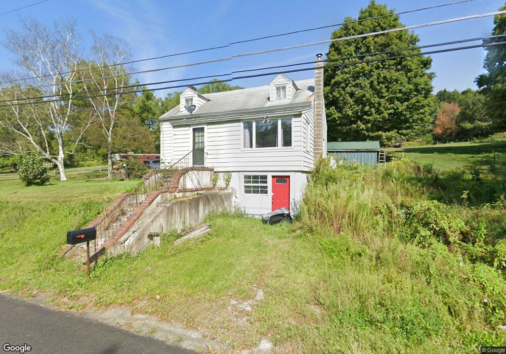
This home is located at 2877 State Route 17c, Owego, NY 13827 and is currently estimated at $185,977, approximately $130 per square foot. 2877 State Route 17c is a home located in Tioga County with nearby schools including Apalachin Elementary School, Owego-Apalachin Middle School, and Owego Free Academy.
Ownership History
Date
Name
Owned For
Owner Type
Purchase Details
Closed on
Feb 7, 2008
Sold by
Harris Lon
Bought by
Miller Amy
Current Estimated Value
Purchase Details
Closed on
Dec 15, 2005
Sold by
Oconnell Sherry
Bought by
Harris Lon
Home Financials for this Owner
Home Financials are based on the most recent Mortgage that was taken out on this home.
Original Mortgage
$34,000
Interest Rate
6.34%
Mortgage Type
Purchase Money Mortgage
Create a Home Valuation Report for This Property
The Home Valuation Report is an in-depth analysis detailing your home's value as well as a comparison with similar homes in the area
Home Values in the Area
Average Home Value in this Area
Purchase History
| Date | Buyer | Sale Price | Title Company |
|---|---|---|---|
| Miller Amy | $130,000 | -- | |
| Harris Lon | $49,000 | William J Scanlon |
Source: Public Records
Mortgage History
| Date | Status | Borrower | Loan Amount |
|---|---|---|---|
| Previous Owner | Harris Lon | $34,000 |
Source: Public Records
Tax History Compared to Growth
Tax History
| Year | Tax Paid | Tax Assessment Tax Assessment Total Assessment is a certain percentage of the fair market value that is determined by local assessors to be the total taxable value of land and additions on the property. | Land | Improvement |
|---|---|---|---|---|
| 2024 | $3,485 | $68,600 | $21,200 | $47,400 |
| 2023 | $34 | $68,600 | $21,200 | $47,400 |
| 2022 | $3,501 | $68,600 | $21,200 | $47,400 |
| 2021 | $3,450 | $68,600 | $21,200 | $47,400 |
| 2020 | $3,387 | $68,600 | $21,200 | $47,400 |
| 2019 | $1,934 | $68,600 | $21,200 | $47,400 |
| 2018 | $3,241 | $68,600 | $21,200 | $47,400 |
| 2017 | $3,166 | $68,600 | $21,200 | $47,400 |
| 2016 | $3,127 | $68,600 | $21,200 | $47,400 |
| 2015 | -- | $68,600 | $21,200 | $47,400 |
| 2014 | -- | $68,600 | $21,200 | $47,400 |
Source: Public Records
Map
Nearby Homes
- 2912 New York 17c
- 2744 State Route 17c
- 63 Holmes Rd Unit 65
- 1442 Marshland Rd
- 68 Degroat Rd
- 3 Lincolnshire Blvd
- 945 Forest Hill Rd
- 2686 Marshland Rd
- 00 Sunnyside Dr S
- 0 Sunnyside Dr S
- 797 Lisle Rd
- 563 Lisle Rd
- 5531 State Route 17c
- 21 Sunnyside Dr
- 21 King Point Cir S
- 0 New York 434
- 00 New York 434
- 1003 Tilbury Hill Rd
- 499 E Front St
- 525 E Main St
- 2912 State Route 17c
- 2813 State Route 17c
- 2930 New York 17c
- 2930 State Route 17c
- 2791 State Route 17c
- 2765 State Route 17c
- 3001 State Route 17c
- 2868 State Route 17c
- 2724 State Route 17c
- 2707 State Route 17c
- 3052 State Route 17c
- 3114 State Route 17c
- 3112 State Route 17c
- 2689 State Route 17c
- 2690 State Route 17c
- 2658 State Route 17c
- 2641 New York 17c
- 2641 State Route 17c
- 2646 State Route 17c
- 2562 State Route 17c