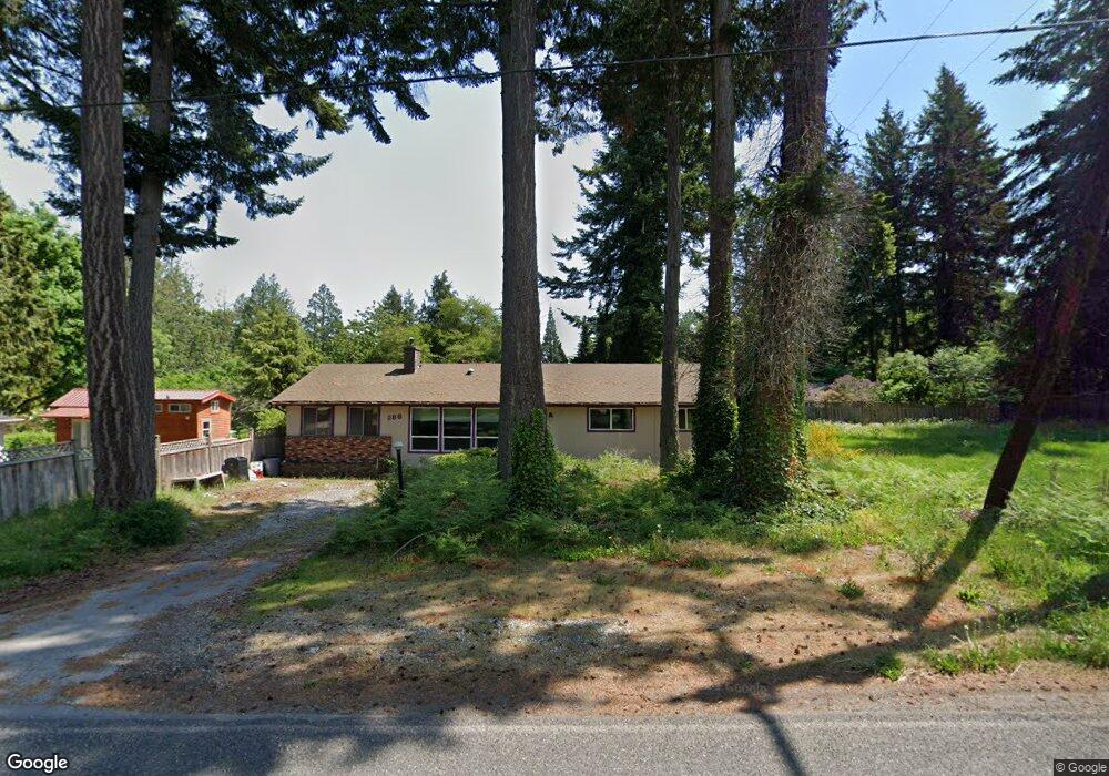
288 Boundary Bay Rd Point Roberts, WA 98281
Estimated Value: $445,673 - $504,000
3
Beds
2
Baths
1,800
Sq Ft
$264/Sq Ft
Est. Value
About This Home
This home is located at 288 Boundary Bay Rd, Point Roberts, WA 98281 and is currently estimated at $475,668, approximately $264 per square foot. 288 Boundary Bay Rd is a home located in Whatcom County with nearby schools including Point Roberts Primary School, Blaine Middle School, and Blaine High School.
Ownership History
Date
Name
Owned For
Owner Type
Purchase Details
Closed on
Jun 1, 2011
Sold by
Mcvee Susan Darlene
Bought by
Marquette Daryl and Marquette Roberta
Current Estimated Value
Purchase Details
Closed on
Apr 11, 2001
Sold by
Mcvee Lyle Edwin and Mcvee Susan Darlene
Bought by
Mcvee Susan Darlene
Create a Home Valuation Report for This Property
The Home Valuation Report is an in-depth analysis detailing your home's value as well as a comparison with similar homes in the area
Home Values in the Area
Average Home Value in this Area
Purchase History
| Date | Buyer | Sale Price | Title Company |
|---|---|---|---|
| Marquette Daryl | $187,280 | First American Title Ins | |
| Mcvee Susan Darlene | -- | -- |
Source: Public Records
Tax History Compared to Growth
Tax History
| Year | Tax Paid | Tax Assessment Tax Assessment Total Assessment is a certain percentage of the fair market value that is determined by local assessors to be the total taxable value of land and additions on the property. | Land | Improvement |
|---|---|---|---|---|
| 2024 | $2,852 | $350,818 | $102,383 | $248,435 |
| 2023 | $2,852 | $341,510 | $93,075 | $248,435 |
| 2022 | $2,028 | $311,881 | $85,000 | $226,881 |
| 2021 | $2,020 | $196,913 | $40,128 | $156,785 |
| 2020 | $2,013 | $182,325 | $37,155 | $145,170 |
| 2019 | $1,871 | $174,890 | $35,640 | $139,250 |
| 2018 | $1,735 | $157,225 | $32,040 | $125,185 |
| 2017 | $1,505 | $150,158 | $30,600 | $119,558 |
| 2016 | $1,483 | $147,214 | $30,000 | $117,214 |
| 2015 | $1,576 | $140,988 | $32,847 | $108,141 |
| 2014 | -- | $147,392 | $34,340 | $113,052 |
| 2013 | -- | $140,863 | $32,980 | $107,883 |
Source: Public Records
Map
Nearby Homes
- 251 Elizabeth Dr
- 302 Boundary Bay Rd
- 4 Boundary Bay Rd
- Lot 35 Boundary Bay Rd
- 2138 Benson Rd
- 0 X Weasel Run
- 412 High Bluff Dr
- 2145 Fir St
- 103 Goodman Rd
- 0 Lot 7 Weasel Run Rd
- 6 Weasel Run Rd
- 500 Moose Trail
- 0 3 73 Acres Derby Ave
- Lot 2 Greenwood Dr
- 1976 Cedar Park Dr
- lot 14 Cedar Park Dr Unit 14
- 1931 Sanders Ct Unit 11
- 1871 Johnson Rd
- 0 6 39 Acres South Beach Rd
- 2045 Apa Rd
- 286 Boundary Bay Rd
- 285 Elizabeth Dr
- 303 Madrona Place
- 304 Boundary Bay Rd
- 276 Boundary Bay Rd
- 284 Elizabeth Dr
- 307 Madrona Place
- 272 Boundary Bay Rd
- 280 Elizabeth Dr
- 282 Elizabeth Dr
- 302 Madrona Place
- 3 Madrona Place
- 317 Madrona Place
- 2193 Culp Ct
- 267 Elizabeth Dr
- 2185 Culp Ct
- 276 Elizabeth Dr
- 261 Elizabeth Dr
- 304 Madrona Place
- 304 Madrona Place