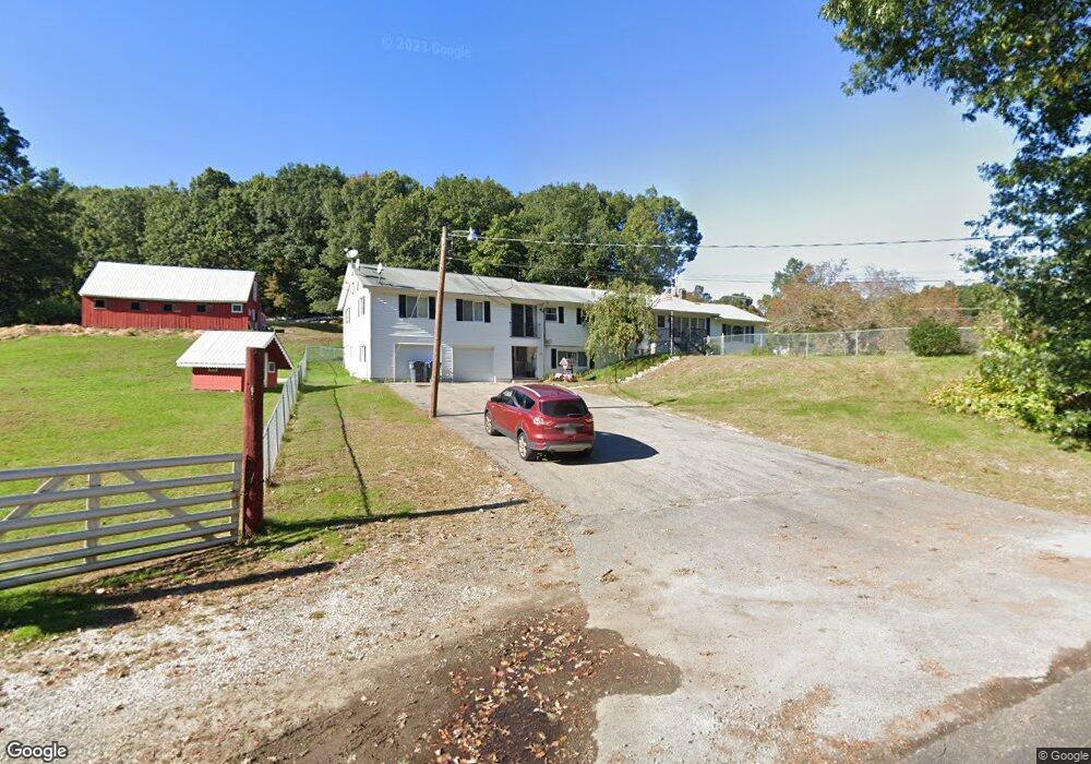
288 Brooks Station Rd Princeton, MA 01541
Estimated Value: $593,861 - $769,000
5
Beds
4
Baths
2,213
Sq Ft
$312/Sq Ft
Est. Value
About This Home
This home is located at 288 Brooks Station Rd, Princeton, MA 01541 and is currently estimated at $689,465, approximately $311 per square foot. 288 Brooks Station Rd is a home located in Worcester County with nearby schools including Wachusett Regional High School.
Ownership History
Date
Name
Owned For
Owner Type
Purchase Details
Closed on
Aug 30, 2011
Sold by
Fife Phyliss J
Bought by
Fife Christopher A
Current Estimated Value
Purchase Details
Closed on
Jun 26, 1962
Bought by
Fife Phyliss Jane
Create a Home Valuation Report for This Property
The Home Valuation Report is an in-depth analysis detailing your home's value as well as a comparison with similar homes in the area
Home Values in the Area
Average Home Value in this Area
Purchase History
| Date | Buyer | Sale Price | Title Company |
|---|---|---|---|
| Fife Christopher A | -- | -- | |
| Fife Phyliss Jane | -- | -- |
Source: Public Records
Mortgage History
| Date | Status | Borrower | Loan Amount |
|---|---|---|---|
| Previous Owner | Fife Phyliss Jane | $110,000 | |
| Previous Owner | Fife Phyliss Jane | $20,000 | |
| Previous Owner | Fife Phyliss Jane | $90,000 | |
| Previous Owner | Fife Phyliss Jane | $20,000 |
Source: Public Records
Tax History Compared to Growth
Tax History
| Year | Tax Paid | Tax Assessment Tax Assessment Total Assessment is a certain percentage of the fair market value that is determined by local assessors to be the total taxable value of land and additions on the property. | Land | Improvement |
|---|---|---|---|---|
| 2025 | $7,429 | $511,300 | $127,300 | $384,000 |
| 2024 | $6,922 | $493,400 | $127,300 | $366,100 |
| 2023 | $6,245 | $412,500 | $101,000 | $311,500 |
| 2022 | $6,038 | $385,100 | $101,000 | $284,100 |
| 2021 | $5,689 | $352,900 | $101,000 | $251,900 |
| 2020 | $5,527 | $348,700 | $101,000 | $247,700 |
| 2019 | $5,472 | $341,600 | $98,000 | $243,600 |
| 2018 | $5,531 | $320,100 | $89,300 | $230,800 |
| 2017 | $4,477 | $251,800 | $135,400 | $116,400 |
| 2016 | $4,482 | $251,800 | $135,400 | $116,400 |
| 2015 | $4,372 | $252,700 | $137,800 | $114,900 |
Source: Public Records
Map
Nearby Homes
- 166 Ball Hill Rd
- 147 E County Rd Unit 149
- 139 E County Rd Unit 139
- 15 Stagecoach Rd
- 9 Stagecoach Rd
- 271 Glenwood Rd
- 81 Glenwood Place
- 14 Oak Cir
- 175 Glenwood Rd
- 101 Brintnal Dr
- 81 Central Tree Rd
- 73 Brintnal Dr
- 56 Hubbardston Rd
- 751 Mason Rd
- 2226 Main St
- 40 Jackson St
- 35 Brintnal Dr
- 20 Mountain Rd
- 10 Beechwood Dr
- 2 Simon Davis Dr
- 288 Brooks Station Rd Unit 1
- 11 Old Brook Station Rd
- 283 Brooks Station Rd
- 293 Brooks Station Rd
- 277 Brooks Station Rd
- 0 Old Brook Station Rd
- 281 Brooks Station Rd
- 281 Brooks Station Rd Unit 1
- 299 Brooks Station Rd
- 282 Brooks Station Rd
- 274 Brooks Station Rd
- 23 Old Brook Station Rd
- 12 Old Brook Station Rd
- 26 Old Brooks Station Rd
- 00 Old Brooks Station Rd
- 310 Brooks Station Rd
- 24 Old Brooks Station Rd
- 16 Old Brook Station Rd
- 313 Brooks Station Rd
- 29 Old Brook Station Rd