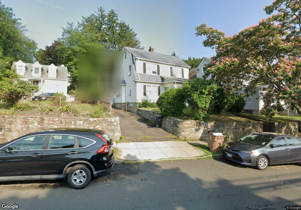
288 Glenbrook Rd Stamford, CT 06906
Glenbrook NeighborhoodEstimated Value: $667,000 - $829,000
4
Beds
2
Baths
1,662
Sq Ft
$445/Sq Ft
Est. Value
About This Home
This home is located at 288 Glenbrook Rd, Stamford, CT 06906 and is currently estimated at $739,758, approximately $445 per square foot. 288 Glenbrook Rd is a home located in Fairfield County with nearby schools including Julia A. Stark Elementary School, Rippowam Middle School, and Stamford High School.
Ownership History
Date
Name
Owned For
Owner Type
Purchase Details
Closed on
May 28, 2004
Sold by
Koutinas Eleftherios I and Koutinas Filitson
Bought by
Herrada Jose
Current Estimated Value
Purchase Details
Closed on
Jun 18, 1996
Sold by
Dennis Levi N and Dennis Olive E
Bought by
Koutinas Eleftherios I and Koutinas Filitsa
Create a Home Valuation Report for This Property
The Home Valuation Report is an in-depth analysis detailing your home's value as well as a comparison with similar homes in the area
Home Values in the Area
Average Home Value in this Area
Purchase History
| Date | Buyer | Sale Price | Title Company |
|---|---|---|---|
| Herrada Jose | $470,000 | -- | |
| Herrada Jose | $470,000 | -- | |
| Koutinas Eleftherios I | $169,000 | -- | |
| Koutinas Eleftherios I | $169,000 | -- |
Source: Public Records
Mortgage History
| Date | Status | Borrower | Loan Amount |
|---|---|---|---|
| Open | Koutinas Eleftherios I | $417,000 | |
| Closed | Koutinas Eleftherios I | $90,699 |
Source: Public Records
Tax History Compared to Growth
Tax History
| Year | Tax Paid | Tax Assessment Tax Assessment Total Assessment is a certain percentage of the fair market value that is determined by local assessors to be the total taxable value of land and additions on the property. | Land | Improvement |
|---|---|---|---|---|
| 2025 | $8,862 | $374,570 | $212,940 | $161,630 |
| 2024 | $8,668 | $374,570 | $212,940 | $161,630 |
| 2023 | $9,312 | $374,570 | $212,940 | $161,630 |
| 2022 | $8,070 | $301,810 | $163,490 | $138,320 |
| 2021 | $7,983 | $301,810 | $163,490 | $138,320 |
| 2020 | $7,778 | $301,810 | $163,490 | $138,320 |
| 2019 | $7,778 | $301,810 | $163,490 | $138,320 |
| 2018 | $7,491 | $301,810 | $163,490 | $138,320 |
| 2017 | $6,952 | $267,380 | $137,340 | $130,040 |
| 2016 | $6,757 | $267,380 | $137,340 | $130,040 |
| 2015 | $6,580 | $267,380 | $137,340 | $130,040 |
| 2014 | $6,361 | $267,380 | $137,340 | $130,040 |
Source: Public Records
Map
Nearby Homes
- 223 Glenbrook Rd
- 52 Penzance Rd
- 100 Hope St Unit 10
- 100 Hope St Unit 8
- 180 Glenbrook Rd Unit 35
- 8 Windell Place
- 160 Glenbrook Rd Unit 6B
- 160 Glenbrook Rd Unit 4D
- 160 Glenbrook Rd Unit 3D
- 75 Coolidge Ave
- 71 Strawberry Hill Ave Unit 421
- 71 Strawberry Hill Ave Unit 118
- 71 Strawberry Hill Ave Unit 203
- 71 Strawberry Hill Ave Unit 305
- 60 Lawn Ave Unit 11
- 60 Lawn Ave Unit 21
- 87 Glenbrook Rd Unit 3D
- 87 Glenbrook Rd Unit 3D
- 21 Holcomb Ave
- 91 Strawberry Hill Ave Unit 1127
- 292 Glenbrook Rd
- 284 Glenbrook Rd
- 296 Glenbrook Rd
- 264 Glenbrook Rd Unit D
- 264 Glenbrook Rd Unit C
- 264 Glenbrook Rd Unit B
- 264 Glenbrook Rd Unit A
- 264 Glenbrook Rd Unit 45C
- 264 Glenbrook Rd Unit 45A
- 287 Glenbrook Rd
- 6 Nash Place
- 4 Nash Place
- 300 Glenbrook Rd
- 262 Glenbrook Rd Unit 44D
- 262 Glenbrook Rd Unit D
- 262 Glenbrook Rd Unit C
- 262 Glenbrook Rd Unit B
- 262 Glenbrook Rd Unit A
- 262 Glenbrook Rd Unit 44A
- 262 Glenbrook Rd Unit 44-B