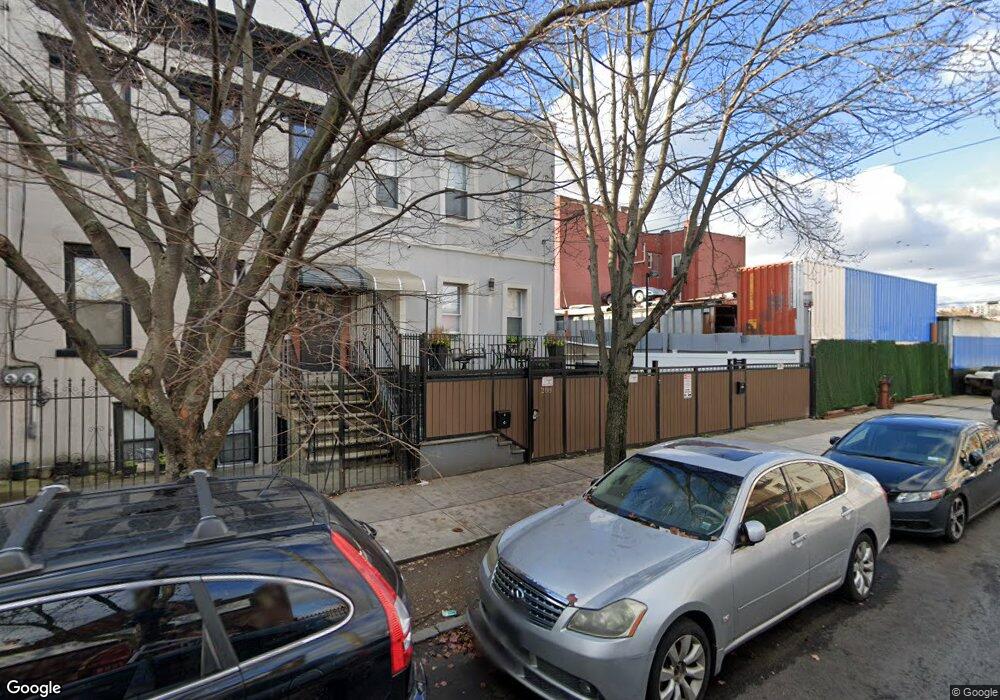
288 Hendrix St Unit 1 Brooklyn, NY 11207
East New York NeighborhoodEstimated Value: $577,000 - $792,000
3
Beds
2
Baths
1,200
Sq Ft
$592/Sq Ft
Est. Value
About This Home
This home is located at 288 Hendrix St Unit 1, Brooklyn, NY 11207 and is currently estimated at $710,432, approximately $592 per square foot. 288 Hendrix St Unit 1 is a home located in Kings County with nearby schools including P.S. 149 Danny Kaye, J.H.S 292 Margaret S. Douglas, and Achievement First Apollo Charter School.
Ownership History
Date
Name
Owned For
Owner Type
Purchase Details
Closed on
Apr 8, 2021
Sold by
Genao Yngrid M and Perez Jiovanni
Bought by
Hendrix Jy Llc
Current Estimated Value
Purchase Details
Closed on
Nov 15, 1999
Sold by
Htb Enterprises Ltd
Bought by
Oquendo Antonio and Oquendo Carmen
Home Financials for this Owner
Home Financials are based on the most recent Mortgage that was taken out on this home.
Original Mortgage
$203,324
Interest Rate
8.15%
Mortgage Type
FHA
Create a Home Valuation Report for This Property
The Home Valuation Report is an in-depth analysis detailing your home's value as well as a comparison with similar homes in the area
Home Values in the Area
Average Home Value in this Area
Purchase History
| Date | Buyer | Sale Price | Title Company |
|---|---|---|---|
| Hendrix Jy Llc | -- | -- | |
| Oquendo Antonio | $77,000 | Commonwealth Land Title Ins |
Source: Public Records
Mortgage History
| Date | Status | Borrower | Loan Amount |
|---|---|---|---|
| Previous Owner | Oquendo Antonio | $203,324 |
Source: Public Records
Tax History
| Year | Tax Paid | Tax Assessment Tax Assessment Total Assessment is a certain percentage of the fair market value that is determined by local assessors to be the total taxable value of land and additions on the property. | Land | Improvement |
|---|---|---|---|---|
| 2025 | $4,957 | $45,960 | $12,900 | $33,060 |
| 2024 | $4,957 | $40,260 | $12,900 | $27,360 |
| 2023 | $5,013 | $35,580 | $12,900 | $22,680 |
| 2022 | $4,768 | $39,000 | $12,900 | $26,100 |
| 2021 | $4,795 | $42,780 | $12,900 | $29,880 |
| 2020 | $1,124 | $37,320 | $12,900 | $24,420 |
| 2019 | $4,303 | $37,320 | $12,900 | $24,420 |
| 2018 | $4,193 | $20,568 | $7,470 | $13,098 |
| 2017 | $4,058 | $19,905 | $7,969 | $11,936 |
| 2016 | $3,796 | $18,987 | $8,594 | $10,393 |
| 2015 | $2,045 | $17,914 | $8,764 | $9,150 |
| 2014 | $2,045 | $17,140 | $9,703 | $7,437 |
Source: Public Records
Map
Nearby Homes
- 279 van Siclen Ave
- 202 Schenck Ave
- 207 Bradford St
- 323 Barbey St
- 597 Liberty Ave
- 599 Liberty Ave
- 396 Barbey St
- 243 Wyona St
- 345 Schenck Ave
- 412 Hendrix St
- 2321 Pitkin Ave
- 563 Belmont Ave
- 387 Miller Ave
- 389 Warwick St
- 168 Miller Ave
- 221 Barbey St
- 2830 Fulton St
- 295 Ashford St
- 239 New Jersey Ave
- 253 Ashford St
- 288 Hendrix St
- 288 Hendrix St
- 288 Hendrix St Unit 2
- 292 Hendrix St
- 282 Hendrix St
- 528 Liberty Ave
- 280 Hendrix St
- 524 Liberty Ave
- 524 Liberty Ave Unit 2
- 296 Hendrix St
- 530 Liberty Ave
- 532 Liberty Ave
- 211 van Siclen Ave
- 300 Hendrix St
- 213 van Siclen Ave
- 207-209 van Siclen Ave
- 221 van Siclen Ave
- 304 Hendrix St
- 536 Liberty Ave
- 203 van Siclen Ave
Your Personal Tour Guide
Ask me questions while you tour the home.