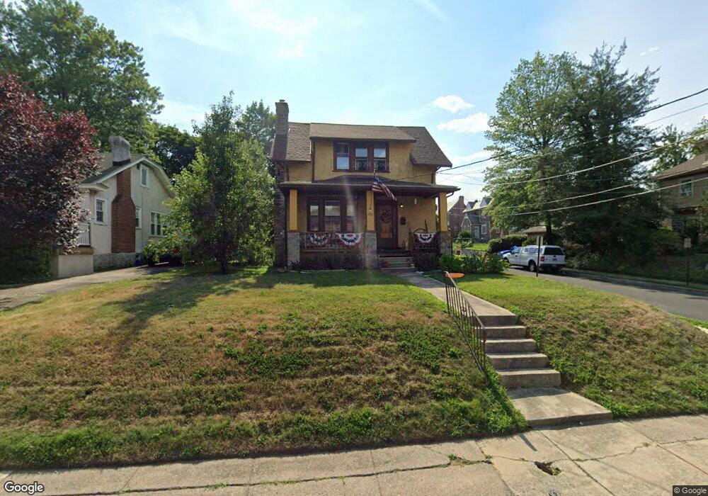
288 N Maple Ave Lansdowne, PA 19050
Estimated Value: $220,000 - $330,000
3
Beds
2
Baths
2,028
Sq Ft
$144/Sq Ft
Est. Value
About This Home
This home is located at 288 N Maple Ave, Lansdowne, PA 19050 and is currently estimated at $291,207, approximately $143 per square foot. 288 N Maple Ave is a home located in Delaware County with nearby schools including East Lansdowne Elementary School, Penn Wood Middle School, and Penn Wood High School - Cypress Street Campus.
Ownership History
Date
Name
Owned For
Owner Type
Purchase Details
Closed on
Feb 5, 2025
Sold by
Farrow James A and Farrow James A
Bought by
James C Farrow Irrevocable Trust
Current Estimated Value
Purchase Details
Closed on
Nov 8, 2005
Sold by
Farrow James A and Farrow Joanna E
Bought by
Farrow James
Home Financials for this Owner
Home Financials are based on the most recent Mortgage that was taken out on this home.
Original Mortgage
$120,000
Interest Rate
6.14%
Mortgage Type
Fannie Mae Freddie Mac
Create a Home Valuation Report for This Property
The Home Valuation Report is an in-depth analysis detailing your home's value as well as a comparison with similar homes in the area
Home Values in the Area
Average Home Value in this Area
Purchase History
| Date | Buyer | Sale Price | Title Company |
|---|---|---|---|
| James C Farrow Irrevocable Trust | -- | None Listed On Document | |
| Farrow James | $150,000 | Lawyers Title Insurance Corp |
Source: Public Records
Mortgage History
| Date | Status | Borrower | Loan Amount |
|---|---|---|---|
| Previous Owner | Farrow James | $120,000 |
Source: Public Records
Tax History
| Year | Tax Paid | Tax Assessment Tax Assessment Total Assessment is a certain percentage of the fair market value that is determined by local assessors to be the total taxable value of land and additions on the property. | Land | Improvement |
|---|---|---|---|---|
| 2025 | $5,470 | $132,860 | $40,520 | $92,340 |
| 2024 | $5,470 | $132,860 | $40,520 | $92,340 |
| 2023 | $5,215 | $132,860 | $40,520 | $92,340 |
| 2022 | $5,113 | $132,860 | $40,520 | $92,340 |
| 2021 | $7,678 | $132,860 | $40,520 | $92,340 |
| 2020 | $4,845 | $73,870 | $24,690 | $49,180 |
| 2019 | $4,763 | $73,870 | $24,690 | $49,180 |
| 2018 | $4,682 | $73,870 | $0 | $0 |
| 2017 | $4,578 | $73,870 | $0 | $0 |
| 2016 | $405 | $73,870 | $0 | $0 |
| 2015 | $405 | $73,870 | $0 | $0 |
| 2014 | $405 | $73,870 | $0 | $0 |
Source: Public Records
Map
Nearby Homes
- 291 N Wycombe Ave
- 212 N Maple Ave
- 247 Coverly Rd
- 243 Coverly Rd
- 210 Wabash Ave
- 291 Jackson Ave
- 7303 Sherbrook Blvd
- 178 N Union Ave
- 91 Lamport Rd
- 360 Huntley Rd
- 7265 Calvin Rd
- 7261 Calvin Rd
- 217 E Greenwood Ave
- 0 Hirst Ave
- 319 Avon Rd
- 230 Wynnewood Ave
- 113 A A000 N Union Ave
- 7283 Bradford Rd
- 346 Long Ln
- 432 Grace Rd
- 286 N Maple Ave
- 158 Windsor Ave
- 161 Windsor Ave
- 156 Windsor Ave
- 159 Windsor Ave
- 280 N Maple Ave
- 157 Windsor Ave
- 161 Midway Ave
- 154 Windsor Ave
- 155 Windsor Ave
- 293 N Maple Ave
- 297 N Maple Ave
- 159 Midway Ave
- 289 N Maple Ave
- 152 Windsor Ave
- 153 Windsor Ave
- 285 N Maple Ave
- 151 Windsor Ave
- 150 Windsor Ave
- 155 Midway Ave
Your Personal Tour Guide
Ask me questions while you tour the home.