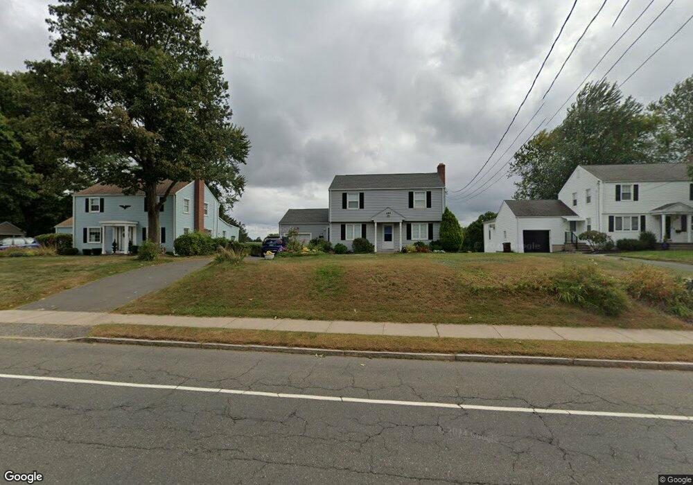
288 S Main St West Hartford, CT 06107
Estimated Value: $484,000 - $529,000
3
Beds
2
Baths
1,542
Sq Ft
$324/Sq Ft
Est. Value
About This Home
This home is located at 288 S Main St, West Hartford, CT 06107 and is currently estimated at $500,058, approximately $324 per square foot. 288 S Main St is a home located in Hartford County with nearby schools including Webster Hill School, Sedgwick Middle School, and Conard High School.
Ownership History
Date
Name
Owned For
Owner Type
Purchase Details
Closed on
Sep 2, 1992
Sold by
Kutteruf Vada
Bought by
Acevedo Myrtha and Acevedo Francicso
Current Estimated Value
Home Financials for this Owner
Home Financials are based on the most recent Mortgage that was taken out on this home.
Original Mortgage
$133,200
Interest Rate
8.09%
Mortgage Type
Unknown
Purchase Details
Closed on
Mar 29, 1989
Sold by
Nursaries Gardners
Bought by
500 Capital Blvd Lp
Create a Home Valuation Report for This Property
The Home Valuation Report is an in-depth analysis detailing your home's value as well as a comparison with similar homes in the area
Home Values in the Area
Average Home Value in this Area
Purchase History
| Date | Buyer | Sale Price | Title Company |
|---|---|---|---|
| Acevedo Myrtha | $149,000 | -- | |
| 500 Capital Blvd Lp | $324,000 | -- |
Source: Public Records
Mortgage History
| Date | Status | Borrower | Loan Amount |
|---|---|---|---|
| Open | 500 Capital Blvd Lp | $62,300 | |
| Closed | 500 Capital Blvd Lp | $133,200 |
Source: Public Records
Tax History Compared to Growth
Tax History
| Year | Tax Paid | Tax Assessment Tax Assessment Total Assessment is a certain percentage of the fair market value that is determined by local assessors to be the total taxable value of land and additions on the property. | Land | Improvement |
|---|---|---|---|---|
| 2025 | $10,140 | $226,450 | $104,300 | $122,150 |
| 2024 | $9,590 | $226,450 | $104,300 | $122,150 |
| 2023 | $9,266 | $226,450 | $104,300 | $122,150 |
| 2022 | $9,212 | $226,450 | $104,300 | $122,150 |
| 2021 | $8,196 | $193,200 | $102,300 | $90,900 |
| 2020 | $8,076 | $193,200 | $86,600 | $106,600 |
| 2019 | $8,076 | $193,200 | $86,590 | $106,610 |
| 2018 | $7,921 | $193,200 | $86,590 | $106,610 |
| 2017 | $7,929 | $193,200 | $86,590 | $106,610 |
| 2016 | $7,777 | $196,840 | $82,250 | $114,590 |
| 2015 | $7,528 | $196,490 | $82,250 | $114,240 |
| 2014 | $7,343 | $196,490 | $82,250 | $114,240 |
Source: Public Records
Map
Nearby Homes
- 96 Bentwood Rd
- 39 Pheasant Hill Dr
- 394 Trout Brook Dr
- 422 S Main St
- 43 Spring Ln
- 34 Sandhurst Dr
- 39 Cortland St
- 236 Ridgewood Rd
- 17 Parkview Rd
- 741 Quaker Ln S
- 204 Trout Brook Dr
- 61 Woodmere Rd
- 50 Tunxis Rd
- 90 Park Place Cir Unit 90
- 49 Park Place Cir Unit 49
- 1 Valley Crest Dr
- 18 Federal St
- 24 Thorne Rd Unit 24
- 29 Fairwood Farms Dr
- 1145 New Britain Ave
- 286 S Main St
- 292 S Main St
- 296 S Main St
- 284 S Main St
- 280 S Main St
- 300 S Main St
- 272 S Main St
- 306 S Main St
- 112 Ledgewood Rd
- 110 Ledgewood Rd
- 106 Ledgewood Rd
- 104 Ledgewood Rd
- 116 Ledgewood Rd
- 102 Ledgewood Rd
- 268 S Main St
- 85 Rockledge Dr
- 81 Rockledge Dr
- 100 Ledgewood Rd
- 96 Ledgewood Rd
- 75 Rockledge Dr