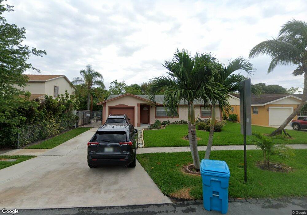
2880 NE 5th Ct Boynton Beach, FL 33435
Boynton Bay NeighborhoodEstimated Value: $349,000 - $376,344
5
Beds
2
Baths
1,300
Sq Ft
$278/Sq Ft
Est. Value
About This Home
This home is located at 2880 NE 5th Ct, Boynton Beach, FL 33435 and is currently estimated at $361,836, approximately $278 per square foot. 2880 NE 5th Ct is a home located in Palm Beach County with nearby schools including Rolling Green Elementary School, Boynton Beach Community High School, and Calf Pen Meadow Elementary School.
Ownership History
Date
Name
Owned For
Owner Type
Purchase Details
Closed on
Aug 18, 2003
Sold by
Stjuste David and Stjuste Amarante
Bought by
Colin Jean and Colin Lucita
Current Estimated Value
Home Financials for this Owner
Home Financials are based on the most recent Mortgage that was taken out on this home.
Original Mortgage
$130,965
Outstanding Balance
$58,091
Interest Rate
5.72%
Mortgage Type
FHA
Estimated Equity
$303,745
Create a Home Valuation Report for This Property
The Home Valuation Report is an in-depth analysis detailing your home's value as well as a comparison with similar homes in the area
Home Values in the Area
Average Home Value in this Area
Purchase History
| Date | Buyer | Sale Price | Title Company |
|---|---|---|---|
| Colin Jean | $132,000 | Flagler Title Company |
Source: Public Records
Mortgage History
| Date | Status | Borrower | Loan Amount |
|---|---|---|---|
| Open | Colin Jean | $130,965 |
Source: Public Records
Tax History Compared to Growth
Tax History
| Year | Tax Paid | Tax Assessment Tax Assessment Total Assessment is a certain percentage of the fair market value that is determined by local assessors to be the total taxable value of land and additions on the property. | Land | Improvement |
|---|---|---|---|---|
| 2024 | $3,614 | $114,644 | -- | -- |
| 2023 | $3,389 | $104,222 | $84,699 | $169,825 |
| 2022 | $3,189 | $94,747 | $0 | $0 |
| 2021 | $2,458 | $134,470 | $19,950 | $114,520 |
| 2020 | $2,618 | $170,927 | $60,000 | $110,927 |
| 2019 | $2,370 | $146,104 | $40,000 | $106,104 |
| 2018 | $2,063 | $126,357 | $19,324 | $107,033 |
| 2017 | $1,885 | $108,519 | $14,865 | $93,654 |
| 2016 | $1,609 | $53,483 | $0 | $0 |
| 2015 | $1,539 | $48,621 | $0 | $0 |
| 2014 | $1,400 | $44,201 | $0 | $0 |
Source: Public Records
Map
Nearby Homes
- 1141 S Ridge Rd
- 8037 Ambach Way Unit 24D
- 00 Highland Rd
- 1228 Highview Rd
- 1047 Miner Rd
- 1191 Highview Rd
- 1076 Highview Rd
- 1093 Highview Rd
- 657 Waterside Dr Unit 14
- 1079 Highview Rd
- 330 NE 26th Ave Unit 2100
- 300 NE 26th Ave Unit 3050
- 644 Waterside Dr
- 130 S Atlantic Dr E
- 7890 Overlook Rd
- 609 Waterside Dr Unit 609
- 627 Waterside Dr
- 230 NE 26th Ave Unit 206
- 230 NE 26th Ave Unit 213
- 230 NE 26th Ave Unit 2140
- 2870 NE 5th Ct
- 2890 NE 5th Ct
- 2860 NE 5th Ct
- 2881 NE 5th Ct
- 2871 NE 5th Ct
- 2891 NE 5th Ct
- 2790 NE 5th Ct
- 2861 NE 5th Ct
- 2861 NE 5th Ct Unit A
- 2861 NE 5th Ct
- 490 Miner Rd
- 2851 NE 5th Ct
- 2780 NE 5th Ct
- 1205 Miner Rd
- 1221 Miner Rd Unit 1
- 1221 Miner Rd Unit 4
- 1221 Miner Rd Unit 3
- 1221 Miner Rd
- 431 NE 28th Ct
- 2890 NE 4th St