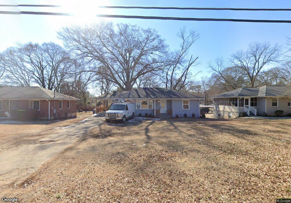
2883 Mcafee Rd Decatur, GA 30032
Estimated Value: $240,000 - $281,000
3
Beds
2
Baths
1,172
Sq Ft
$227/Sq Ft
Est. Value
About This Home
This home is located at 2883 Mcafee Rd, Decatur, GA 30032 and is currently estimated at $266,531, approximately $227 per square foot. 2883 Mcafee Rd is a home located in DeKalb County with nearby schools including Toney Elementary School, Columbia Middle School, and Columbia High School.
Ownership History
Date
Name
Owned For
Owner Type
Purchase Details
Closed on
Jan 24, 2020
Sold by
10 Sixteen Development Grp Llc
Bought by
First Page New Chapter Management Llc
Current Estimated Value
Home Financials for this Owner
Home Financials are based on the most recent Mortgage that was taken out on this home.
Original Mortgage
$200,000
Interest Rate
3.74%
Mortgage Type
Commercial
Create a Home Valuation Report for This Property
The Home Valuation Report is an in-depth analysis detailing your home's value as well as a comparison with similar homes in the area
Home Values in the Area
Average Home Value in this Area
Purchase History
| Date | Buyer | Sale Price | Title Company |
|---|---|---|---|
| First Page New Chapter Management Llc | $160,000 | -- | |
| 10 Sixteen Development Grp Llc | $145,000 | -- | |
| Benjaminhouse Investments Llc | $123,000 | -- |
Source: Public Records
Mortgage History
| Date | Status | Borrower | Loan Amount |
|---|---|---|---|
| Closed | Benjaminhouse Investments Llc | $200,000 |
Source: Public Records
Tax History Compared to Growth
Tax History
| Year | Tax Paid | Tax Assessment Tax Assessment Total Assessment is a certain percentage of the fair market value that is determined by local assessors to be the total taxable value of land and additions on the property. | Land | Improvement |
|---|---|---|---|---|
| 2025 | $5,637 | $118,640 | $29,320 | $89,320 |
| 2024 | $6,012 | $127,240 | $28,040 | $99,200 |
| 2023 | $6,012 | $117,480 | $21,560 | $95,920 |
| 2022 | $5,078 | $107,880 | $14,680 | $93,200 |
| 2021 | $3,972 | $82,680 | $9,520 | $73,160 |
| 2020 | $2,225 | $42,880 | $9,520 | $33,360 |
| 2019 | $2,276 | $44,040 | $9,520 | $34,520 |
| 2018 | $1,431 | $33,080 | $9,520 | $23,560 |
| 2017 | $1,526 | $23,400 | $2,920 | $20,480 |
| 2016 | $1,057 | $16,160 | $2,920 | $13,240 |
| 2014 | $1,035 | $15,280 | $2,920 | $12,360 |
Source: Public Records
Map
Nearby Homes
- 2917 Mcafee Rd
- 1996 Meadow Ln
- 1981 Meadow Ln
- 2952 Mcafee Rd
- 2922 Dale Place
- 2819 Long Way
- 1979 Creekside Ct
- 2791 Mcafee Rd
- 2115 Nichols Ln
- 2096 Dellwood Place
- 2075 Dellwood Place
- 2854 Mitchell Dr
- 2126 Seavey Dr
- 2127 Nichols Ln
- 2130 Seavey Dr
- 1909 Meadow Ln
- 1903 Meadow Ln
- 2812 Mitchell Dr
- 1883 Meadow Ln
- 1884 Meadow Ln
- 2889 Mcafee Rd
- 2877 Mcafee Rd
- 2028 Seavey Dr
- 2899 Mcafee Rd
- 2034 Seavey Dr
- 2033 Nichols Ln
- 2865 Mcafee Rd
- 2880 Mcafee Rd
- 2870 Mcafee Rd
- 2039 Nichols Ln
- 2042 Seavey Dr
- 2029 Seavey Dr
- 2003 Meadow Ln
- 2866 Mcafee Rd
- 2859 Mcafee Rd
- 2035 Seavey Dr
- 1994 Long Dr
- 2045 Nichols Ln
- 1997 Meadow Ln
- 2048 Seavey Dr