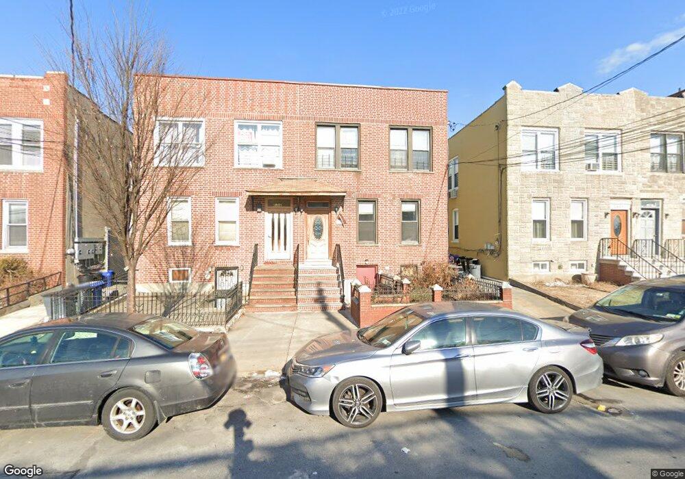
2883 Philip Ave Bronx, NY 10465
Throgs Neck-Edgewater Park NeighborhoodEstimated Value: $530,000 - $1,272,000
--
Bed
--
Bath
3,240
Sq Ft
$292/Sq Ft
Est. Value
About This Home
This home is located at 2883 Philip Ave, Bronx, NY 10465 and is currently estimated at $947,667, approximately $292 per square foot. 2883 Philip Ave is a home located in Bronx County with nearby schools including P.S. 14 Senator John Calandra, Herbert H Lehman High School, and St Benedict School.
Ownership History
Date
Name
Owned For
Owner Type
Purchase Details
Closed on
Feb 3, 2017
Sold by
Boga Cafo and Boga Xhemal
Bought by
Boga Xhemal
Current Estimated Value
Home Financials for this Owner
Home Financials are based on the most recent Mortgage that was taken out on this home.
Original Mortgage
$350,000
Outstanding Balance
$288,889
Interest Rate
4.09%
Mortgage Type
Purchase Money Mortgage
Estimated Equity
$658,778
Create a Home Valuation Report for This Property
The Home Valuation Report is an in-depth analysis detailing your home's value as well as a comparison with similar homes in the area
Home Values in the Area
Average Home Value in this Area
Purchase History
| Date | Buyer | Sale Price | Title Company |
|---|---|---|---|
| Boga Xhemal | $330,931 | -- |
Source: Public Records
Mortgage History
| Date | Status | Borrower | Loan Amount |
|---|---|---|---|
| Open | Boga Xhemal | $350,000 |
Source: Public Records
Tax History Compared to Growth
Tax History
| Year | Tax Paid | Tax Assessment Tax Assessment Total Assessment is a certain percentage of the fair market value that is determined by local assessors to be the total taxable value of land and additions on the property. | Land | Improvement |
|---|---|---|---|---|
| 2025 | $16,521 | $132,145 | $35,132 | $97,013 |
| 2024 | $16,521 | $132,144 | $36,340 | $95,804 |
| 2023 | $15,009 | $122,356 | $28,637 | $93,719 |
| 2022 | $14,494 | $284,850 | $79,200 | $205,650 |
| 2021 | $0 | $335,250 | $79,200 | $256,050 |
| 2020 | $12,679 | $336,150 | $79,200 | $256,950 |
| 2019 | $12,820 | $280,260 | $79,200 | $201,060 |
| 2018 | $11,971 | $94,120 | $31,917 | $62,203 |
| 2017 | $11,590 | $91,127 | $33,553 | $57,574 |
| 2016 | $10,883 | $84,418 | $33,844 | $50,574 |
| 2015 | $7,062 | $78,192 | $28,258 | $49,934 |
| 2014 | $7,062 | $78,192 | $33,896 | $44,296 |
Source: Public Records
Map
Nearby Homes
- 836 Revere Ave
- 2916 Sullivan Place
- - Ave
- 710 Revere Ave
- 2808 Philip Ave
- 755 Logan Ave
- 815 Swinton Ave
- 831 Swinton Ave
- 837 Swinton Ave
- 819 Hollywood Ave
- 854 Logan Ave
- 730 Logan Ave
- 731 Hollywood Ave
- 840 Hollywood Ave
- 724 Hollywood Ave
- 945 Swinton Ave
- 636 Logan Ave
- 2921 Greene Place
- 3021 Barkley Ave
- 1032 Swinton Ave
- 2885 Philip Ave
- 2881 Philip Ave
- 2879 Philip Ave
- 2879 Philip Ave Unit 1-F
- 2879 Philip Ave Unit 2
- 2887 Philip Ave
- 810 Revere Ave
- 810 Revere Ave Unit B
- 810 Revere Ave Unit PARK
- 810 Revere Ave Unit A
- 2877 Philip Ave
- 812 Revere Ave
- 3630 E Tremont Ave
- 822 Revere Ave
- 3628 E Tremont Ave
- 2871 Philip Ave
- 824 Revere Ave
- 3626 E Tremont Ave
- 2882 Philip Ave
- 2884 Philip Ave