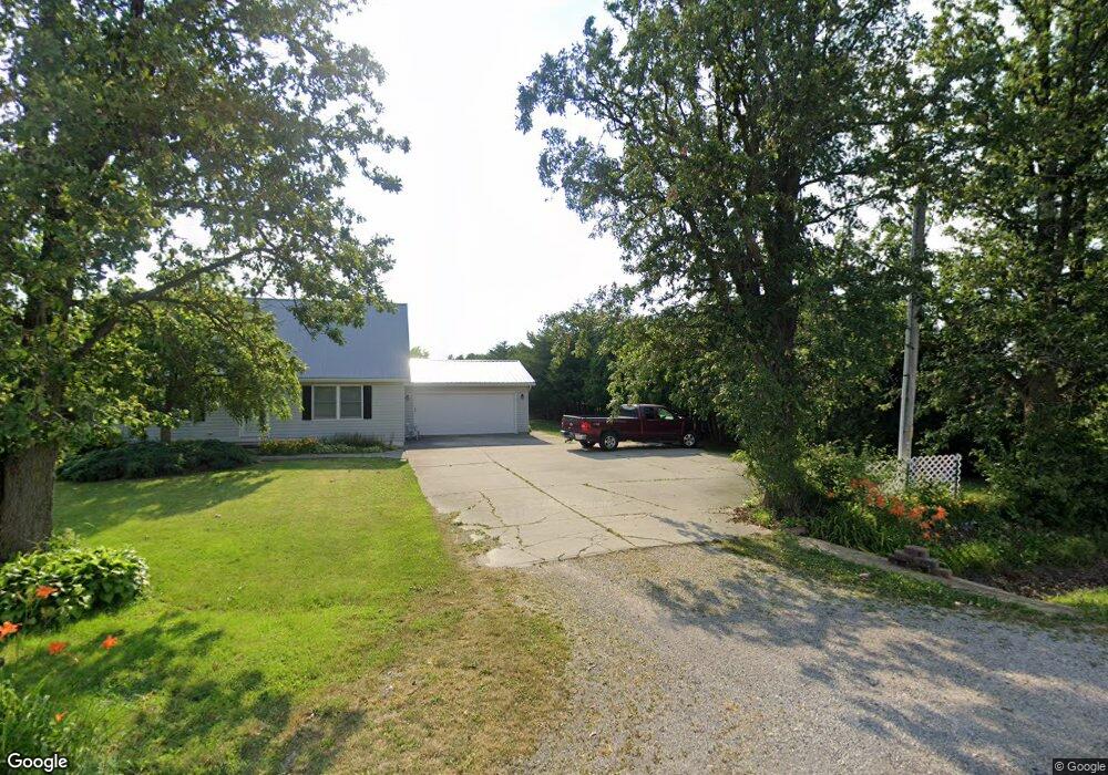
2883 Range Line Rd Custar, OH 43511
Estimated Value: $155,000 - $363,013
3
Beds
2
Baths
1,112
Sq Ft
$246/Sq Ft
Est. Value
About This Home
This home is located at 2883 Range Line Rd, Custar, OH 43511 and is currently estimated at $273,253, approximately $245 per square foot. 2883 Range Line Rd is a home located in Wood County with nearby schools including McComb Elementary School, McComb Middle School, and Mccomb Local High School.
Ownership History
Date
Name
Owned For
Owner Type
Purchase Details
Closed on
Jan 3, 2024
Sold by
Given Not
Bought by
Revocable Living Trust and Householder
Current Estimated Value
Purchase Details
Closed on
Mar 26, 2012
Sold by
Householder Harry R and Householder Helen J
Bought by
Householder Ronald L
Purchase Details
Closed on
Jan 1, 1990
Bought by
Householder Harry Ray
Create a Home Valuation Report for This Property
The Home Valuation Report is an in-depth analysis detailing your home's value as well as a comparison with similar homes in the area
Purchase History
| Date | Buyer | Sale Price | Title Company |
|---|---|---|---|
| Revocable Living Trust | $275,500 | None Listed On Document | |
| Householder Ronald L | -- | Attorney | |
| Householder Harry Ray | -- | -- |
Source: Public Records
Tax History
| Year | Tax Paid | Tax Assessment Tax Assessment Total Assessment is a certain percentage of the fair market value that is determined by local assessors to be the total taxable value of land and additions on the property. | Land | Improvement |
|---|---|---|---|---|
| 2025 | $2,453 | $98,980 | $49,420 | $49,560 |
| 2024 | $2,141 | $98,980 | $49,420 | $49,560 |
| 2023 | $2,141 | $98,980 | $49,420 | $49,560 |
| 2021 | $1,833 | $82,120 | $42,250 | $39,870 |
| 2020 | $1,849 | $82,120 | $42,250 | $39,870 |
| 2019 | $1,867 | $71,440 | $35,210 | $36,230 |
| 2018 | $1,811 | $71,440 | $35,210 | $36,230 |
| 2017 | $879 | $71,440 | $35,210 | $36,230 |
| 2016 | $1,705 | $60,340 | $25,550 | $34,790 |
| 2015 | $1,705 | $60,340 | $25,550 | $34,790 |
| 2014 | $1,790 | $60,340 | $25,550 | $34,790 |
| 2013 | $708 | $54,880 | $23,240 | $31,640 |
Source: Public Records
Map
Nearby Homes
- 2970 Otsego Pike
- 0 Deshler Rd
- 0 Hockenberry Rd
- 508 W Walnut St
- 1128 County Road 139
- 122 W Broadway St
- 4134 County Road 203
- 0 Oil Center Rd
- 115 S 2nd St
- 313 S Main St
- 306 S Tarr St
- 24642 Hammansburg Rd
- Lot 112 Foley Run
- 12078 Eagleville Rd
- 930 E Broadway St Unit LOT 73
- 930 E Broadway St
- 223 Cherry St
- 257 S Main St
- 0000 Eagleville Rd
- 0 Joshua Rd Unit 6126475
- 2946 Range Line Rd
- 19019 Needles Rd
- 18927 Needles Rd
- 19265 Needles Rd
- 19293 Needles Rd
- 19388 Needles Rd
- 2264 Range Line Rd
- 19700 Needles Rd
- 19621 Hoytville Rd
- 19781 Needles Rd
- 19839 Needles Rd
- 19805 E Church St
- 19841 E Church St
- 0 E Hoytville Rd
- 19841 E Church St
- 0 Hoytville Rd
- 19842 E Church St
- 19841 E Church St
- 19841 Hoytville Rd
- 0 Garfield St
Your Personal Tour Guide
Ask me questions while you tour the home.