Estimated Value: $97,531 - $163,000
2
Beds
1
Bath
880
Sq Ft
$152/Sq Ft
Est. Value
About This Home
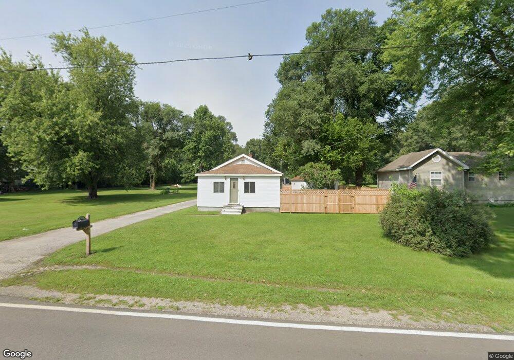
This home is located at 2883 S Range Rd, Knox, IN 46534 and is currently estimated at $133,383, approximately $151 per square foot. 2883 S Range Rd is a home located in Starke County with nearby schools including North Judson-San Pierre Elementary School and N. Judson-San Pierre Junior/Senior High School.
Ownership History
Date
Name
Owned For
Owner Type
Purchase Details
Closed on
Dec 26, 2015
Sold by
Burger Carl P and Burger Lisa A
Bought by
Burger Carl P and Burger Lisa A
Current Estimated Value
Home Financials for this Owner
Home Financials are based on the most recent Mortgage that was taken out on this home.
Original Mortgage
$43,200
Outstanding Balance
$17,030
Interest Rate
3.92%
Mortgage Type
New Conventional
Estimated Equity
$116,353
Purchase Details
Closed on
Nov 2, 2005
Sold by
Burger Carl P
Bought by
Burger Carl P and Kaiser Lisa A
Home Financials for this Owner
Home Financials are based on the most recent Mortgage that was taken out on this home.
Original Mortgage
$35,000
Interest Rate
6.04%
Mortgage Type
Stand Alone Second
Create a Home Valuation Report for This Property
The Home Valuation Report is an in-depth analysis detailing your home's value as well as a comparison with similar homes in the area
Purchase History
| Date | Buyer | Sale Price | Title Company |
|---|---|---|---|
| Burger Carl P | -- | None Available | |
| Burger Carl P | -- | None Available |
Source: Public Records
Mortgage History
| Date | Status | Borrower | Loan Amount |
|---|---|---|---|
| Open | Burger Carl P | $43,200 | |
| Previous Owner | Burger Carl P | $35,000 |
Source: Public Records
Tax History
| Year | Tax Paid | Tax Assessment Tax Assessment Total Assessment is a certain percentage of the fair market value that is determined by local assessors to be the total taxable value of land and additions on the property. | Land | Improvement |
|---|---|---|---|---|
| 2025 | $298 | $77,200 | $22,900 | $54,300 |
| 2024 | $298 | $72,800 | $21,900 | $50,900 |
| 2023 | $287 | $66,600 | $19,500 | $47,100 |
| 2022 | $280 | $62,200 | $18,000 | $44,200 |
| 2021 | $282 | $54,400 | $17,800 | $36,600 |
| 2020 | $304 | $52,800 | $17,800 | $35,000 |
| 2019 | $275 | $49,000 | $16,600 | $32,400 |
| 2018 | $249 | $45,700 | $15,100 | $30,600 |
| 2017 | $236 | $45,800 | $15,000 | $30,800 |
| 2016 | $225 | $45,700 | $15,000 | $30,700 |
| 2014 | $195 | $45,100 | $14,900 | $30,200 |
| 2013 | $198 | $45,900 | $15,500 | $30,400 |
Source: Public Records
Map
Nearby Homes
- 840 W 450 S
- 3360 S State Road 39
- 1892 W 200 S
- 0 E 500 S
- 2760 S Lovelia Dr
- 2075 E 200 S
- 2455 W Impala St
- 4540 S 300 E
- 2240 S 350 E
- 1301 W Culver Rd
- 1309 S Roosevelt Rd
- 14.89 Acres W Culver Rd
- 3395 U S 35
- 2260 S Us Highway 35
- 903 S Portland St
- 4189 E County Road 200 S
- 305 W New York St
- 701 S Shield St
- 703 S Main St
- 154 W New York St
- 2937 S Range Rd
- 2875 S Range Rd
- 2955 S Range Rd
- 2880 S Range Rd
- 2860 S Range Rd
- 2920 S Range Rd
- 2960 S Range Rd
- 2840 S Range Rd
- 0 E Toto Rd
- 0 E Toto Rd Unit NRA545431
- 0 E Toto Rd Unit GNR523935
- 0 E Toto Rd Unit GNR501595
- 0 E Toto Rd Unit GNR471821
- 0 E Toto Rd Unit GNR367698
- 0 E Toto Rd Unit GNR355327
- 0 E Toto Rd Unit GNR6292331
- 0 E Toto Rd Unit GNR319530
- 0 E Toto Rd Unit GNR313048
- 0 E Toto Rd Unit GNR312253
- 0 E Toto Rd Unit GNR296484
Your Personal Tour Guide
Ask me questions while you tour the home.