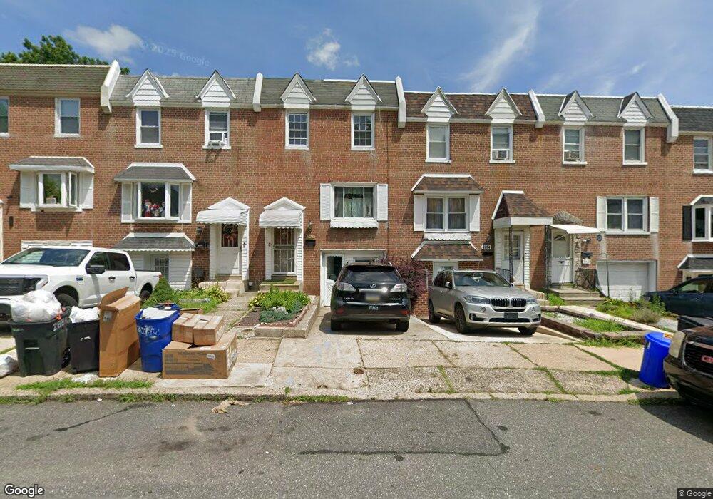
2884 Angus Rd Philadelphia, PA 19114
Torresdale NeighborhoodEstimated Value: $287,000 - $302,263
3
Beds
1
Bath
1,296
Sq Ft
$228/Sq Ft
Est. Value
About This Home
This home is located at 2884 Angus Rd, Philadelphia, PA 19114 and is currently estimated at $295,066, approximately $227 per square foot. 2884 Angus Rd is a home located in Philadelphia County with nearby schools including Lincoln High School, Robert B. Pollock School, and Meehan Austin Middle School.
Ownership History
Date
Name
Owned For
Owner Type
Purchase Details
Closed on
Mar 10, 2022
Sold by
Kenneth Kumba E
Bought by
Brown Augustus
Current Estimated Value
Home Financials for this Owner
Home Financials are based on the most recent Mortgage that was taken out on this home.
Original Mortgage
$231,400
Outstanding Balance
$216,031
Interest Rate
3.85%
Mortgage Type
New Conventional
Estimated Equity
$79,035
Purchase Details
Closed on
Dec 15, 2006
Sold by
Dualu Edward and Dualu Kenneth Kumba
Bought by
Kenneth Kumba E and Nelson Esther Y
Home Financials for this Owner
Home Financials are based on the most recent Mortgage that was taken out on this home.
Original Mortgage
$152,000
Interest Rate
9.12%
Mortgage Type
New Conventional
Purchase Details
Closed on
Aug 27, 1999
Sold by
Scherfel Julie and Englert Joan
Bought by
Rivera Gloria and Toledo Jose
Create a Home Valuation Report for This Property
The Home Valuation Report is an in-depth analysis detailing your home's value as well as a comparison with similar homes in the area
Home Values in the Area
Average Home Value in this Area
Purchase History
| Date | Buyer | Sale Price | Title Company |
|---|---|---|---|
| Brown Augustus | $260,000 | New Title Company Name | |
| Kenneth Kumba E | -- | None Available | |
| Rivera Gloria | $71,900 | -- |
Source: Public Records
Mortgage History
| Date | Status | Borrower | Loan Amount |
|---|---|---|---|
| Open | Brown Augustus | $231,400 | |
| Previous Owner | Kenneth Kumba E | $152,000 |
Source: Public Records
Tax History Compared to Growth
Tax History
| Year | Tax Paid | Tax Assessment Tax Assessment Total Assessment is a certain percentage of the fair market value that is determined by local assessors to be the total taxable value of land and additions on the property. | Land | Improvement |
|---|---|---|---|---|
| 2025 | $2,913 | $259,800 | $51,960 | $207,840 |
| 2024 | $2,913 | $259,800 | $51,960 | $207,840 |
| 2023 | $2,913 | $208,100 | $41,620 | $166,480 |
| 2022 | $2,359 | $208,100 | $41,620 | $166,480 |
| 2021 | $2,359 | $0 | $0 | $0 |
| 2020 | $2,359 | $0 | $0 | $0 |
| 2019 | $2,221 | $0 | $0 | $0 |
| 2018 | $2,100 | $0 | $0 | $0 |
| 2017 | $2,100 | $0 | $0 | $0 |
| 2016 | $2,100 | $0 | $0 | $0 |
| 2015 | $2,010 | $0 | $0 | $0 |
| 2014 | -- | $150,000 | $22,756 | $127,244 |
| 2012 | -- | $19,840 | $3,900 | $15,940 |
Source: Public Records
Map
Nearby Homes
- 2843 Woodbridge Rd
- 9428 Woodbridge Rd
- 2710 Riverhouse Rd
- 2833 Saxton Rd
- 9311 Andover Rd
- 2959 Tremont St
- 3215 Brookdale Rd
- 9328 Academy Rd
- 2738 Maxwell St
- 2831 Sebring Rd
- 9214 Andover Rd
- 3108 Fairfield St
- 2831 Chase Rd
- 9202 Treaty Rd
- 9612 Convent Ave
- 2777 Welsh Rd
- 3414 Aubrey Ave
- 2742 Welsh Rd
- 9235 Outlook Ave
- 3427 Aubrey Ave