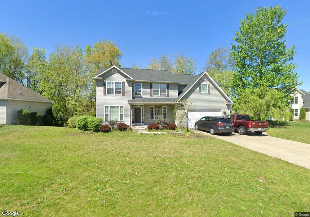
2885 Crows Nest Cir Uniontown, OH 44685
Estimated Value: $423,000 - $537,000
3
Beds
4
Baths
2,962
Sq Ft
$157/Sq Ft
Est. Value
About This Home
This home is located at 2885 Crows Nest Cir, Uniontown, OH 44685 and is currently estimated at $464,414, approximately $156 per square foot. 2885 Crows Nest Cir is a home located in Summit County with nearby schools including Greenwood Elementary School, Green Primary School, and Green Intermediate Elementary School.
Ownership History
Date
Name
Owned For
Owner Type
Purchase Details
Closed on
Jan 5, 2005
Sold by
Union Commerce Corp
Bought by
Kirkbride Thomas A and Kirkbride Bobbi J
Current Estimated Value
Home Financials for this Owner
Home Financials are based on the most recent Mortgage that was taken out on this home.
Original Mortgage
$276,000
Interest Rate
5.25%
Mortgage Type
Construction
Create a Home Valuation Report for This Property
The Home Valuation Report is an in-depth analysis detailing your home's value as well as a comparison with similar homes in the area
Home Values in the Area
Average Home Value in this Area
Purchase History
| Date | Buyer | Sale Price | Title Company |
|---|---|---|---|
| Kirkbride Thomas A | $53,000 | Land America-Lawyers Title |
Source: Public Records
Mortgage History
| Date | Status | Borrower | Loan Amount |
|---|---|---|---|
| Closed | Kirkbride Thomas A | $276,000 |
Source: Public Records
Tax History Compared to Growth
Tax History
| Year | Tax Paid | Tax Assessment Tax Assessment Total Assessment is a certain percentage of the fair market value that is determined by local assessors to be the total taxable value of land and additions on the property. | Land | Improvement |
|---|---|---|---|---|
| 2025 | $6,113 | $129,290 | $21,126 | $108,164 |
| 2024 | $6,113 | $129,290 | $21,126 | $108,164 |
| 2023 | $6,113 | $129,290 | $21,126 | $108,164 |
| 2022 | $5,497 | $104,384 | $17,038 | $87,346 |
| 2021 | $5,155 | $104,384 | $17,038 | $87,346 |
| 2020 | $5,056 | $104,390 | $17,040 | $87,350 |
| 2019 | $4,644 | $89,760 | $16,360 | $73,400 |
| 2018 | $4,747 | $89,760 | $16,360 | $73,400 |
| 2017 | $4,397 | $89,760 | $16,360 | $73,400 |
| 2016 | $4,375 | $77,990 | $16,360 | $61,630 |
| 2015 | $4,397 | $77,990 | $16,360 | $61,630 |
| 2014 | $4,368 | $77,990 | $16,360 | $61,630 |
| 2013 | $4,469 | $79,350 | $16,360 | $62,990 |
Source: Public Records
Map
Nearby Homes
- 3979 Northdale St NW
- 3217 Deborah Ct
- 3212 Deborah Ct
- 2771 Superior Dr
- 2944 Sunset Dr
- 0 Pine St NW
- 13704 Greenland Ave NW
- 3796 Sweitzer St NW
- 2500 Marlborough Dr
- 3003 Myersville Rd
- Northwood Plan at Spring Hill - Spring Hill Villas
- Kenai Plan at Spring Hill - Spring Hill Villas
- Bradbern Plan at Spring Hill - Spring Hill Villas
- Sarasota Plan at Spring Hill - Spring Hill Villas
- Holston Plan at Spring Hill - Spring Hill Villas
- Chester Plan at Spring Hill - Spring Hill Villas
- 2418 Island Dr
- 3534 Chanticleer Ct
- 3514 Chanticleer Ct
- 2577 Sweitzer Rd
- 2893 Crows Nest Cir
- 2877 Crows Nest Cir
- 2901 Crows Nest Cir
- 2876 Crows Nest Cir
- 2869 Crows Nest Cir
- 2884 Crows Nest Cir
- 2900 Crows Nest Cir
- 2861 Crows Nest Cir
- 2838 Lakeview Dr Unit 114
- 2838 Lakeview Dr
- S/L 145 Jonathan Ct
- 2870 Jonathan Ct
- 2864 Crows Nest Cir
- 2854 Lakeview Dr
- 2830 Lakeview Dr Unit S/L 1
- 2846 Lakeview Dr Unit 113
- 2846 Lakeview Dr
- 2861 Lakeview Dr
- 2854 Lakeview Dr
- 2895 Jonathan Ct