Estimated Value: $207,000 - $240,000
3
Beds
2
Baths
1,440
Sq Ft
$157/Sq Ft
Est. Value
About This Home
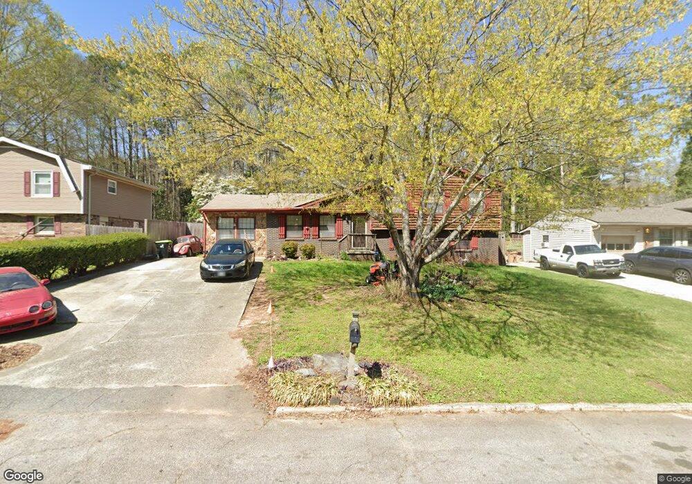
This home is located at 2886 Bretton Dr, Rex, GA 30273 and is currently estimated at $225,770, approximately $156 per square foot. 2886 Bretton Dr is a home located in Clayton County with nearby schools including William M. Mcgarrah Elementary School, Rex Mill Middle School, and Mount Zion High School.
Ownership History
Date
Name
Owned For
Owner Type
Purchase Details
Closed on
Mar 27, 2001
Bought by
Webb Dennis L and Webb Katrina L
Current Estimated Value
Home Financials for this Owner
Home Financials are based on the most recent Mortgage that was taken out on this home.
Original Mortgage
$19,700
Outstanding Balance
$7,262
Interest Rate
7.02%
Mortgage Type
New Conventional
Estimated Equity
$218,508
Purchase Details
Closed on
Aug 31, 1993
Sold by
Burger B Dawn
Bought by
Webb Dennis L Katina L
Home Financials for this Owner
Home Financials are based on the most recent Mortgage that was taken out on this home.
Original Mortgage
$74,778
Interest Rate
7.21%
Mortgage Type
FHA
Create a Home Valuation Report for This Property
The Home Valuation Report is an in-depth analysis detailing your home's value as well as a comparison with similar homes in the area
Home Values in the Area
Average Home Value in this Area
Purchase History
| Date | Buyer | Sale Price | Title Company |
|---|---|---|---|
| Webb Dennis L | -- | -- | |
| Webb Dennis L Katina L | $75,900 | -- |
Source: Public Records
Mortgage History
| Date | Status | Borrower | Loan Amount |
|---|---|---|---|
| Open | Webb Dennis L | $19,700 | |
| Previous Owner | Webb Dennis L Katina L | $74,778 |
Source: Public Records
Tax History Compared to Growth
Tax History
| Year | Tax Paid | Tax Assessment Tax Assessment Total Assessment is a certain percentage of the fair market value that is determined by local assessors to be the total taxable value of land and additions on the property. | Land | Improvement |
|---|---|---|---|---|
| 2024 | $2,678 | $78,640 | $7,200 | $71,440 |
| 2023 | $2,880 | $79,760 | $7,200 | $72,560 |
| 2022 | $2,217 | $66,480 | $7,200 | $59,280 |
| 2021 | $1,425 | $46,080 | $7,200 | $38,880 |
| 2020 | $1,328 | $43,193 | $7,200 | $35,993 |
| 2019 | $1,148 | $38,288 | $5,600 | $32,688 |
| 2018 | $1,007 | $34,817 | $5,600 | $29,217 |
| 2017 | $776 | $29,066 | $5,600 | $23,466 |
| 2016 | $621 | $25,262 | $5,600 | $19,662 |
| 2015 | $454 | $0 | $0 | $0 |
| 2014 | $470 | $21,807 | $6,400 | $15,407 |
Source: Public Records
Map
Nearby Homes
- 2933 Bretton Dr
- 2881 Panther Ct
- 2845 Heritage Ln
- 2783 Mill Lake Way
- 6486 Aquila Dr
- 6485 Bobolink Ct
- 6498 Carolyn Ct
- 2688 Heritage Ln
- 6697 Cambridge Dr
- 2705 Heritage Ln
- 2681 Heritage Ln
- 6844 Silver Maple Dr
- 6848 Silver Maple Dr
- 6348 Towhee Way
- 6357 Towhee Way
- 6371 Towhee Way
- 6389 Warbler Ct
- 6383 Warbler Ct
- 6375 Warbler Ct
- 2894 Bretton Dr
- 2878 Bretton Dr
- 2870 Bretton Dr
- 2902 Bretton Dr
- 2887 Bretton Dr
- 2879 Bretton Dr
- 2895 Bretton Dr
- 2862 Bretton Dr
- 2871 Bretton Dr
- 2912 Bretton Dr
- 6593 Katie Ln
- 2861 Bretton Dr
- 6583 Katie Ln
- 2854 Bretton Dr
- 6582 Aquila Dr
- 0 Bretton Dr Unit 3215141
- 0 Bretton Dr Unit 7264084
- 0 Bretton Dr Unit 3140734
- 0 Bretton Dr Unit 3166467
- 0 Bretton Dr Unit 3175040