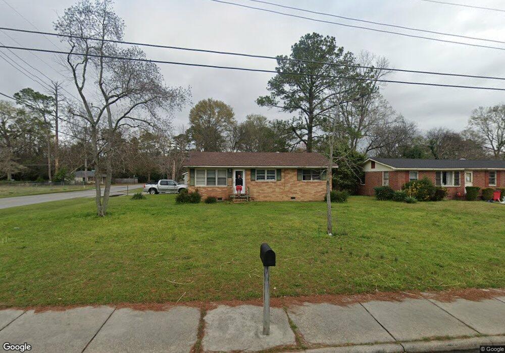
2887 Bonnie Ave Macon, GA 31206
Estimated Value: $104,000 - $144,788
3
Beds
2
Baths
1,784
Sq Ft
$69/Sq Ft
Est. Value
About This Home
This home is located at 2887 Bonnie Ave, Macon, GA 31206 and is currently estimated at $123,947, approximately $69 per square foot. 2887 Bonnie Ave is a home located in Bibb County with nearby schools including Veterans Elementary School, Southwest High School, and Gilead Christian Academy.
Ownership History
Date
Name
Owned For
Owner Type
Purchase Details
Closed on
Mar 8, 2007
Sold by
Harmon Adrian
Bought by
Thomas Dorothy M
Current Estimated Value
Home Financials for this Owner
Home Financials are based on the most recent Mortgage that was taken out on this home.
Original Mortgage
$81,852
Outstanding Balance
$49,159
Interest Rate
6.3%
Mortgage Type
FHA
Estimated Equity
$74,788
Purchase Details
Closed on
Dec 6, 2005
Bought by
Thomas Dorothy M
Purchase Details
Closed on
Dec 20, 2001
Create a Home Valuation Report for This Property
The Home Valuation Report is an in-depth analysis detailing your home's value as well as a comparison with similar homes in the area
Home Values in the Area
Average Home Value in this Area
Purchase History
| Date | Buyer | Sale Price | Title Company |
|---|---|---|---|
| Thomas Dorothy M | $82,500 | None Available | |
| Thomas Dorothy M | $88,700 | -- | |
| Secretary Of Hud | -- | None Available | |
| -- | $80,000 | -- |
Source: Public Records
Mortgage History
| Date | Status | Borrower | Loan Amount |
|---|---|---|---|
| Open | Thomas Dorothy M | $81,852 |
Source: Public Records
Tax History Compared to Growth
Tax History
| Year | Tax Paid | Tax Assessment Tax Assessment Total Assessment is a certain percentage of the fair market value that is determined by local assessors to be the total taxable value of land and additions on the property. | Land | Improvement |
|---|---|---|---|---|
| 2025 | $980 | $46,890 | $3,300 | $43,590 |
| 2024 | $1,013 | $46,890 | $3,300 | $43,590 |
| 2023 | $271 | $35,687 | $2,640 | $33,047 |
| 2022 | $818 | $30,617 | $3,286 | $27,331 |
| 2021 | $614 | $23,167 | $2,300 | $20,867 |
| 2020 | $384 | $16,889 | $1,643 | $15,246 |
| 2019 | $387 | $16,889 | $1,643 | $15,246 |
| 2018 | $773 | $16,889 | $1,643 | $15,246 |
| 2017 | $349 | $16,311 | $1,643 | $14,668 |
| 2016 | $322 | $16,311 | $1,643 | $14,668 |
| 2015 | $456 | $16,311 | $1,643 | $14,668 |
| 2014 | $576 | $16,311 | $1,643 | $14,668 |
Source: Public Records
Map
Nearby Homes
- 2770 Bonnie Ave
- 2769 Nancy Dr
- 2972 Richard Dr
- 2768 Nancy Dr
- 2995 Virginia Dr
- 2801 Deeb Dr
- 3078 Alfred Dr
- 2868 Barrett Ave
- 2704 Reynolds Dr
- 5711 Sterling Place
- 2960 Jadan Place
- 5746 Sterling Place
- 5756 Edwina Dr
- 5780 Edwina Dr
- 2830 Village Green Dr
- 2824 Village Green Dr
- 2841 Shamrock Dr
- 5771 Satterfield Dr
- 5770 Satterfield Dr
- 2775 Village Green Ln
- 2869 Bonnie Ave
- 2904 Alfred Dr
- 2851 Bonnie Ave
- 2884 Virginia Dr
- 2872 Virginia Dr
- 2910 Alfred Dr
- 2886 Bonnie Ave
- 5349 Nisbet Dr
- 2833 Bonnie Ave
- 2856 Virginia Dr
- 2868 Bonnie Ave
- 2905 Richard Dr
- 2916 Alfred Dr
- 2840 Virginia Dr
- 5345 Nisbet Dr
- 2815 Bonnie Ave
- 2911 Richard Dr
- 2832 Bonnie Ave
- 2913 Alfred Dr
- 0 Virginia Dr Unit 7584836