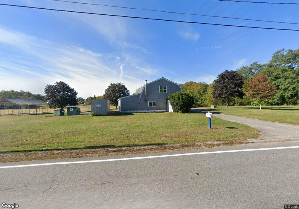
289 7 Bridge Rd Lancaster, MA 01523
Estimated Value: $794,824
1
Bed
2
Baths
1,800
Sq Ft
$442/Sq Ft
Est. Value
About This Home
This home is located at 289 7 Bridge Rd, Lancaster, MA 01523 and is currently estimated at $794,824, approximately $441 per square foot. 289 7 Bridge Rd is a home located in Worcester County with nearby schools including Mary Rowlandson Elementary School, Luther Burbank Middle School, and Nashoba Regional High School.
Ownership History
Date
Name
Owned For
Owner Type
Purchase Details
Closed on
Apr 18, 2012
Sold by
Rich Eleanor R
Bought by
289 Seven Bridge Road
Current Estimated Value
Home Financials for this Owner
Home Financials are based on the most recent Mortgage that was taken out on this home.
Original Mortgage
$330,000
Outstanding Balance
$227,719
Interest Rate
3.89%
Mortgage Type
Commercial
Estimated Equity
$567,105
Create a Home Valuation Report for This Property
The Home Valuation Report is an in-depth analysis detailing your home's value as well as a comparison with similar homes in the area
Home Values in the Area
Average Home Value in this Area
Purchase History
| Date | Buyer | Sale Price | Title Company |
|---|---|---|---|
| 289 Seven Bridge Road | $330,000 | -- |
Source: Public Records
Mortgage History
| Date | Status | Borrower | Loan Amount |
|---|---|---|---|
| Open | 289 Seven Bridge Road | $330,000 |
Source: Public Records
Tax History Compared to Growth
Tax History
| Year | Tax Paid | Tax Assessment Tax Assessment Total Assessment is a certain percentage of the fair market value that is determined by local assessors to be the total taxable value of land and additions on the property. | Land | Improvement |
|---|---|---|---|---|
| 2025 | $6,794 | $420,400 | $124,600 | $295,800 |
| 2024 | $7,398 | $423,700 | $114,600 | $309,100 |
| 2023 | $7,012 | $407,900 | $104,600 | $303,300 |
| 2022 | $7,657 | $393,700 | $95,200 | $298,500 |
| 2021 | $7,734 | $387,100 | $95,200 | $291,900 |
| 2020 | $7,624 | $384,100 | $95,200 | $288,900 |
| 2019 | $7,234 | $366,300 | $95,200 | $271,100 |
| 2018 | $6,979 | $349,300 | $95,200 | $254,100 |
| 2016 | $6,453 | $330,100 | $94,200 | $235,900 |
| 2015 | $6,491 | $346,000 | $86,500 | $259,500 |
| 2014 | $6,055 | $320,200 | $86,500 | $233,700 |
Source: Public Records
Map
Nearby Homes
- 144 Seven Bridge Rd
- 0 Main St
- 22 Kettle Hole Rd
- 285 Still River Rd
- 303 Ponakin Rd
- 2038-1 Laurel Hill Ln
- 2038 Laurel Hill Ln Unit LOT 18
- 93 Fox Run Rd
- 453 Blue Heron Dr Unit 453
- 132 Kilbourn Rd
- 85 Prescott St
- 63 Settlers Path
- 29 Bennett Ln
- 23 Bennett Ln
- 136 Mill St
- 92 Mill St
- 238 Mill Street Extension
- 295 Vaughn Hill Rd
- 93 Vaughn Hill Rd
- 12 Woodruff Rd
- 289 7 Bridge Rd
- Lot 7 Deershorn Rd
- 280 7 Bridge Rd
- 361 Harvard Rd
- 250 7 Bridge Rd
- 250 Seven Bridge Rd
- 339 7 Bridge Rd
- 230 Seven Bridge Rd
- 230 7 Bridge Rd
- 356 Harvard Rd
- 455 Harvard Rd
- 444 Harvard Rd
- 390 Harvard Rd
- 220 7 Bridge Rd
- 456 Harvard Rd
- 309 Harvard Rd
- 473 Harvard Rd
- 1 Shasta Dr
- 472 Harvard Rd
- 3 Shasta Dr