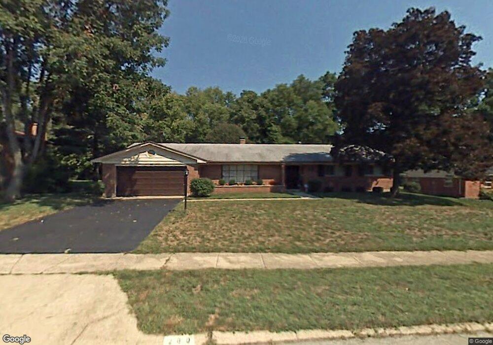
289 Burgess Ave Dayton, OH 45415
Estimated Value: $228,000 - $251,000
3
Beds
3
Baths
2,236
Sq Ft
$106/Sq Ft
Est. Value
About This Home
This home is located at 289 Burgess Ave, Dayton, OH 45415 and is currently estimated at $237,257, approximately $106 per square foot. 289 Burgess Ave is a home located in Montgomery County with nearby schools including Valerie Elementary School, Imagine Schools - Woodbury Academy, and Horizon Science Academy-Dayton Elementary School.
Ownership History
Date
Name
Owned For
Owner Type
Purchase Details
Closed on
Jan 3, 2019
Sold by
Duffy Martha M
Bought by
Hespeth Joseph Wesley and Hespeth Elizabeth
Current Estimated Value
Purchase Details
Closed on
Nov 1, 2002
Sold by
Bilberry Gail M
Bought by
Duffy Martha M
Purchase Details
Closed on
Apr 1, 2000
Sold by
Lee Lieberman Claire
Bought by
Bilberry Gail M
Home Financials for this Owner
Home Financials are based on the most recent Mortgage that was taken out on this home.
Original Mortgage
$99,900
Interest Rate
8.24%
Create a Home Valuation Report for This Property
The Home Valuation Report is an in-depth analysis detailing your home's value as well as a comparison with similar homes in the area
Home Values in the Area
Average Home Value in this Area
Purchase History
| Date | Buyer | Sale Price | Title Company |
|---|---|---|---|
| Hespeth Joseph Wesley | $116,000 | Sterling Land Title Agency I | |
| Duffy Martha M | $128,000 | Landmark Title | |
| Bilberry Gail M | $111,000 | Vintage Title Agency Inc |
Source: Public Records
Mortgage History
| Date | Status | Borrower | Loan Amount |
|---|---|---|---|
| Previous Owner | Bilberry Gail M | $99,900 |
Source: Public Records
Tax History Compared to Growth
Tax History
| Year | Tax Paid | Tax Assessment Tax Assessment Total Assessment is a certain percentage of the fair market value that is determined by local assessors to be the total taxable value of land and additions on the property. | Land | Improvement |
|---|---|---|---|---|
| 2024 | $4,072 | $65,530 | $17,780 | $47,750 |
| 2023 | $4,072 | $65,530 | $17,780 | $47,750 |
| 2022 | $3,073 | $39,960 | $10,840 | $29,120 |
| 2021 | $3,062 | $39,960 | $10,840 | $29,120 |
| 2020 | $3,055 | $39,960 | $10,840 | $29,120 |
| 2019 | $3,038 | $36,590 | $9,760 | $26,830 |
| 2018 | $3,041 | $36,590 | $9,760 | $26,830 |
| 2017 | $3,023 | $36,590 | $9,760 | $26,830 |
| 2016 | $3,085 | $36,150 | $10,840 | $25,310 |
| 2015 | $2,687 | $36,150 | $10,840 | $25,310 |
| 2014 | $2,687 | $36,150 | $10,840 | $25,310 |
| 2012 | -- | $35,260 | $10,630 | $24,630 |
Source: Public Records
Map
Nearby Homes
- 159 Burgess Ave
- 701 Fredericksburg Dr
- 270 Pamela Ave
- 5653 Philadelphia Dr
- 6552 Stillcrest Way
- 8090 Dog Leg Rd
- 455 Shiloh Dr
- 0 Tall Hickory Trail
- 266 Briarcliff Rd
- 4763 Shaunee Creek Dr Unit 31
- 4743 Shaunee Creek Dr Unit 21
- 7725 Harrington Ave
- 4553 Lansmore Dr Unit 37
- 71 Westbrook Rd
- 4507 Lansmore Dr Unit 83
- 0 Springway Dr Unit 927025
- 7935 Harrington Ave
- 42 Swallow Dr
- 5129 Rivers Edge Blvd
- 6029 Imperial Hills Dr
- 297 Burgess Ave
- 281 Burgess Ave
- 290 Burgess Ave
- 273 Burgess Ave
- 305 Burgess Ave Unit 37
- 278 Burgess Ave
- 5648 Jeannie Ct
- 265 Burgess Ave
- 270 Burgess Ave
- 309 Burgess Ave
- 5707 Daphne Ln
- 5588 Maefel Ln
- 5638 Jeannie Ct
- 310 Burgess Ave
- 5713 Daphne Ln
- 5633 Jeannie Ct
- 5580 Maefel Ln
- 257 Burgess Ave
- 5585 Maefel Ln
- 5719 Daphne Ln